 |
|
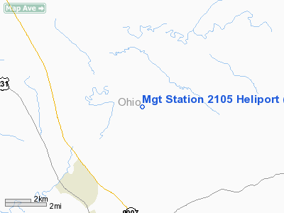
Midwestern Gas Transmission Station 2105 Heliport |
|
Location &
QuickFacts
|
FAA
Information Effective: |
2008-09-25 |
|
Airport
Identifier: |
0KY2 |
|
Airport
Status: |
Operational |
|
Longitude/Latitude: |
086-50-15.0000W/37-30-20.0000N
-86.837500/37.505556 (Estimated) |
|
Elevation: |
540 ft / 164.59 m (Estimated) |
|
Land: |
0 acres |
|
From
nearest city: |
6 nautical miles NE of Hartford, KY |
|
Location: |
Ohio County, KY |
|
Magnetic Variation: |
01W (1990) |
Owner & Manager
|
Ownership: |
Privately owned |
|
Owner: |
Midwestern Gas Transmission |
|
Address: |
Hwy 69n, Box 185
Hartford, KY 42347 |
|
Phone
number: |
901-376-8449 |
|
Manager: |
Midwestern Gas Transmission |
|
Address: |
Hwy 69n, Box 185
Hartford, KY 42347 |
|
Phone number: |
901-376-8449 |
Airport Operations and Facilities
|
Airport
Use: |
Private |
|
Segmented Circle: |
No |
|
Control
Tower: |
No |
|
Sectional chart: |
St Louis |
|
Region: |
ASO - Southern |
|
Boundary
ARTCC: |
ZID - Indianapolis |
|
Tie-in
FSS: |
LOU - Louisville |
|
FSS on
Airport: |
No |
|
FSS Toll
Free: |
1-800-WX-BRIEF |
|
Runway Information
Helipad H1
|
Dimension: |
35 x 35 ft / 10.7 x 10.7 m |
|
Surface: |
CONC, |
|
|
Runway H1
|
Runway
|
|
Traffic
Pattern: |
Left |
Left |
|
Radio Navigation Aids
|
ID |
Type |
Name |
Ch |
Freq |
Var |
Dist |
|
GMH |
NDB |
Muhlenberg |
|
362.00 |
01E |
22.7 nm |
|
TEL |
NDB |
Tell City |
|
206.00 |
02W |
31.4 nm |
|
HIX |
NDB |
Honey Grove |
|
356.00 |
01W |
44.5 nm |
|
FNZ |
NDB |
Ferdinand |
|
239.00 |
00E |
44.7 nm |
|
PDW |
NDB |
Evansville |
|
284.00 |
00E |
46.0 nm |
|
GVA |
NDB |
Geneva |
|
224.00 |
01W |
47.9 nm |
|
GOI |
NDB |
Godman |
|
396.00 |
02W |
49.2 nm |
|
BVQ |
NDB |
Beaver Creek |
|
260.00 |
02W |
49.3 nm |
|
MYS |
VOR |
Mystic |
|
108.20 |
01W |
36.6 nm |
|
OWB |
VOR/DME |
Owensboro |
023X |
108.60 |
01E |
21.2 nm |
|
HNB |
VOR/DME |
Huntingburg |
029X |
109.20 |
00E |
45.1 nm |
|
FTK |
VOR/DME |
Fort Knox |
033X |
109.60 |
01W |
47.7 nm |
|
CCT |
VORTAC |
Central City |
035X |
109.80 |
01W |
21.6 nm |
|
BWG |
VORTAC |
Bowling Green |
126X |
117.90 |
02E |
39.5 nm |
Remarks
-
PROVIDED VFR/PR
USE; ALL APCH/DEP ROUTE HEL OPNS ARE FROM 045-260 DEG AND FROM 300-360 DEG;
AREA APPROPRIATELY MKD; A WIND INDICATOR IN MNTND.
Midwestern Gas Transmission Station 2105
Heliport
Address:
Ohio County, KY
Tel:
901-376-8449
Images
and information placed above are from
http://www.airport-data.com/airport/0KY2/
We
thank them for the data!
|
General Info |
| Country |
United
States |
| State |
KENTUCKY
|
| FAA ID |
0KY2
|
| Latitude |
37-30-20.000N |
|
Longitude |
086-50-15.000W |
|
Elevation |
540 feet
|
| Near
City |
HARTFORD
|
We don't guarantee the information is fresh and accurate. The data may
be wrong or outdated.
For more up-to-date information please refer to other sources.
|
|


