 |
|
|
Location &
QuickFacts
|
FAA
Information Effective: |
2008-09-25 |
|
Airport
Identifier: |
3KY3 |
|
Airport
Status: |
Operational |
|
Longitude/Latitude: |
085-21-34.0000W/38-02-18.0000N
-85.359444/38.038333 (Estimated) |
|
Elevation: |
510 ft / 155.45 m (Estimated) |
|
Land: |
200 acres |
|
From
nearest city: |
2 nautical miles NW of Taylorsville, KY |
|
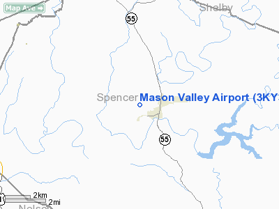
Location: |
Spencer County, KY |
|
Magnetic Variation: |
() |
Owner & Manager
|
Ownership: |
Privately owned |
|
Owner: |
Thomas K. Mason & Ronald G. Mason |
|
Address: |
243 Elk Creek Road
Taylorsville, KY 40071 |
|
Phone
number: |
502-477-6420 |
|
Manager: |
Ronald G. Mason |
|
Address: |
243 Elk Creek Road
Taylorsville, KY 40071 |
|
Phone number: |
502-477-6420 |
Airport Operations and Facilities
|
Airport
Use: |
Private |
|
Control
Tower: |
No |
|
Sectional chart: |
St Louis |
|
Region: |
ASO - Southern |
|
Boundary
ARTCC: |
ZID - Indianapolis |
|
Tie-in
FSS: |
LOU - Louisville |
|
FSS Toll
Free: |
1-800-WX-BRIEF |
|
Runway Information
Runway 14/32
|
Dimension: |
1500 x 200 ft / 457.2 x 61.0 m |
|
Surface: |
TURF, |
|
|
Runway 14
|
Runway 32
|
|
Traffic
Pattern: |
Right |
Left |
|
Obstruction: |
70 ft pline, 1500.0 ft from runway |
40 ft pline, 650.0 ft from runway |
|
Radio Navigation Aids
|
ID |
Type |
Name |
Ch |
Freq |
Var |
Dist |
|
BRY |
NDB |
Bardstown/dcmsnd |
|
248.00 |
02W |
12.9 nm |
|
IKY |
NDB |
Springfield |
|
429.00 |
03W |
25.0 nm |
|
FEU |
NDB |
Arnold |
|
521.00 |
03W |
27.6 nm |
|
GOI |
NDB |
Godman |
|
396.00 |
02W |
29.6 nm |
|
LE |
NDB |
Blayd |
|
242.00 |
04W |
33.2 nm |
|
TYC |
NDB |
Taylor County |
|
272.00 |
02W |
38.6 nm |
|
DVK |
NDB |
Goodall |
|
311.00 |
03W |
39.6 nm |
|
IMS |
NDB |
Madison |
|
404.00 |
03W |
43.7 nm |
|
FFT |
VOR |
Frankfort |
|
109.40 |
03W |
23.0 nm |
|
MYS |
VOR |
Mystic |
|
108.20 |
01W |
42.8 nm |
|
BQM |
VOR/DME |
Bowman |
059X |
112.20 |
01W |
18.5 nm |
|
EWO |
VOR/DME |
New Hope |
045X |
110.80 |
01E |
28.7 nm |
|
FTK |
VOR/DME |
Fort Knox |
033X |
109.60 |
01W |
30.1 nm |
|
IIU |
VORTAC |
Louisville |
095X |
114.80 |
01E |
11.0 nm |
|
ABB |
VORTAC |
Nabb |
071X |
112.40 |
01E |
35.6 nm |
|
HYK |
VORTAC |
Lexington |
073X |
112.60 |
00E |
42.2 nm |
|
SDF |
VOT |
Louisville Standifd |
|
111.00 |
|
19.7 nm |
Remarks
-
1000 FT MSL TWR 1
NM E.
-
ALL TFC RMN W AND
N OF RY.
-
PRVDD VFR OPNS
AND PVT USE.
Based Aircraft
|
Aircraft based
on field: |
1 |
|
Single Engine
Airplanes: |
1 |
Mason Valley Airport
Address:
Spencer County, KY
Tel:
502-477-6420
Images
and information placed above are from
http://www.airport-data.com/airport/3KY3/
We
thank them for the data!
|
|


