 |
|
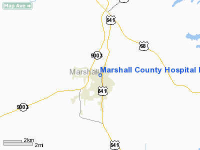
Marshall County Hospital Heliport |
|
Location &
QuickFacts
|
FAA
Information Effective: |
2008-09-25 |
|
Airport
Identifier: |
18KY |
|
Airport
Status: |
Operational |
|
Longitude/Latitude: |
088-21-10.1340W/36-51-45.2010N
-88.352815/36.862556 (Estimated) |
|
Elevation: |
395 ft / 120.40 m (Estimated) |
|
Land: |
1 acres |
|
From
nearest city: |
0 nautical miles N of Benton, KY |
|
Location: |
Marshall County, KY |
|
Magnetic Variation: |
01E (1985) |
Owner & Manager
|
Ownership: |
Publicly owned |
|
Owner: |
Marshall County Hospital |
|
Address: |
503 George Mc Clain Drive
Benton, KY 42025 |
|
Phone
number: |
502-527-4800 |
|
Manager: |
Bruce Goffin |
|
Address: |
503 George Mc Clain Drive
Benton, KY 42025 |
|
Phone number: |
502-527-1336 |
Airport Operations and Facilities
|
Airport
Use: |
Private
MEDICAL. |
|
Wind
indicator: |
Yes |
|
Segmented Circle: |
No |
|
Control
Tower: |
No |
|
Lighting
Schedule: |
PHONE REQ
FOR PERIMETER LGTS CALL 502-527-1336. |
|
Sectional chart: |
St Louis |
|
Region: |
ASO - Southern |
|
Boundary
ARTCC: |
ZME - Memphis |
|
Tie-in
FSS: |
LOU - Louisville |
|
FSS Toll
Free: |
1-800-WX-BRIEF |
|
NOTAMs
Facility: |
LOU |
|
Runway Information
Helipad H1
|
Dimension: |
40 x 40 ft / 12.2 x 12.2 m |
|
Surface: |
CONC, |
|
|
Runway H1
|
Runway
|
|
Traffic
Pattern: |
Left |
Left |
|
Radio Navigation Aids
|
ID |
Type |
Name |
Ch |
Freq |
Var |
Dist |
|
GGK |
NDB |
Mayfield |
|
401.00 |
00E |
15.5 nm |
|
BDD |
NDB |
Bellgrade |
|
254.00 |
00E |
22.8 nm |
|
TIQ |
NDB |
Trainer |
|
410.00 |
00E |
37.0 nm |
|
TWT |
NDB |
Tradewater |
|
276.00 |
00E |
41.2 nm |
|
CIR |
NDB |
Cairo |
|
397.00 |
00E |
43.5 nm |
|
FK |
NDB |
Airbe |
|
273.00 |
01W |
45.8 nm |
|
UC |
NDB |
Obion |
|
212.00 |
00E |
46.0 nm |
|
HZD |
NDB |
Huntingdon |
|
217.00 |
00E |
46.9 nm |
|
CHQ |
NDB |
Charleston |
|
208.00 |
01E |
48.3 nm |
|
HIX |
NDB |
Honey Grove |
|
356.00 |
01W |
48.8 nm |
|
HXW |
TACAN |
Screaming Eagle |
096X |
|
01W |
42.8 nm |
|
CKV |
VOR/DME |
Clarksville |
043X |
110.60 |
01W |
47.5 nm |
|
CNG |
VORTAC |
Cunningham |
078X |
113.10 |
03E |
24.9 nm |
Remarks
Marshall County Hospital Heliport
Address:
Marshall County, KY
Tel:
502-527-4800,
502-527-1336
Images
and information placed above are from
http://www.airport-data.com/airport/18KY/
We
thank them for the data!
|
General Info |
| Country |
United
States |
| State |
KENTUCKY
|
| FAA ID |
18KY
|
| Latitude |
36-51-45.201N |
|
Longitude |
088-21-10.134W |
|
Elevation |
395 feet
|
| Near
City |
BENTON
|
We don't guarantee the information is fresh and accurate. The data may
be wrong or outdated.
For more up-to-date information please refer to other sources.
|
|


