 |
|
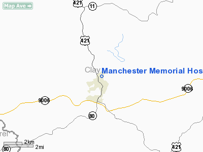
Manchester Memorial Hospital Heliport |
|
Location &
QuickFacts
|
FAA
Information Effective: |
2008-09-25 |
|
Airport
Identifier: |
4KY2 |
|
Airport
Status: |
Operational |
|
Longitude/Latitude: |
083-45-42.7200W/37-09-45.0100N
-83.761867/37.162503 (Estimated) |
|
Elevation: |
935 ft / 284.99 m (Estimated) |
|
Land: |
0 acres |
|
From
nearest city: |
1 nautical miles N of Manchester, KY |
|
Location: |
Clay County, KY |
|
Magnetic Variation: |
04W () |
Owner & Manager
|
Ownership: |
Privately owned |
|
Owner: |
Manchester Memorial Hospital |
|
Address: |
401 Memorial Drive
Manchester, KY 40962 |
|
Phone number: |
606-598-5104 |
|
Manager: |
Manchester Memorial Hospital |
|
Address: |
401 Memorial Drive
Manchester, KY 40962 |
|
Phone number: |
606-598-5104 |
Airport
Operations and Facilities
|
Airport
Use: |
Private |
|
Wind
indicator: |
Yes |
|
Segmented Circle: |
No |
|
Control
Tower: |
No |
|
Lighting
Schedule: |
PHONE REQ
FOR PERIMETER LGTS CALL 606-598-5104. |
|
Sectional chart: |
Cincinnati |
|
Region: |
ASO - Southern |
|
Boundary
ARTCC: |
ZID - Indianapolis |
|
Tie-in
FSS: |
LOU - Louisville |
|
FSS Toll
Free: |
1-800-WX-BRIEF |
|
Runway Information
Helipad H1
|
Dimension: |
50 x 50 ft / 15.2 x 15.2 m |
|
Surface: |
ASPH, |
|
|
Runway H1
|
Runway
|
|
Traffic
Pattern: |
Left |
Left |
|
Radio Navigation Aids
|
ID |
Type |
Name |
Ch |
Freq |
Var |
Dist |
|
XYC |
NDB |
Seco |
|
393.00 |
03W |
38.0 nm |
|
LQV |
NDB |
Long Hollow |
|
252.00 |
03W |
42.9 nm |
|
CDX |
NDB |
Cumberland River |
|
388.00 |
05E |
45.2 nm |
|
AZQ |
VOR/DME |
Hazard |
049X |
111.20 |
04W |
27.5 nm |
|
LOZ |
VORTAC |
London |
108X |
116.10 |
03W |
18.4 nm |
Remarks
-
PRVDD APCH/DEP
OPNS FROM 141 DEGS CLKWS TO 341, AREA IS MARKED, WIND INDICATOR IS MAINTAINED.
Manchester Memorial Hospital Heliport
Address:
Clay County, KY
Tel:
606-598-5104
Images
and information placed above are from
http://www.airport-data.com/airport/4KY2/
We
thank them for the data!
|
General Info |
| Country |
United
States |
| State |
KENTUCKY
|
| FAA ID |
4KY2
|
| Latitude |
37-09-45.010N |
|
Longitude |
083-45-42.720W |
|
Elevation |
935 feet
|
| Near
City |
MANCHESTER |
We don't guarantee the information is fresh and accurate. The data may
be wrong or outdated.
For more up-to-date information please refer to other sources.
|
|


