 |
|
|
Location &
QuickFacts
|
FAA
Information Effective: |
2008-09-25 |
|
Airport
Identifier: |
5KY5 |
|
Airport
Status: |
Operational |
|
Longitude/Latitude: |
087-47-25.0550W/36-51-45.1760N
-87.790293/36.862549 (Estimated) |
|
Elevation: |
498 ft / 151.79 m (Estimated) |
|
Land: |
0 acres |
|
From
nearest city: |
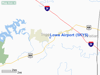
2 nautical miles E of Cadiz, KY |
|
Location: |
Trigg County, KY |
|
Magnetic Variation: |
00E (1985) |
Owner & Manager
|
Ownership: |
Privately owned |
|
Owner: |
Clifton Lowe |
|
Address: |
2008 River Sound Drive
Knoxville, TN 37922 |
|
Phone
number: |
865-675-0568 |
|
Manager: |
Clifton Lowe |
|
Address: |
2008 River Sound Drive
Knoxville, TN 37922 |
|
Phone number: |
865-207-2421 |
Airport Operations and Facilities
|
Airport Use: |
Private |
|
Wind indicator: |
Yes |
|
Segmented Circle: |
No |
|
Control Tower: |
No |
|
Landing fee charge: |
No |
|
Sectional chart: |
St Louis |
|
Region: |
ASO - Southern |
|
Boundary ARTCC: |
ZME - Memphis |
|
Tie-in FSS: |
LOU - Louisville |
|
FSS on Airport: |
No |
|
FSS Toll Free: |
1-800-WX-BRIEF |
|
NOTAMs Facility: |
LOU |
Airport Services
|
Airframe
Repair: |
NONE |
|
Power
Plant Repair: |
NONE |
|
Runway Information
Runway 18/36
|
Dimension: |
3100 x 40 ft / 944.9 x 12.2 m |
|
Surface: |
ASPH, |
|
|
Runway 18
|
Runway 36
|
|
Traffic
Pattern: |
Left |
Left |
|
Displaced
threshold: |
290.00 ft |
290.00 ft |
|
Radio Navigation Aids
|
ID |
Type |
Name |
Ch |
Freq |
Var |
Dist |
|
FK |
NDB |
Airbe |
|
273.00 |
01W |
19.6 nm |
|
HIX |
NDB |
Honey Grove |
|
356.00 |
01W |
21.8 nm |
|
TWT |
NDB |
Tradewater |
|
276.00 |
00E |
37.1 nm |
|
GMH |
NDB |
Muhlenberg |
|
362.00 |
01E |
37.4 nm |
|
GGK |
NDB |
Mayfield |
|
401.00 |
00E |
40.0 nm |
|
AEY |
NDB |
Waverly |
|
329.00 |
00E |
44.9 nm |
|
BDD |
NDB |
Bellgrade |
|
254.00 |
00E |
45.5 nm |
|
ON |
NDB |
Music |
|
279.00 |
03W |
45.8 nm |
|
PED |
NDB |
Needmore |
|
221.00 |
01W |
46.4 nm |
|
DMZ |
NDB |
Dickson |
|
203.00 |
01W |
47.5 nm |
|
TIQ |
NDB |
Trainer |
|
410.00 |
00E |
47.6 nm |
|
HXW |
TACAN |
Screaming Eagle |
096X |
|
01W |
18.1 nm |
|
CKV |
VOR/DME |
Clarksville |
043X |
110.60 |
01W |
23.2 nm |
|
CCT |
VORTAC |
Central City |
035X |
109.80 |
01W |
40.2 nm |
Remarks
-
TWR-L E. RWY 18
HWY N. RWY 36 TREES P-LINE S.
-
VFR USE ONLY
Based Aircraft
|
Aircraft based
on field: |
2 |
|
Single Engine
Airplanes: |
1 |
|
Multi Engine
Airplanes: |
1 |
Lowe Airport
Address:
Trigg County, KY
Tel:
865-675-0568,
865-207-2421
Images
and information placed above are from
http://www.airport-data.com/airport/5KY5/
We
thank them for the data!
|
General Info |
| Country |
United
States |
| State |
KENTUCKY
|
| FAA ID |
5KY5
|
| Latitude |
36.862550
36° 51' 45.18" N |
|
Longitude |
-87.790294
087° 47' 25.06" W |
|
Elevation |
498 feet
152 meters |
| Magnetic
Variation |
002° W
(01/06) |
|
Operating Agency |
PRIVATE
|
| Daylight
Saving Time |
Second
Sunday in March at 0200 to first Sunday in November at 0200 local time
(Exception Arizona and that portion of Indiana in the Eastern Time
Zone) |
We don't guarantee the information is fresh and accurate. The data may
be wrong or outdated.
For more up-to-date information please refer to other sources.
|
|


