|
|
London-Corbin Airport - Magee Field Airport |
London-Corbin Airport
Magee Field |
| IATA: LOZ â ICAO: KLOZ â FAA LID: LOZ |
| Summary |
| Airport type |
Public |
| Owner |
Cities of London & Corbin |
| Serves |
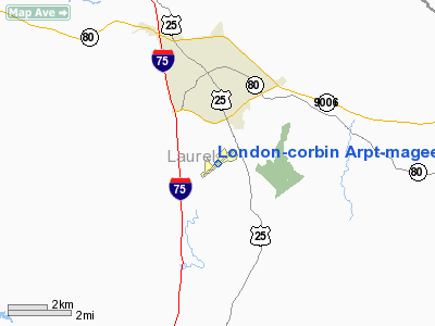
London, Kentucky |
| Elevation AMSL |
1,212 ft / 369 m |
| Coordinates |
37°05â²13â³N 084°04â²39â³W / 37.08694°N 84.0775°W / 37.08694; -84.0775 |
| Website |
london-corbinairport.com |
| Runways |
| Direction |
Length |
Surface |
| ft |
m |
| 6/24 |
5,750 |
1,753 |
Asphalt |
| Statistics (2006) |
| Aircraft operations |
13,063 |
| Based aircraft |
73 |
| Source: Federal Aviation Administration |
London-Corbin Airport (IATA: LOZ, ICAO: KLOZ, FAA LID: LOZ), also known as Magee Field, is a general aviation airport located in Laurel County, Kentucky, three nautical miles (6 km) south of the central business district of London and about 12 miles north of Corbin. The airport is operated by both cities. It is not currently served by scheduled airline service, though service was once available on US Airways Express dba Air Kentucky and Tennessee Airways. Prior to the passage of the Airline Deregulation Act, the airport was served by Piedmont Airlines (1948-1989) turboprops, including the Fairchild Hiller FH-227 and the NAMC YS-11.
Facilities and aircraft
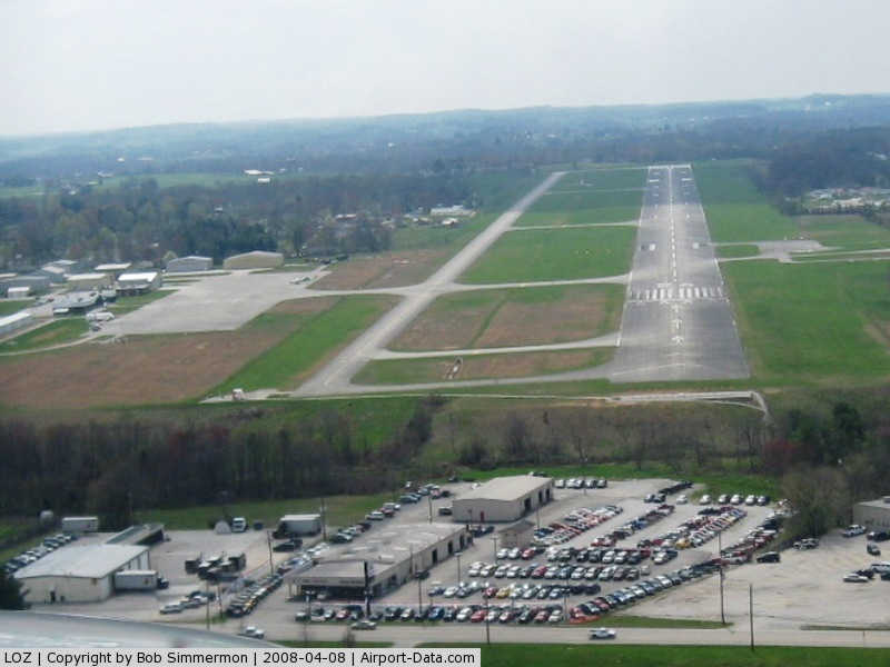
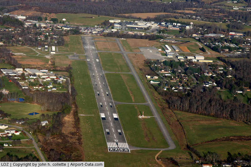
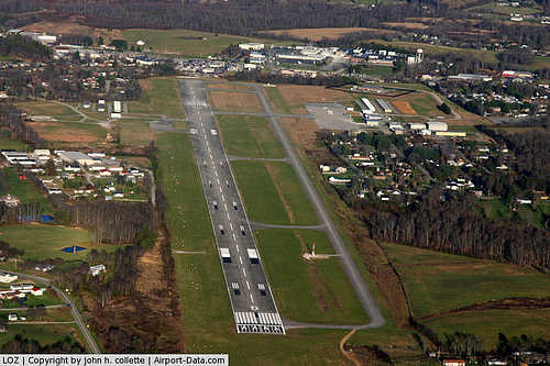
London-Corbin Airport covers an area of 186 acres (75 ha) at an elevation of 1,212 feet (369 m) above mean sea level. It has one asphalt paved runway designated 6/24 which measures 5,750 by 150 feet (1,753 x 46 m).
For the 12-month period ending January 10, 2006, the airport had 13,063 aircraft operations, an average of 35 per day: 53% general aviation, 31% military and 17% air taxi. At that time there were 73 aircraft based at this airport: 78% single-engine, 7% multi-engine, 3% jet, 10% helicopter, 1% glider, 1% ultralight.
The above content comes from Wikipedia and is published under free licenses – click here to read more.
|
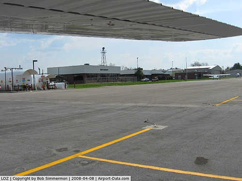 |
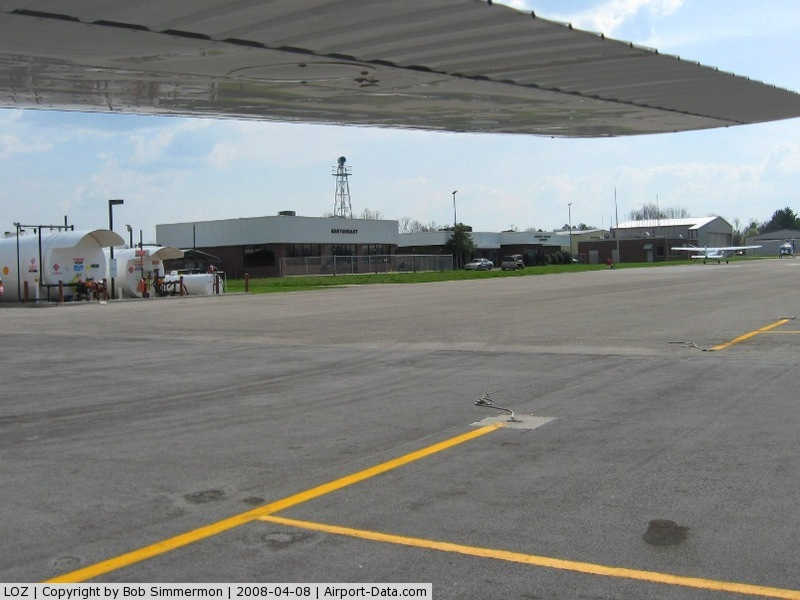
(Click on the photo to enlarge) |
|
 |
(Click on the photo to enlarge) |
|
 |
(Click on the photo to enlarge) |
|
Location &
QuickFacts
|
FAA
Information Effective: |
2008-09-25 |
|
Airport
Identifier: |
LOZ |
|
Airport
Status: |
Operational |
|
Longitude/Latitude: |
084-04-38.6000W/37-05-12.8000N
-84.077389/37.086889 (Estimated) |
|
Elevation: |
1212 ft / 369.42 m (Surveyed) |
|
Land: |
186 acres |
|
From
nearest city: |
3 nautical miles S of London, KY |
|
Location: |
Laurel County, KY |
|
Magnetic Variation: |
05W (2005) |
Owner & Manager
|
Ownership: |
Publicly owned |
|
Owner: |
Cities Of London & Corbin |
|
Address: |
566 Hal Rogers Drive
London, KY 40744 |
|
Phone
number: |
606-878-9100
AIRPORT BOARD CHAIRMAN. |
|
Manager: |
Larry E. Corum |
|
Address: |
566 Hal Rogers Drive
London, KY 40744 |
|
Phone number: |
606-232-1452 |
Airport Operations and Facilities
|
Airport
Use: |
Open to public |
|
Wind
indicator: |
Yes |
|
Segmented Circle: |
Yes |
|
Control
Tower: |
No |
|
Lighting
Schedule: |
DUSK-DAWN
ACTVT MIRL RY 06/24 AND REIL RYS 06 & 24 - CTAF. |
|
Beacon
Color: |
Clear-Green (lighted land airport) |
|
Landing
fee charge: |
No |
|
Sectional chart: |
Cincinnati |
|
Region: |
ASO - Southern |
|
Boundary
ARTCC: |
ZID - Indianapolis |
|
Tie-in
FSS: |
LOU - Louisville |
|
FSS Toll
Free: |
1-800-WX-BRIEF |
|
NOTAMs
Facility: |
LOZ (NOTAM-d service avaliable) |
|
Federal Agreements: |
NGY |
Airport Communications
|
CTAF: |
123.000 |
|
Unicom: |
123.000 |
Airport Services
|
Fuel
available: |
100LLA |
|
Airframe
Repair: |
MAJOR |
|
Power
Plant Repair: |
MAJOR |
|
Bottled
Oxygen: |
HIGH |
|
Bulk
Oxygen: |
HIGH |
|
Runway Information
Runway 06/24
|
Dimension: |
5750 x 150 ft / 1752.6 x 45.7 m |
|
Surface: |
ASPH, Good Condition |
|
Weight Limit: |
Single wheel: 71000 lbs.
Dual wheel: 95000 lbs.
Dual tandem wheel: 151000 lbs. |
|
Edge Lights: |
Medium |
|
|
Runway 06
|
Runway 24
|
|
Longitude: |
084-05-06.6911W |
084-04-10.5252W |
|
Latitude: |
37-04-55.4357N |
37-05-30.1913N |
|
Elevation: |
1212.00 ft |
1182.00 ft |
|
Alignment: |
52 |
127 |
|
ILS Type: |
ILS/DME |
|
|
Traffic
Pattern: |
Left |
Left |
|
Markings: |
Precision instrument, Good Condition |
Non-precision instrument, Good Condition |
|
Crossing
Height: |
48.00 ft |
73.00 ft |
|
Displaced
threshold: |
100.00 ft |
550.00 ft |
|
VASI: |
4-light PAPI on left side |
4-light PAPI on left side |
|
Visual
Glide Angle: |
3.00° |
4.00° |
|
Runway End
Identifier: |
Yes |
Yes |
|
Obstruction: |
60 ft tree, 1400.0 ft from runway, 280 ft right of
centerline, 20:1 slope to clear
RY 06 21:1 TO DSPLCD THLD. |
378 ft tower, 9651.0 ft from runway, 1095 ft right of
centerline, 25:1 slope to clear |
|
Radio Navigation Aids
|
ID |
Type |
Name |
Ch |
Freq |
Var |
Dist |
|
CDX |
NDB |
Cumberland River |
|
388.00 |
05E |
29.5 nm |
|
BPO |
NDB |
Piney Grove |
|
403.00 |
05W |
38.1 nm |
|
EKQ |
NDB |
Elk Spring |
|
290.00 |
03W |
39.7 nm |
|
XYC |
NDB |
Seco |
|
393.00 |
03W |
40.4 nm |
|
DVK |
NDB |
Goodall |
|
311.00 |
03W |
44.1 nm |
|
JAU |
NDB |
Jacksboro |
|
204.00 |
03W |
45.2 nm |
|
AZQ |
VOR/DME |
Hazard |
049X |
111.20 |
04W |
43.1 nm |
|
LOZ |
VORTAC |
London |
108X |
116.10 |
03W |
3.6 nm |
Remarks
-
TREES BOTH SIDE
SW END OF RWY VIOLATES 7:1 TRANS.
-
SMALL FLOCKS OF
MIGRATING BIRDS ON AND INVOF ARPT.
-
EXISTED PRIOR TO 1959.
Based Aircraft
|
Aircraft based
on field: |
73 |
|
Single Engine
Airplanes: |
57 |
|
Multi Engine
Airplanes: |
5 |
|
Jet Engine
Airplanes: |
2 |
|
Helicopters: |
7 |
|
Gliders: |
1 |
|
Ultralights: |
1 |
Operational Statistics
Time Period: 2005-01-11 - 2006-01-10
|
Aircraft
Operations: |
252/Week |
|
Air Taxi: |
16.8% |
|
General
Aviation Local: |
52.1% |
|
General
Aviation Itinerant: |
0.5% |
|
Military: |
30.6% |
London-corbin Airport-magee Field
Airport
Address:
Laurel County, KY
Tel:
606-878-9100,
606-232-1452
Images
and information placed above are from
http://www.airport-data.com/airport/LOZ/
We
thank them for the data!
|
General Info |
| Country |
United
States |
| State |
KENTUCKY
|
| FAA ID |
LOZ
|
| Latitude |
37-05-14.200N |
|
Longitude |
084-04-36.400W |
|
Elevation |
1212
feet |
| Near
City |
LONDON
|
We don't guarantee the information is fresh and accurate. The data may
be wrong or outdated.
For more up-to-date information please refer to other sources.
|
|