 |
|
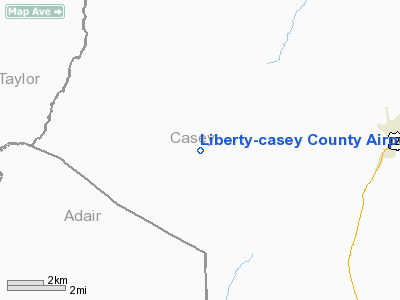
Liberty-Casey County Airport |
|
|
|
Location &
QuickFacts
|
FAA
Information Effective: |
2008-09-25 |
|
Airport
Identifier: |
I53 |
|
Airport
Status: |
Operational |
|
Longitude/Latitude: |
085-03-32.8000W/37-18-30.8000N
-85.059111/37.308556 (Estimated) |
|
Elevation: |
1040 ft / 316.99 m (Surveyed) |
|
Land: |
11 acres |
|
From
nearest city: |
7 nautical miles W of Liberty, KY |
|
Location: |
Casey County, KY |
|
Magnetic Variation: |
02W (1985) |
Owner & Manager
|
Ownership: |
Publicly owned |
|
Owner: |
Liberty-casey Co Arpt Board |
|
Address: |
Po Box 206
Liberty, KY 42539 |
|
Phone
number: |
859-739-4773 |
|
Manager: |
Jack Prewitt
ARPT BOARD CHMN. |
|
Address: |
Po Box 206
Liberty, KY 42539 |
|
Phone number: |
859-734-4773 |
Airport
Operations and Facilities
|
Airport
Use: |
Open to public |
|
Wind
indicator: |
Yes |
|
Segmented Circle: |
Yes |
|
Control
Tower: |
No |
|
Landing
fee charge: |
No |
|
Sectional chart: |
St Louis |
|
Region: |
ASO - Southern |
|
Boundary
ARTCC: |
ZID - Indianapolis |
|
Tie-in
FSS: |
LOU - Louisville |
|
FSS on
Airport: |
No |
|
FSS Toll
Free: |
1-800-WX-BRIEF |
|
NOTAMs
Facility: |
LOU (NOTAM-d service avaliable) |
Airport Communications
Airport Services
|
Airframe
Repair: |
NONE |
|
Power
Plant Repair: |
NONE |
|
Bottled
Oxygen: |
NONE |
|
Bulk
Oxygen: |
NONE |
|
Runway Information
Runway 01/19
|
Dimension: |
3000 x 60 ft / 914.4 x 18.3 m |
|
Surface: |
ASPH, Fair Condition |
|
|
Runway 01
|
Runway 19
|
|
Longitude: |
085-03-36.8400W |
085-03-28.8400W |
|
Latitude: |
37-18-16.2500N |
37-18-45.2500N |
|
Traffic
Pattern: |
Left |
Left |
|
Markings: |
Basic, Poor Condition
RY MARKINGS BADLY FADED. |
Basic, Poor Condition
RY MARKINGS BADLY FADED. |
|
Obstruction: |
35 ft trees, 210.0 ft from runway, 100 ft right of
centerline
+10 FT GROUND 0-200 FT FROM RY END, 100 FT RIGHT. |
16 ft road, 200.0 ft from runway, 100 ft right of
centerline
+16 FT ARPT ROAD 0-200 FT FROM RY END, 100 FT RIGHT. |
|
Radio Navigation Aids
|
ID |
Type |
Name |
Ch |
Freq |
Var |
Dist |
|
TYC |
NDB |
Taylor County |
|
272.00 |
02W |
10.5 nm |
|
IKY |
NDB |
Springfield |
|
429.00 |
03W |
21.4 nm |
|
DVK |
NDB |
Goodall |
|
311.00 |
03W |
21.4 nm |
|
CDX |
NDB |
Cumberland River |
|
388.00 |
05E |
26.1 nm |
|
EKQ |
NDB |
Elk Spring |
|
290.00 |
03W |
28.9 nm |
|
BRY |
NDB |
Bardstown/dcmsnd |
|
248.00 |
02W |
38.2 nm |
|
LE |
NDB |
Blayd |
|
242.00 |
04W |
45.0 nm |
|
BVQ |
NDB |
Beaver Creek |
|
260.00 |
02W |
48.8 nm |
|
EWO |
VOR/DME |
New Hope |
045X |
110.80 |
01E |
35.3 nm |
|
LVT |
VORTAC |
Livingston |
021X |
108.40 |
02W |
43.8 nm |
|
LOZ |
VORTAC |
London |
108X |
116.10 |
03W |
48.4 nm |
|
HYK |
VORTAC |
Lexington |
073X |
112.60 |
00E |
48.4 nm |
Remarks
-
RWY 01 LGTD &
MRKD RDO TWR 310' VCNTY OF RWY.
-
EVIDENCE OF
VEHICULAR TFC ON AIR OPS AREAS.
-
TREES AND
ELEVATIONS OF LAND TO LEFT & RIGHT OF APCH TO RWY 19 PENETRATE TRNSL SFC.
-
VFR OPNS DALGT ONLY.
-
EXISTED PRIOR TO 1959.
Operational Statistics
Time Period: 2006-07-18 - 2007-07-17
|
Aircraft
Operations: |
5/Month |
|
General
Aviation Itinerant: |
100.0% |
Liberty-casey County Airport
Address:
Casey County, KY
Tel:
859-739-4773
Images
and information placed above are from
http://www.airport-data.com/airport/I53/
We
thank them for the data!
|
General Info |
| Country |
United
States |
| State |
KENTUCKY
|
| FAA ID |
I53
|
| Latitude |
37-18-34.253N |
|
Longitude |
085-03-31.844W |
|
Elevation |
1040
feet |
| Near
City |
LIBERTY
|
We don't guarantee the information is fresh and accurate. The data may
be wrong or outdated.
For more up-to-date information please refer to other sources.
|
|


