 |
|
|
Location &
QuickFacts
|
FAA
Information Effective: |
2008-09-25 |
|
Airport
Identifier: |
68KY |
|
Airport
Status: |
Operational |
|
Longitude/Latitude: |
084-43-47.0000W/37-01-24.0000N
-84.729722/37.023333 (Estimated) |
|
Elevation: |
970 ft / 295.66 m (Estimated) |
|
Land: |
13 acres |
|
From
nearest city: |
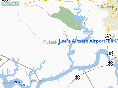
8 nautical miles W of Somerset, KY |
|
Location: |
Pulaski County, KY |
|
Magnetic Variation: |
() |
Owner & Manager
|
Ownership: |
Privately owned |
|
Owner: |
Leland H. Stevenson |
|
Address: |
3085 Ky Highway 235
Nancy, KY 42544-8557 |
|
Phone number: |
606-636-6537 |
|
Manager: |
Leland H. Stevenson |
|
Address: |
3085 Ky Highway 235
Nancy, KY 42544-8557 |
|
Phone number: |
606-636-6537 |
Airport
Operations and Facilities
|
Airport
Use: |
Private |
|
Segmented Circle: |
No |
|
Control
Tower: |
No |
|
Sectional chart: |
Cincinnati |
|
Region: |
ASO - Southern |
|
Boundary
ARTCC: |
ZID - Indianapolis |
|
Tie-in
FSS: |
LOU - Louisville |
|
FSS Toll
Free: |
1-800-WX-BRIEF |
|
Runway Information
Runway 09/27
|
Dimension: |
2400 x 75 ft / 731.5 x 22.9 m |
|
Surface: |
TURF, |
|
|
Runway 09
|
Runway 27
|
|
Traffic
Pattern: |
Left |
Left |
|
Radio Navigation Aids
|
ID |
Type |
Name |
Ch |
Freq |
Var |
Dist |
|
CDX |
NDB |
Cumberland River |
|
388.00 |
05E |
2.8 nm |
|
EKQ |
NDB |
Elk Spring |
|
290.00 |
03W |
11.7 nm |
|
BPO |
NDB |
Piney Grove |
|
403.00 |
05W |
31.5 nm |
|
DVK |
NDB |
Goodall |
|
311.00 |
03W |
33.3 nm |
|
TYC |
NDB |
Taylor County |
|
272.00 |
02W |
33.5 nm |
|
IKY |
NDB |
Springfield |
|
429.00 |
03W |
44.0 nm |
|
JAU |
NDB |
Jacksboro |
|
204.00 |
03W |
49.5 nm |
|
LOZ |
VORTAC |
London |
108X |
116.10 |
03W |
29.7 nm |
|
LVT |
VORTAC |
Livingston |
021X |
108.40 |
02W |
33.7 nm |
Remarks
Based Aircraft
|
Aircraft based
on field: |
5 |
|
Single Engine
Airplanes: |
2 |
|
Ultralights: |
3 |
Lee's Airpark Airport
Address:
Pulaski County, KY
Tel:
606-636-6537
Images
and information placed above are from
http://www.airport-data.com/airport/68KY/
We
thank them for the data!
|
|


