 |
|
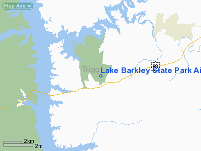
Lake Barkley State Park Airport |
|
|
|
Location &
QuickFacts
|
FAA
Information Effective: |
2008-09-25 |
|
Airport
Identifier: |
1M9 |
|
Airport
Status: |
Operational |
|
Longitude/Latitude: |
087-54-26.8000W/36-49-03.7000N
-87.907444/36.817694 (Estimated) |
|
Elevation: |
570 ft / 173.74 m (Surveyed) |
|
Land: |
200 acres |
|
From
nearest city: |
4 nautical miles SW of Cadiz, KY |
|
Location: |
Trigg County, KY |
|
Magnetic Variation: |
00E (1985) |
Owner & Manager
|
Ownership: |
Publicly owned |
|
Owner: |
Ky Dept Of Parks |
|
Address: |
Capital Plaza Tower
Frankfort, KY 40601 |
|
Phone number: |
502-564-2172 |
|
Manager: |
John Rittenhouse |
|
Address: |
Po Box 790
Cadiz, KY 42211 |
|
Phone number: |
270-924-1131 |
Airport
Operations and Facilities
|
Airport
Use: |
Open to public |
|
Wind
indicator: |
Yes |
|
Segmented Circle: |
Yes |
|
Control
Tower: |
No |
|
Lighting
Schedule: |
DUSK-DAWN
MIRL RY 02/20 PRESET MED INTST DUSK-DAWN; TO INCR INTST ACTVT - 123.0. |
|
Beacon
Color: |
Clear-Green (lighted land airport) |
|
Landing
fee charge: |
No |
|
Sectional chart: |
St Louis |
|
Region: |
ASO - Southern |
|
Boundary
ARTCC: |
ZME - Memphis |
|
Tie-in
FSS: |
LOU - Louisville |
|
FSS on
Airport: |
No |
|
FSS Toll
Free: |
1-800-WX-BRIEF |
|
NOTAMs
Facility: |
LOU (NOTAM-d service avaliable) |
Airport Communications
|
CTAF: |
122.800 |
|
Unicom: |
122.800 |
Airport Services
|
Airframe
Repair: |
NONE |
|
Power
Plant Repair: |
NONE |
|
Bottled
Oxygen: |
NONE |
|
Bulk
Oxygen: |
NONE |
|
Runway Information
Runway 02/20
|
Dimension: |
4800 x 100 ft / 1463.0 x 30.5 m |
|
Surface: |
ASPH, Good Condition |
|
Weight Limit: |
Single wheel: 30000 lbs. |
|
Edge Lights: |
Medium |
|
|
Runway 02
|
Runway 20
|
|
Longitude: |
087-54-37.1100W |
087-54-16.5600W |
|
Latitude: |
36-48-41.4600N |
36-49-25.9600N |
|
Traffic
Pattern: |
Left |
Left |
|
Markings: |
Non-precision instrument, Fair Condition |
Non-precision instrument, Fair Condition |
|
Crossing
Height: |
48.00 ft |
41.00 ft |
|
VASI: |
2-box on left side |
2-box on left side |
|
Visual
Glide Angle: |
3.00° |
3.00° |
|
Runway End
Identifier: |
Yes
& RY 20 REILS OTS INDEFLY. |
Yes |
|
Obstruction: |
10 ft trees, 252.0 ft from runway, 24L/ ft right of
centerline, 5:1 slope to clear |
6 ft trees, 212.0 ft from runway, 229 ft left of
centerline, 2:1 slope to clear |
|
Radio Navigation Aids
|
ID |
Type |
Name |
Ch |
Freq |
Var |
Dist |
|
FK |
NDB |
Airbe |
|
273.00 |
01W |
24.3 nm |
|
HIX |
NDB |
Honey Grove |
|
356.00 |
01W |
27.7 nm |
|
GGK |
NDB |
Mayfield |
|
401.00 |
00E |
33.9 nm |
|
TWT |
NDB |
Tradewater |
|
276.00 |
00E |
39.1 nm |
|
BDD |
NDB |
Bellgrade |
|
254.00 |
00E |
41.6 nm |
|
TIQ |
NDB |
Trainer |
|
410.00 |
00E |
42.0 nm |
|
AEY |
NDB |
Waverly |
|
329.00 |
00E |
42.9 nm |
|
GMH |
NDB |
Muhlenberg |
|
362.00 |
01E |
43.5 nm |
|
DMZ |
NDB |
Dickson |
|
203.00 |
01W |
47.4 nm |
|
ON |
NDB |
Music |
|
279.00 |
03W |
49.3 nm |
|
HXW |
TACAN |
Screaming Eagle |
096X |
|
01W |
21.6 nm |
|
CKV |
VOR/DME |
Clarksville |
043X |
110.60 |
01W |
26.6 nm |
|
CCT |
VORTAC |
Central City |
035X |
109.80 |
01W |
45.9 nm |
|
CNG |
VORTAC |
Cunningham |
078X |
113.10 |
03E |
46.1 nm |
Remarks
Based Aircraft
|
Aircraft based
on field: |
1 |
|
Single Engine
Airplanes: |
1 |
Operational Statistics
Time Period: 2005-02-07 - 2006-02-06
|
Aircraft
Operations: |
78/Week |
|
Air Taxi: |
6.2% |
|
General
Aviation Local: |
4.9% |
|
General
Aviation Itinerant: |
59.3% |
|
Military: |
29.6% |
Lake Barkley State Park Airport
Address:
Trigg County, KY
Tel:
502-564-2172, 270-924-1131
Images
and information placed above are from
http://www.airport-data.com/airport/1M9/
We
thank them for the data!
|
General Info |
| Country |
United
States |
| State |
KENTUCKY
|
| FAA ID |
1M9
|
| Latitude |
36-49-08.182N |
|
Longitude |
087-54-32.075W |
|
Elevation |
570 feet
|
| Near
City |
CADIZ
|
We don't guarantee the information is fresh and accurate. The data may
be wrong or outdated.
For more up-to-date information please refer to other sources.
|
|


