 |
|
|
Location &
QuickFacts
|
FAA
Information Effective: |
2008-09-25 |
|
Airport
Identifier: |
12KY |
|
Airport
Status: |
Operational |
|
Longitude/Latitude: |
085-10-06.8360W/38-27-37.2390N
-85.168566/38.460344 (Estimated) |
|
Elevation: |
853 ft / 259.99 m (Estimated) |
|
Land: |
0 acres |
|
From
nearest city: |
2 nautical miles N of New Castle, KY |
|
Location: |
Henry County, KY |
|
Magnetic Variation: |
03W (1985) |
Owner & Manager
|
Ownership: |
Privately owned |
|
Owner: |
John B. Foree, Dvm |
|
Address: |
Route 1, Box 284
Campbellsburg, KY 40011 |
|
Phone number: |
502-845-7272 |
|
Address: |
|
|
Phone number: |
502-845-7272 |
Airport
Operations and Facilities
|
Airport
Use: |
Private |
|
Wind
indicator: |
Yes |
|
Segmented Circle: |
Yes |
|
Control
Tower: |
No |
|
Lighting
Schedule: |
PHONE REQ
FOR LIRL RY 13/31 CALL 502-845-7272. |
|
Landing fee charge: |
No |
|
Sectional chart: |
St Louis |
|
Region: |
ASO - Southern |
|
Boundary ARTCC: |
ZID - Indianapolis |
|
Tie-in FSS: |
LOU - Louisville |
|
FSS on Airport: |
No |
|
FSS Toll Free: |
1-800-WX-BRIEF |
Airport Services
|
Airframe
Repair: |
NONE |
|
Power
Plant Repair: |
NONE |
|
Runway Information
Runway 13/31
|
Dimension: |
2500 x 100 ft / 762.0 x 30.5 m |
|
Surface: |
TURF, |
|
Edge Lights: |
Low |
|
|
Runway 13
|
Runway 31
|
|
Traffic
Pattern: |
Left |
Left |
|
Radio Navigation Aids
|
ID |
Type |
Name |
Ch |
Freq |
Var |
Dist |
|
FEU |
NDB |
Arnold |
|
521.00 |
03W |
22.1 nm |
|
IMS |
NDB |
Madison |
|
404.00 |
03W |
22.7 nm |
|
LE |
NDB |
Blayd |
|
242.00 |
04W |
37.2 nm |
|
BRY |
NDB |
Bardstown/dcmsnd |
|
248.00 |
02W |
39.7 nm |
|
UR |
NDB |
Burln |
|
321.00 |
04W |
39.8 nm |
|
OVO |
NDB |
North Vernon |
|
374.00 |
02W |
40.8 nm |
|
EQZ |
NDB |
Captain |
|
308.00 |
02W |
45.0 nm |
|
GOI |
NDB |
Godman |
|
396.00 |
02W |
48.6 nm |
|
IKY |
NDB |
Springfield |
|
429.00 |
03W |
49.7 nm |
|
FFT |
VOR |
Frankfort |
|
109.40 |
03W |
20.7 nm |
|
BQM |
VOR/DME |
Bowman |
059X |
112.20 |
01W |
27.2 nm |
|
FLM |
VOR/DME |
Falmouth |
117X |
117.00 |
04W |
41.9 nm |
|
ABB |
VORTAC |
Nabb |
071X |
112.40 |
01E |
23.3 nm |
|
IIU |
VORTAC |
Louisville |
095X |
114.80 |
01E |
28.9 nm |
|
CVG |
VORTAC |
Cincinnati |
120X |
117.30 |
04W |
39.9 nm |
|
HYK |
VORTAC |
Lexington |
073X |
112.60 |
00E |
44.3 nm |
|
SDF |
VOT |
Louisville Standifd |
|
111.00 |
|
31.7 nm |
Remarks
Based Aircraft
|
Aircraft based
on field: |
3 |
|
Single Engine
Airplanes: |
2 |
|
Multi Engine
Airplanes: |
1 |
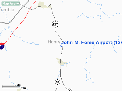
John M. Foree Airport
Address:
Henry County, KY
Tel:
502-845-7272
Images
and information placed above are from
http://www.airport-data.com/airport/12KY/
We
thank them for the data!
|
General Info |
| Country |
United
States |
| State |
KENTUCKY
|
| FAA ID |
12KY
|
| Latitude |
38-27-37.239N |
|
Longitude |
085-10-06.836W |
|
Elevation |
853 feet
|
| Near
City |
NEW
CASTLE |
We don't guarantee the information is fresh and accurate. The data may
be wrong or outdated.
For more up-to-date information please refer to other sources.
|
|


