 |
|
|
|
|
|
|
Location &
QuickFacts
|
FAA
Information Effective: |
2008-09-25 |
|
Airport
Identifier: |
41KY |
|
Airport
Status: |
Operational |
|
Longitude/Latitude: |
085-45-01.8640W/38-15-07.2560N
-85.750518/38.252016 (Estimated) |
|
Elevation: |
440 ft / 134.11 m (Estimated) |
|
Land: |
0 acres |
|
From
nearest city: |
0 nautical miles N of Louisville, KY |
|
Location: |
Jefferson County, KY |
|
Magnetic Variation: |
02W (1990) |
Owner & Manager
|
Ownership: |
Privately owned |
|
Owner: |
Jh Air Ambulance Inc. Skycare |
|
Address: |
217 E. Chestnut Street
Louisville, KY 40202 |
|
Phone
number: |
502-583-2444 |
|
Manager: |
John G. Blumenstock |
|
Address: |
217 E. Chestnut Street
Louisville, KY 40202 |
|
Phone number: |
502-583-2444 |
Airport Operations and Facilities
|
Airport Use: |
Private
MEDICAL USE. |
|
Wind indicator: |
Yes |
|
Segmented Circle: |
No |
|
Control Tower: |
No |
|
Lighting Schedule: |
DUSK-DAWN |
|
Beacon Color: |
Clear (unlighted land airport) |
|
Sectional chart: |
St Louis |
|
Region: |
ASO - Southern |
|
Boundary ARTCC: |
ZID - Indianapolis |
|
Tie-in FSS: |
LOU - Louisville |
|
FSS Toll Free: |
1-800-WX-BRIEF |
Airport
Communications
|
Runway Information
Helipad H1
|
Dimension: |
120 x 62 ft / 36.6 x 18.9 m |
|
Surface: |
CONC, |
|
|
Runway H1
|
Runway
|
|
Traffic
Pattern: |
Left |
Left |
|
Radio Navigation Aids
|
ID |
Type |
Name |
Ch |
Freq |
Var |
Dist |
|
GOI |
NDB |
Godman |
|
396.00 |
02W |
20.6 nm |
|
BRY |
NDB |
Bardstown/dcmsnd |
|
248.00 |
02W |
27.4 nm |
|
IMS |
NDB |
Madison |
|
404.00 |
03W |
33.5 nm |
|
EQZ |
NDB |
Captain |
|
308.00 |
02W |
38.4 nm |
|
RRJ |
NDB |
Oranj |
|
368.00 |
02W |
40.2 nm |
|
FEU |
NDB |
Arnold |
|
521.00 |
03W |
44.0 nm |
|
IKY |
NDB |
Springfield |
|
429.00 |
03W |
44.4 nm |
|
TEL |
NDB |
Tell City |
|
206.00 |
02W |
46.7 nm |
|
BFR |
NDB |
Bedford |
|
344.00 |
02W |
47.8 nm |
|
OVO |
NDB |
North Vernon |
|
374.00 |
02W |
48.5 nm |
|
MYS |
VOR |
Mystic |
|
108.20 |
01W |
31.8 nm |
|
FFT |
VOR |
Frankfort |
|
109.40 |
03W |
40.0 nm |
|
BQM |
VOR/DME |
Bowman |
059X |
112.20 |
01W |
4.3 nm |
|
FTK |
VOR/DME |
Fort Knox |
033X |
109.60 |
01W |
23.2 nm |
|
EWO |
VOR/DME |
New Hope |
045X |
110.80 |
01E |
37.4 nm |
|
IIU |
VORTAC |
Louisville |
095X |
114.80 |
01E |
12.1 nm |
|
ABB |
VORTAC |
Nabb |
071X |
112.40 |
01E |
21.0 nm |
|
SDF |
VOT |
Louisville Standifd |
|
111.00 |
|
4.5 nm |
Remarks
-
PRVDD VFR; PVT
USE; APCH/DEP RTE OPS FM 100 TO 285 DEG & FM 310 TO 085 DEG; TKOF/LDG AREA MKD;
& WIND IND IS MAINTAINED.
Based Aircraft
|
Aircraft based
on field: |
1 |
|
Helicopters: |
1 |
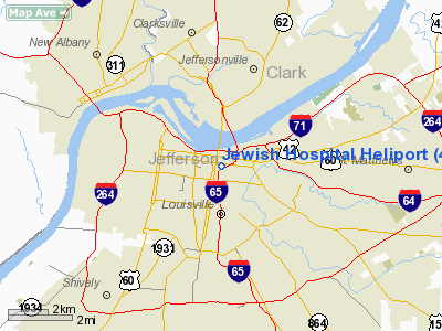
Jewish Hospital Heliport
Address:
Jefferson County, KY
Tel:
502-583-2444
Images
and information placed above are from
http://www.airport-data.com/airport/41KY/
We
thank them for the data!
|
General Info |
| Country |
United
States |
| State |
KENTUCKY
|
| FAA ID |
41KY
|
| Latitude |
38-15-07.256N |
|
Longitude |
085-45-01.864W |
|
Elevation |
440 feet
|
| Near
City |
LOUISVILLE |
We don't guarantee the information is fresh and accurate. The data may
be wrong or outdated.
For more up-to-date information please refer to other sources.
|
|


