 |
|
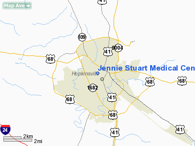
Jennie Stuart Medical Center Heliport |
|
Location &
QuickFacts
|
FAA
Information Effective: |
2008-09-25 |
|
Airport
Identifier: |
4KY6 |
|
Airport
Status: |
Operational |
|
Longitude/Latitude: |
087-29-41.0000W/36-51-40.0000N
-87.494722/36.861111 (Estimated) |
|
Elevation: |
550 ft / 167.64 m (Estimated) |
|
Land: |
0 acres |
|
From
nearest city: |
1 nautical miles S of Hopkinsville, KY |
|
Location: |
Christian County, KY |
|
Magnetic Variation: |
01W () |
Owner & Manager
|
Ownership: |
Privately owned |
|
Owner: |
Jennie Stuart Medical Center |
|
Address: |
320 West 18th Street
Hopkinsville, KY 42240 |
|
Phone
number: |
270-887-0100 |
|
Manager: |
Cathy Abrams Or Eric Lee |
|
Address: |
320 West 18th Street
Hopkinsville, KY 42240 |
|
Phone number: |
270-887-0224 |
Airport Operations and Facilities
|
Airport
Use: |
Private
MEDICAL USE. |
|
Wind
indicator: |
Yes
ROOFTOP WINDSOCK. |
|
Segmented Circle: |
No |
|
Control
Tower: |
No |
|
Lighting
Schedule: |
DUSK-DAWN |
|
Sectional chart: |
St Louis |
|
Region: |
ASO - Southern |
|
Boundary
ARTCC: |
ZME - Memphis |
|
Tie-in
FSS: |
LOU - Louisville |
|
FSS Toll
Free: |
1-800-WX-BRIEF |
|
Runway Information
Helipad H1
|
Dimension: |
40 x 40 ft / 12.2 x 12.2 m |
|
Surface: |
MATS, |
|
|
Runway H1
|
Runway
|
|
Traffic
Pattern: |
Left |
Left |
|
Radio Navigation Aids
|
ID |
Type |
Name |
Ch |
Freq |
Var |
Dist |
|
HIX |
NDB |
Honey Grove |
|
356.00 |
01W |
7.6 nm |
|
FK |
NDB |
Airbe |
|
273.00 |
01W |
8.4 nm |
|
GMH |
NDB |
Muhlenberg |
|
362.00 |
01E |
27.3 nm |
|
PED |
NDB |
Needmore |
|
221.00 |
01W |
34.0 nm |
|
ON |
NDB |
Music |
|
279.00 |
03W |
34.6 nm |
|
TWT |
NDB |
Tradewater |
|
276.00 |
00E |
42.4 nm |
|
DMZ |
NDB |
Dickson |
|
203.00 |
01W |
44.2 nm |
|
AEY |
NDB |
Waverly |
|
329.00 |
00E |
46.3 nm |
|
HXW |
TACAN |
Screaming Eagle |
096X |
|
01W |
11.2 nm |
|
CKV |
VOR/DME |
Clarksville |
043X |
110.60 |
01W |
14.9 nm |
|
CCT |
VORTAC |
Central City |
035X |
109.80 |
01W |
33.2 nm |
Remarks
-
60 FT TREES 160
FT SOUTH, 30 FT POWER LINES 150 FT FROM HELIPAD IN ALL QUADRANTS.
-
PRVDD VFR OPNS,
PVT USE, TLOF IS APPROPRIATELY MARKED, WIND INDICATOR IS MAINTAINED.
Jennie Stuart Medical Center Heliport
Address:
Christian County, KY
Tel:
270-887-0100,
270-887-0224
Images
and information placed above are from
http://www.airport-data.com/airport/4KY6/
We
thank them for the data!
|
General Info |
| Country |
United
States |
| State |
KENTUCKY
|
| FAA ID |
4KY6
|
| Latitude |
36-51-40.000N |
|
Longitude |
087-29-41.000W |
|
Elevation |
550 feet
|
| Near
City |
HOPKINSVILLE |
We don't guarantee the information is fresh and accurate. The data may
be wrong or outdated.
For more up-to-date information please refer to other sources.
|
|


