 |
|
|
Location &
QuickFacts
|
FAA
Information Effective: |
2008-09-25 |
|
Airport
Identifier: |
6KY6 |
|
Airport
Status: |
Operational |
|
Longitude/Latitude: |
085-21-47.0000W/38-21-38.0000N
-85.363056/38.360556 (Estimated) |
|
Elevation: |
803 ft / 244.75 m (Estimated) |
|
Land: |
200 acres |
|
From
nearest city: |
18 nautical miles NE of Louisville, KY |
|
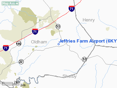
Location: |
Oldham County, KY |
|
Magnetic Variation: |
() |
Owner & Manager
|
Ownership: |
Privately owned |
|
Owner: |
Kevin Jeffries |
|
Address: |
1503 East Highway 22
Crestwood, KY 40014 |
|
Phone number: |
502-222-9877 |
|
Manager: |
Kevin Jeffries |
|
Address: |
1503 East Highway 22
Crestwood, KY 40014 |
|
Phone number: |
502-222-9877 |
Airport
Operations and Facilities
|
Airport
Use: |
Private |
|
Wind
indicator: |
Yes |
|
Control
Tower: |
No |
|
Sectional chart: |
St Louis |
|
Region: |
ASO - Southern |
|
Boundary
ARTCC: |
ZID - Indianapolis |
|
Tie-in
FSS: |
LOU - Louisville |
|
FSS Toll
Free: |
1-800-WX-BRIEF |
|
Runway Information
Runway 04/22
|
Dimension: |
1500 x 80 ft / 457.2 x 24.4 m |
|
Surface: |
TURF, |
|
|
Runway 04
|
Runway 22
|
|
Traffic
Pattern: |
Left |
Left |
|
Radio Navigation Aids
|
ID |
Type |
Name |
Ch |
Freq |
Var |
Dist |
|
IMS |
NDB |
Madison |
|
404.00 |
03W |
24.5 nm |
|
FEU |
NDB |
Arnold |
|
521.00 |
03W |
27.1 nm |
|
BRY |
NDB |
Bardstown/dcmsnd |
|
248.00 |
02W |
31.3 nm |
|
GOI |
NDB |
Godman |
|
396.00 |
02W |
37.7 nm |
|
LE |
NDB |
Blayd |
|
242.00 |
04W |
40.1 nm |
|
EQZ |
NDB |
Captain |
|
308.00 |
02W |
41.8 nm |
|
OVO |
NDB |
North Vernon |
|
374.00 |
02W |
42.9 nm |
|
IKY |
NDB |
Springfield |
|
429.00 |
03W |
44.0 nm |
|
UR |
NDB |
Burln |
|
321.00 |
04W |
49.6 nm |
|
FFT |
VOR |
Frankfort |
|
109.40 |
03W |
24.0 nm |
|
BQM |
VOR/DME |
Bowman |
059X |
112.20 |
01W |
16.2 nm |
|
FTK |
VOR/DME |
Fort Knox |
033X |
109.60 |
01W |
39.7 nm |
|
EWO |
VOR/DME |
New Hope |
045X |
110.80 |
01E |
46.2 nm |
|
IIU |
VORTAC |
Louisville |
095X |
114.80 |
01E |
18.5 nm |
|
ABB |
VORTAC |
Nabb |
071X |
112.40 |
01E |
18.8 nm |
|
HYK |
VORTAC |
Lexington |
073X |
112.60 |
00E |
48.3 nm |
|
SDF |
VOT |
Louisville Standifd |
|
111.00 |
|
20.8 nm |
Remarks
-
150 FT WATER TANK
1.5 NM E AND 100 FT MICROWAVE TWR .5 NM NE.
-
PRVDD VFR OPNS
AND PVT USE.
Based Aircraft
|
Aircraft based
on field: |
2 |
|
Single Engine
Airplanes: |
2 |
Jeffries Farm Airport
Address:
Oldham County, KY
Tel:
502-222-9877
Images
and information placed above are from
http://www.airport-data.com/airport/6KY6/
We
thank them for the data!
|
|


