 |
|
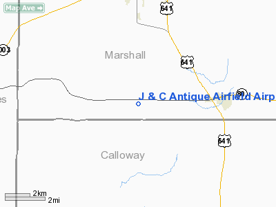
J And C Antique Airfield Airport |
|
Location &
QuickFacts
|
FAA
Information Effective: |
2008-09-25 |
|
Airport
Identifier: |
4KY0 |
|
Airport
Status: |
Operational |
|
Longitude/Latitude: |
088-22-36.0000W/36-45-43.0000N
-88.376667/36.761944 (Estimated) |
|
Elevation: |
540 ft / 164.59 m (Estimated) |
|
Land: |
18 acres |
|
From
nearest city: |
5 nautical miles W of Hardin, KY |
|
Location: |
Marshall County, KY |
|
Magnetic Variation: |
00W (1995) |
Owner & Manager
|
Ownership: |
Privately owned |
|
Owner: |
John A Ferrero |
|
Address: |
4035 Brewers Hwy 80
Benton, KY 42025 |
|
Phone number: |
502-527-2208 |
|
Manager: |
John A Ferrero |
|
Address: |
4035 Brewers Hwy 80
Benton, KY 42025 |
|
Phone number: |
502-527-2208 |
Airport
Operations and Facilities
|
Airport
Use: |
Private |
|
Wind
indicator: |
Yes |
|
Segmented Circle: |
No |
|
Control
Tower: |
No |
|
Sectional chart: |
St Louis |
|
Region: |
ASO - Southern |
|
Boundary
ARTCC: |
ZME - Memphis |
|
Tie-in
FSS: |
LOU - Louisville |
|
FSS Toll
Free: |
1-800-WX-BRIEF |
|
Runway Information
Runway 18/36
|
Dimension: |
1300 x 100 ft / 396.2 x 30.5 m |
|
Surface: |
TURF, |
|
|
Runway 18
|
Runway 36
|
|
Traffic
Pattern: |
Left |
Left |
|
Obstruction: |
22 ft pline, 50.0 ft from runway |
4 ft fence, 10.0 ft from runway |
|
Radio Navigation Aids
|
ID |
Type |
Name |
Ch |
Freq |
Var |
Dist |
|
GGK |
NDB |
Mayfield |
|
401.00 |
00E |
11.2 nm |
|
BDD |
NDB |
Bellgrade |
|
254.00 |
00E |
27.0 nm |
|
TIQ |
NDB |
Trainer |
|
410.00 |
00E |
30.9 nm |
|
HZD |
NDB |
Huntingdon |
|
217.00 |
00E |
40.7 nm |
|
UC |
NDB |
Obion |
|
212.00 |
00E |
40.9 nm |
|
CIR |
NDB |
Cairo |
|
397.00 |
00E |
44.5 nm |
|
FK |
NDB |
Airbe |
|
273.00 |
01W |
46.4 nm |
|
TWT |
NDB |
Tradewater |
|
276.00 |
00E |
47.1 nm |
|
CHQ |
NDB |
Charleston |
|
208.00 |
01E |
47.4 nm |
|
AEY |
NDB |
Waverly |
|
329.00 |
00E |
49.5 nm |
|
HXW |
TACAN |
Screaming Eagle |
096X |
|
01W |
42.8 nm |
|
CKV |
VOR/DME |
Clarksville |
043X |
110.60 |
01W |
47.2 nm |
|
CNG |
VORTAC |
Cunningham |
078X |
113.10 |
03E |
26.6 nm |
Remarks
-
PRVDD APCH/DEP
FROM 360 AND 180 DEGS, AREA IS MKD, WIND INDICATOR IS MAINTAINED.
J And C Antique Airfield Airport
Address:
Marshall County, KY
Tel:
502-527-2208
Images
and information placed above are from
http://www.airport-data.com/airport/4KY0/
We
thank them for the data!
|
General Info |
| Country |
United
States |
| State |
KENTUCKY
|
| FAA ID |
4KY0
|
| Latitude |
36-45-43.000N |
|
Longitude |
088-22-36.000W |
|
Elevation |
540 feet
|
| Near
City |
HARDIN
|
We don't guarantee the information is fresh and accurate. The data may
be wrong or outdated.
For more up-to-date information please refer to other sources.
|
|


