 |
|
|
Location &
QuickFacts
|
FAA
Information Effective: |
2008-09-25 |
|
Airport
Identifier: |
55KY |
|
Airport
Status: |
Operational |
|
Longitude/Latitude: |
088-20-04.1430W/36-35-20.2010N
-88.334484/36.588945 (Estimated) |
|
Elevation: |
548 ft / 167.03 m (Estimated) |
|
Land: |
0 acres |
|
From
nearest city: |
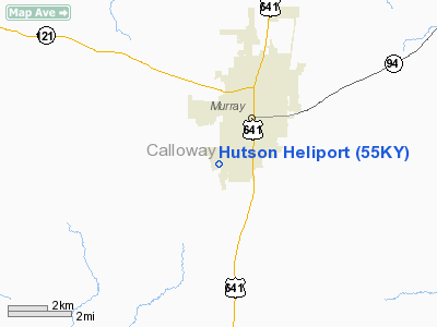
0 nautical miles SW of Murray, KY |
|
Location: |
Calloway County, KY |
|
Magnetic Variation: |
01E (1985) |
Owner & Manager
|
Ownership: |
Privately owned |
|
Owner: |
Hutson Inc |
|
Address: |
P O Box 1002
Murray, KY 42071 |
|
Phone
number: |
502-753-7422 |
|
Manager: |
Jim Lamb |
|
Address: |
P O Box 1002
Murray, KY 42071 |
|
Phone number: |
502-753-7422 |
Airport Operations and Facilities
|
Airport
Use: |
Private |
|
Wind
indicator: |
Yes |
|
Segmented Circle: |
No |
|
Control
Tower: |
No |
|
Lighting
Schedule: |
RDO-CTL
ACTVT PERIMETER LGTS RY H1 - 122.8. |
|
Sectional chart: |
St Louis |
|
Region: |
ASO - Southern |
|
Boundary
ARTCC: |
ZME - Memphis |
|
Tie-in
FSS: |
LOU - Louisville |
|
FSS on
Airport: |
No |
|
FSS Toll
Free: |
1-800-WX-BRIEF |
|
NOTAMs
Facility: |
LOU |
|
Runway Information
Helipad H1
|
Dimension: |
30 x 30 ft / 9.1 x 9.1 m |
|
Surface: |
CONC, |
|
|
Runway H1
|
Runway
|
|
Traffic
Pattern: |
Left |
Left |
|
Radio Navigation Aids
|
ID |
Type |
Name |
Ch |
Freq |
Var |
Dist |
|
GGK |
NDB |
Mayfield |
|
401.00 |
00E |
13.9 nm |
|
TIQ |
NDB |
Trainer |
|
410.00 |
00E |
20.8 nm |
|
HZD |
NDB |
Huntingdon |
|
217.00 |
00E |
30.8 nm |
|
UC |
NDB |
Obion |
|
212.00 |
00E |
36.4 nm |
|
BDD |
NDB |
Bellgrade |
|
254.00 |
00E |
37.2 nm |
|
AEY |
NDB |
Waverly |
|
329.00 |
00E |
40.4 nm |
|
FK |
NDB |
Airbe |
|
273.00 |
01W |
45.3 nm |
|
TGC |
NDB |
Gibson |
|
378.00 |
01E |
46.6 nm |
|
HXW |
TACAN |
Screaming Eagle |
096X |
|
01W |
40.8 nm |
|
CKV |
VOR/DME |
Clarksville |
043X |
110.60 |
01W |
44.5 nm |
|
CNG |
VORTAC |
Cunningham |
078X |
113.10 |
03E |
34.9 nm |
Remarks
-
VFR USE;
COMPATIBLE OPNL AGRMT IS MAINTD WITH HOKE HELI.
Based Aircraft
|
Aircraft based
on field: |
1 |
|
Helicopters: |
1 |
Hutson Heliport
Address:
Calloway County, KY
Tel:
502-753-7422
Images
and information placed above are from
http://www.airport-data.com/airport/55KY/
We
thank them for the data!
|
General Info |
| Country |
United
States |
| State |
KENTUCKY
|
| FAA ID |
55KY
|
| Latitude |
36-35-20.201N |
|
Longitude |
088-20-04.143W |
|
Elevation |
548 feet
|
| Near
City |
MURRAY
|
We don't guarantee the information is fresh and accurate. The data may
be wrong or outdated.
For more up-to-date information please refer to other sources.
|
|


