 |
|
Hopkinsville-Christian County Airport |
| Hopkinsville-Christian County Airport |
| IATA: none â ICAO: KHVC â FAA LID: HVC |
| Summary |
| Airport type |
Public |
| Owner |
City of Hopkinsville |
| Serves |
Hopkinsville, Kentucky |
| Elevation AMSL |
564 ft / 172 m |
| Coordinates |
36°51â²25â³N 087°27â²18â³W / 36.85694°N 87.455°W / 36.85694; -87.455 |
| Runways |
| Direction |
Length |
Surface |
| ft |
m |
| 8/26 |
5,505 |
1,678 |
Asphalt |
| Statistics (2008) |
| Aircraft operations |
25,800 |
| Based aircraft |
47 |
| Source: Federal Aviation Administration |
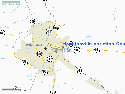
Hopkinsville-Christian County Airport (ICAO: KHVC, FAA LID: HVC) is a city-owned public-use airport located two nautical miles (3.7 km) east of the central business district of Hopkinsville, a city in Christian County, Kentucky, United States.
Although most U.S. airports use the same three-letter location identifier for the FAA and IATA, this airport is assigned HVC by the FAA but has no designation from the IATA.
Facilities and aircraft
Hopkinsville-Christian County Airport covers an area of 180 acres (73 ha) at an elevation of 564 feet (172 m) above mean sea level. It has one asphalt paved runway designated 8/26 which measures 5,505 by 100 feet (1,678 x 30 m).
For the 12-month period ending November 21, 2008, the airport had 25,800 aircraft operations, an average of 70 per day: 87% general aviation, 7% air taxi and 6% military. At that time there were 47 aircraft based at this airport: 98% single-engine and 2% multi-engine.
The above content comes from Wikipedia and is published under free licenses – click here to read more.
|
Location &
QuickFacts
|
FAA
Information Effective: |
2008-09-25 |
|
Airport
Identifier: |
HVC |
|
Airport
Status: |
Operational |
|
Longitude/Latitude: |
087-27-18.2400W/36-51-25.1000N
-87.455067/36.856972 (Estimated) |
|
Elevation: |
564 ft / 171.91 m (Estimated) |
|
Land: |
180 acres |
|
From
nearest city: |
2 nautical miles E of Hopkinsville, KY |
|
Location: |
Christian County, KY |
|
Magnetic Variation: |
01W (1995) |
Owner & Manager
|
Ownership: |
Publicly owned |
|
Owner: |
City Of Hopkinsville
AND CHRISTIAN COUNTY. |
|
Address: |
Municipal Bldg
Hopkinsville, KY 42240 |
|
Phone
number: |
270-887-4000 |
|
Manager: |
Al Eckles |
|
Address: |
300 Memorial Field Drive
Hopkinsville, KY 42240 |
|
Phone number: |
270-887-4157
SECOND LINE 270-887-4166 |
Airport Operations and Facilities
|
Airport
Use: |
Open to public |
|
Wind
indicator: |
Yes |
|
Segmented Circle: |
Yes |
|
Control
Tower: |
No |
|
Lighting
Schedule: |
DUSK-DAWN
ACTVT MIRL RY 08/26 AND REIL RYS 08 & 26 - 122.8. |
|
Beacon
Color: |
Clear-Green (lighted land airport) |
|
Landing
fee charge: |
No |
|
Sectional chart: |
St Louis |
|
Region: |
ASO - Southern |
|
Boundary
ARTCC: |
ZME - Memphis |
|
Tie-in
FSS: |
LOU - Louisville |
|
FSS on
Airport: |
No |
|
FSS Toll
Free: |
1-800-WX-BRIEF |
|
NOTAMs
Facility: |
LOU (NOTAM-d service avaliable) |
|
Federal Agreements: |
NGY |
Airport Communications
|
CTAF: |
122.800 |
|
Unicom: |
122.800 |
Airport Services
|
Fuel
available: |
100LLA MOGAS |
|
Airframe
Repair: |
NONE |
|
Power
Plant Repair: |
NONE |
|
Bottled
Oxygen: |
NONE |
|
Bulk
Oxygen: |
NONE |
|
Runway Information
Runway 08/26
|
Dimension: |
5502 x 100 ft / 1677.0 x 30.5 m |
|
Surface: |
ASPH, Good Condition |
|
Weight Limit: |
Single wheel: 14000 lbs. |
|
Edge Lights: |
Medium |
|
|
Runway 08
|
Runway 26
|
|
Longitude: |
087-27-51.3300W |
087-26-45.1600W |
|
Latitude: |
36-51-19.3500N |
36-51-30.8500N |
|
Elevation: |
537.00 ft |
564.00 ft |
|
Alignment: |
78 |
127 |
|
ILS Type: |
|
LOCALIZER |
|
Traffic
Pattern: |
Left |
Left |
|
Markings: |
Non-precision instrument, Good Condition |
Non-precision instrument, Good Condition |
|
Crossing
Height: |
38.00 ft |
34.00 ft |
|
VASI: |
4-light PAPI on left side |
4-light PAPI on left side |
|
Visual
Glide Angle: |
3.50° |
4.00° |
|
Runway End
Identifier: |
Yes |
Yes |
|
Obstruction: |
29 ft trees, 912.0 ft from runway, 252 ft left of
centerline, 25:1 slope to clear |
, 50:1 slope to clear |
|
Radio Navigation Aids
|
ID |
Type |
Name |
Ch |
Freq |
Var |
Dist |
|
HIX |
NDB |
Honey Grove |
|
356.00 |
01W |
5.8 nm |
|
FK |
NDB |
Airbe |
|
273.00 |
01W |
7.5 nm |
|
GMH |
NDB |
Muhlenberg |
|
362.00 |
01E |
26.4 nm |
|
PED |
NDB |
Needmore |
|
221.00 |
01W |
32.3 nm |
|
ON |
NDB |
Music |
|
279.00 |
03W |
33.1 nm |
|
TWT |
NDB |
Tradewater |
|
276.00 |
00E |
43.6 nm |
|
DMZ |
NDB |
Dickson |
|
203.00 |
01W |
43.9 nm |
|
AEY |
NDB |
Waverly |
|
329.00 |
00E |
46.6 nm |
|
HXW |
TACAN |
Screaming Eagle |
096X |
|
01W |
11.1 nm |
|
CKV |
VOR/DME |
Clarksville |
043X |
110.60 |
01W |
14.3 nm |
|
CCT |
VORTAC |
Central City |
035X |
109.80 |
01W |
32.9 nm |
|
BWG |
VORTAC |
Bowling Green |
126X |
117.90 |
02E |
48.8 nm |
Remarks
Based Aircraft
|
Aircraft based
on field: |
31 |
|
Single Engine
Airplanes: |
30 |
|
Multi Engine
Airplanes: |
1 |
Operational Statistics
Time Period: 2005-02-08 - 2006-02-07
|
Aircraft
Operations: |
64/Day |
|
Air Taxi: |
7.7% |
|
General
Aviation Local: |
42.9% |
|
General
Aviation Itinerant: |
42.9% |
|
Military: |
6.4% |
Hopkinsville-christian County Airport
Address:
Christian County, KY
Tel:
270-887-4000,
270-887-4157
Images
and information placed above are from
http://www.airport-data.com/airport/HVC/
We
thank them for the data!
|
General Info |
| Country |
United
States |
| State |
KENTUCKY
|
| FAA ID |
HVC
|
| Latitude |
36-51-25.100N |
|
Longitude |
087-27-18.240W |
|
Elevation |
564 feet
|
| Near
City |
HOPKINSVILLE |
We don't guarantee the information is fresh and accurate. The data may
be wrong or outdated.
For more up-to-date information please refer to other sources.
|
|


