 |
|
|
Location &
QuickFacts
|
FAA
Information Effective: |
2008-09-25 |
|
Airport
Identifier: |
64KY |
|
Airport
Status: |
Operational |
|
Longitude/Latitude: |
085-07-07.8340W/38-09-11.2530N
-85.118843/38.153126 (Estimated) |
|
Elevation: |
860 ft / 262.13 m (Estimated) |
|
Land: |
0 acres |
|
From
nearest city: |
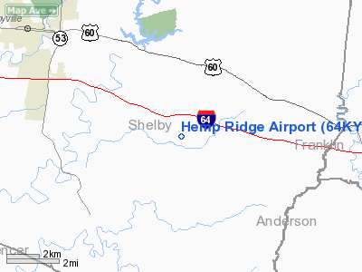
7 nautical miles NW of Shelbyville, KY |
|
Location: |
Shelby County, KY |
|
Magnetic Variation: |
03W (1985) |
Owner & Manager
|
Ownership: |
Privately owned |
|
Owner: |
T. O. Palmer |
|
Address: |
2806 Hempridge Rd
Shelbyville, KY 40065 |
|
Phone number: |
502-829-5603 |
|
Manager: |
T.o. Palmer |
|
Address: |
2806 Hempridge Rd
Shelbyville, KY 40065 |
|
Phone number: |
502-829-5603 |
Airport
Operations and Facilities
|
Airport
Use: |
Private |
|
Wind
indicator: |
Yes |
|
Segmented Circle: |
No |
|
Control
Tower: |
No |
|
Landing
fee charge: |
No |
|
Sectional chart: |
Cincinnati |
|
Region: |
ASO - Southern |
|
Boundary
ARTCC: |
ZID - Indianapolis |
|
Tie-in
FSS: |
LOU - Louisville |
|
FSS on
Airport: |
No |
|
FSS Toll
Free: |
1-800-WX-BRIEF |
|
Runway Information
Runway 17/35
|
Dimension: |
1600 x 100 ft / 487.7 x 30.5 m |
|
Surface: |
TURF, |
|
|
Runway 17
|
Runway 35
|
|
Traffic
Pattern: |
Left |
Left |
|
Obstruction: |
30 ft pline |
|
|
Radio Navigation Aids
|
ID |
Type |
Name |
Ch |
Freq |
Var |
Dist |
|
FEU |
NDB |
Arnold |
|
521.00 |
03W |
14.6 nm |
|
LE |
NDB |
Blayd |
|
242.00 |
04W |
23.9 nm |
|
BRY |
NDB |
Bardstown/dcmsnd |
|
248.00 |
02W |
25.2 nm |
|
IKY |
NDB |
Springfield |
|
429.00 |
03W |
31.7 nm |
|
DVK |
NDB |
Goodall |
|
311.00 |
03W |
38.5 nm |
|
IMS |
NDB |
Madison |
|
404.00 |
03W |
39.9 nm |
|
GOI |
NDB |
Godman |
|
396.00 |
02W |
42.2 nm |
|
TYC |
NDB |
Taylor County |
|
272.00 |
02W |
45.5 nm |
|
FFT |
VOR |
Frankfort |
|
109.40 |
03W |
10.1 nm |
|
BQM |
VOR/DME |
Bowman |
059X |
112.20 |
01W |
26.2 nm |
|
EWO |
VOR/DME |
New Hope |
045X |
110.80 |
01E |
41.0 nm |
|
FTK |
VOR/DME |
Fort Knox |
033X |
109.60 |
01W |
43.0 nm |
|
FLM |
VOR/DME |
Falmouth |
117X |
117.00 |
04W |
48.4 nm |
|
IIU |
VORTAC |
Louisville |
095X |
114.80 |
01E |
21.9 nm |
|
HYK |
VORTAC |
Lexington |
073X |
112.60 |
00E |
32.6 nm |
|
ABB |
VORTAC |
Nabb |
071X |
112.40 |
01E |
35.8 nm |
|
SDF |
VOT |
Louisville Standifd |
|
111.00 |
|
29.2 nm |
Remarks
Based Aircraft
|
Aircraft based
on field: |
1 |
|
Single Engine
Airplanes: |
1 |
Hemp Ridge Airport
Address:
Shelby County, KY
Tel:
502-829-5603
Images
and information placed above are from
http://www.airport-data.com/airport/64KY/
We
thank them for the data!
|
General Info |
| Country |
United
States |
| State |
KENTUCKY
|
| FAA ID |
64KY
|
| Latitude |
38-09-11.253N |
|
Longitude |
085-07-07.834W |
|
Elevation |
860 feet
|
| Near
City |
SHELBYVILLE |
We don't guarantee the information is fresh and accurate. The data may
be wrong or outdated.
For more up-to-date information please refer to other sources.
|
|


