 |
|
Hardin Memorial Hospital Heliport |
|
Location &
QuickFacts
|
FAA
Information Effective: |
2008-09-25 |
|
Airport
Identifier: |
1KY1 |
|
Airport
Status: |
Operational |
|
Longitude/Latitude: |
085-52-37.0000W/37-42-38.0000N
-85.876944/37.710556 (Estimated) |
|
Elevation: |
838 ft / 255.42 m (Estimated) |
|
Land: |
0 acres |
|
From
nearest city: |
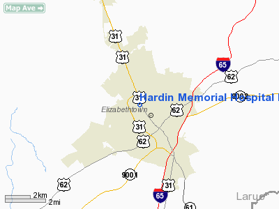
0 nautical miles N of Elizabethtown, KY |
|
Location: |
Hardin County, KY |
|
Magnetic Variation: |
02W (1990) |
Owner & Manager
|
Ownership: |
Publicly owned |
|
Owner: |
Hardin Memorial Hospital |
|
Address: |
913 N Dixie Hwy
Elizabethtown, KY 42701 |
|
Phone
number: |
502-737-1212 |
|
Manager: |
William J. Allen |
|
Address: |
913 N Dixie Hwy
Elizabethtown, KY 42701 |
|
Phone number: |
502-765-1583 |
Airport Operations and Facilities
|
Airport
Use: |
Private
MEDICAL USE. |
|
Wind
indicator: |
Yes |
|
Segmented Circle: |
No |
|
Control
Tower: |
No |
|
Lighting
Schedule: |
DUSK-DAWN |
|
Sectional chart: |
St Louis |
|
Region: |
ASO - Southern |
|
Boundary
ARTCC: |
ZID - Indianapolis |
|
Tie-in
FSS: |
LOU - Louisville |
|
FSS on
Airport: |
No |
|
FSS Toll
Free: |
1-800-WX-BRIEF |
|
Runway Information
Helipad H1
|
Dimension: |
31 x 31 ft / 9.4 x 9.4 m |
|
Surface: |
CONC, |
|
|
Runway H1
|
Runway
|
|
Traffic
Pattern: |
Left |
Left |
|
Radio Navigation Aids
|
ID |
Type |
Name |
Ch |
Freq |
Var |
Dist |
|
GOI |
NDB |
Godman |
|
396.00 |
02W |
15.6 nm |
|
BRY |
NDB |
Bardstown/dcmsnd |
|
248.00 |
02W |
20.5 nm |
|
IKY |
NDB |
Springfield |
|
429.00 |
03W |
30.8 nm |
|
TYC |
NDB |
Taylor County |
|
272.00 |
02W |
35.4 nm |
|
BVQ |
NDB |
Beaver Creek |
|
260.00 |
02W |
42.1 nm |
|
TEL |
NDB |
Tell City |
|
206.00 |
02W |
42.7 nm |
|
MYS |
VOR |
Mystic |
|
108.20 |
01W |
20.7 nm |
|
EWO |
VOR/DME |
New Hope |
045X |
110.80 |
01E |
10.7 nm |
|
FTK |
VOR/DME |
Fort Knox |
033X |
109.60 |
01W |
12.7 nm |
|
BQM |
VOR/DME |
Bowman |
059X |
112.20 |
01W |
32.8 nm |
|
IIU |
VORTAC |
Louisville |
095X |
114.80 |
01E |
27.6 nm |
|
SDF |
VOT |
Louisville Standifd |
|
111.00 |
|
28.9 nm |
Remarks
-
VFR; PRIVATE USE;
OPNS CONDUCTED FROM 110 DEG TO 320 DEG; AREA IS MARKED; WIND INDICATOR IS
MAINTAINED.
Hardin Memorial Hospital Heliport
Address:
Hardin County, KY
Tel:
502-737-1212,
502-765-1583
Images
and information placed above are from
http://www.airport-data.com/airport/1KY1/
We
thank them for the data!
|
General Info |
| Country |
United
States |
| State |
KENTUCKY
|
| FAA ID |
1KY1
|
| Latitude |
37-42-38.000N |
|
Longitude |
085-52-37.000W |
|
Elevation |
838 feet
|
| Near
City |
ELIZABETHTOWN |
We don't guarantee the information is fresh and accurate. The data may
be wrong or outdated.
For more up-to-date information please refer to other sources.
|
|


