 |
|
|
Location &
QuickFacts
|
FAA
Information Effective: |
2008-09-25 |
|
Airport
Identifier: |
1KY6 |
|
Airport
Status: |
Operational |
|
Longitude/Latitude: |
084-50-58.8280W/37-45-21.2720N
-84.849674/37.755909 (Estimated) |
|
Elevation: |
920 ft / 280.42 m (Estimated) |
|
Land: |
0 acres |
|
From
nearest city: |
0 nautical miles N of Harrodsburg, KY |
|
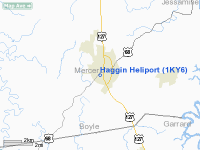
Location: |
Mercer County, KY |
|
Magnetic Variation: |
03W (1990) |
Owner & Manager
|
Ownership: |
Privately owned |
|
Owner: |
The James B Haggin Mem Hosp |
|
Address: |
464 Linden Ave
Harrodsburg, KY 40330 |
|
Phone number: |
606-734-5441 |
|
Manager: |
Earl J Motzer Phd |
|
Address: |
464 Linden Ave
Harrodsburg, KY 40330 |
|
Phone number: |
606-734-5441 |
Airport
Operations and Facilities
|
Airport
Use: |
Private |
|
Segmented Circle: |
No |
|
Control
Tower: |
No |
|
Landing
fee charge: |
No |
|
Sectional chart: |
Cincinnati |
|
Region: |
ASO - Southern |
|
Boundary
ARTCC: |
ZID - Indianapolis |
|
Tie-in
FSS: |
LOU - Louisville |
|
FSS Toll
Free: |
1-800-WX-BRIEF |
|
Runway Information
Helipad H1
|
Dimension: |
40 x 40 ft / 12.2 x 12.2 m |
|
Surface: |
ASPH, |
|
|
Runway H1
|
Runway
|
|
Traffic
Pattern: |
Left |
Left |
|
Radio Navigation Aids
|
ID |
Type |
Name |
Ch |
Freq |
Var |
Dist |
|
DVK |
NDB |
Goodall |
|
311.00 |
03W |
11.5 nm |
|
LE |
NDB |
Blayd |
|
242.00 |
04W |
16.5 nm |
|
IKY |
NDB |
Springfield |
|
429.00 |
03W |
19.8 nm |
|
FEU |
NDB |
Arnold |
|
521.00 |
03W |
27.6 nm |
|
TYC |
NDB |
Taylor County |
|
272.00 |
02W |
28.4 nm |
|
BRY |
NDB |
Bardstown/dcmsnd |
|
248.00 |
02W |
30.6 nm |
|
XYC |
NDB |
Seco |
|
393.00 |
03W |
38.9 nm |
|
IOB |
NDB |
Mount Sterling |
|
210.00 |
04W |
45.0 nm |
|
CDX |
NDB |
Cumberland River |
|
388.00 |
05E |
46.4 nm |
|
FFT |
VOR |
Frankfort |
|
109.40 |
03W |
25.8 nm |
|
EWO |
VOR/DME |
New Hope |
045X |
110.80 |
01E |
40.0 nm |
|
BQM |
VOR/DME |
Bowman |
059X |
112.20 |
01W |
48.0 nm |
|
HYK |
VORTAC |
Lexington |
073X |
112.60 |
00E |
21.9 nm |
|
IIU |
VORTAC |
Louisville |
095X |
114.80 |
01E |
40.3 nm |
|
SDF |
VOT |
Louisville Standifd |
|
111.00 |
|
49.1 nm |
Remarks
-
VFR, PRIVATE USE;
OPERATIONS CONDUCTED FROM 170 TO 230 & FROM 350 TO 020; AREA IS MARKED; WIND
INDICATOR IS MAINTAINED.
Haggin Heliport
Address:
Mercer County, KY
Tel:
606-734-5441
Images
and information placed above are from
http://www.airport-data.com/airport/1KY6/
We
thank them for the data!
|
General Info |
| Country |
United
States |
| State |
KENTUCKY
|
| FAA ID |
1KY6
|
| Latitude |
37-45-21.272N |
|
Longitude |
084-50-58.828W |
|
Elevation |
920 feet
|
| Near
City |
HARRODSBURG |
We don't guarantee the information is fresh and accurate. The data may
be wrong or outdated.
For more up-to-date information please refer to other sources.
|
|


