 |
|
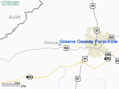
Greene County Parachute Center Airport |
|
Location &
QuickFacts
|
FAA
Information Effective: |
2008-09-25 |
|
Airport
Identifier: |
84KY |
|
Airport
Status: |
Operational |
|
Longitude/Latitude: |
085-32-23.8490W/37-48-55.2210N
-85.539958/37.815339 (Estimated) |
|
Elevation: |
650 ft / 198.12 m (Estimated) |
|
Land: |
0 acres |
|
From
nearest city: |
3 nautical miles E of Bardstown, KY |
|
Location: |
Nelson County, KY |
|
Magnetic Variation: |
02W (1985) |
Owner & Manager
|
Ownership: |
Privately owned |
|
Owner: |
B Adams |
|
Address: |
Rt 2
Bardstown, KY 40004 |
|
Phone number: |
502-348-9531 |
|
Manager: |
K Heismann |
|
Address: |
Rt 2
Bardstown, KY 40004 |
|
Phone number: |
502-348-9531 |
Airport
Operations and Facilities
|
Airport
Use: |
Private |
|
Segmented Circle: |
No |
|
Control
Tower: |
No |
|
Sectional chart: |
Cincinnati |
|
Region: |
ASO - Southern |
|
Boundary
ARTCC: |
ZID - Indianapolis |
|
Tie-in
FSS: |
LOU - Louisville |
|
FSS Toll
Free: |
1-800-WX-BRIEF |
|
Runway Information
Runway 13/31
|
Dimension: |
2000 x 75 ft / 609.6 x 22.9 m |
|
Surface: |
TURF, |
|
|
Runway 13
|
Runway 31
|
|
Traffic
Pattern: |
Left |
Left |
|
Obstruction: |
50 ft bldg, 100.0 ft from runway |
25 ft trees, 20.0 ft from runway |
|
Radio Navigation Aids
|
ID |
Type |
Name |
Ch |
Freq |
Var |
Dist |
|
BRY |
NDB |
Bardstown/dcmsnd |
|
248.00 |
02W |
3.3 nm |
|
IKY |
NDB |
Springfield |
|
429.00 |
03W |
18.1 nm |
|
GOI |
NDB |
Godman |
|
396.00 |
02W |
22.4 nm |
|
TYC |
NDB |
Taylor County |
|
272.00 |
02W |
28.6 nm |
|
DVK |
NDB |
Goodall |
|
311.00 |
03W |
39.6 nm |
|
FEU |
NDB |
Arnold |
|
521.00 |
03W |
41.7 nm |
|
LE |
NDB |
Blayd |
|
242.00 |
04W |
43.0 nm |
|
MYS |
VOR |
Mystic |
|
108.20 |
01W |
33.8 nm |
|
FFT |
VOR |
Frankfort |
|
109.40 |
03W |
37.2 nm |
|
EWO |
VOR/DME |
New Hope |
045X |
110.80 |
01E |
12.8 nm |
|
FTK |
VOR/DME |
Fort Knox |
033X |
109.60 |
01W |
21.3 nm |
|
BQM |
VOR/DME |
Bowman |
059X |
112.20 |
01W |
25.6 nm |
|
IIU |
VORTAC |
Louisville |
095X |
114.80 |
01E |
17.4 nm |
|
ABB |
VORTAC |
Nabb |
071X |
112.40 |
01E |
46.7 nm |
|
SDF |
VOT |
Louisville Standifd |
|
111.00 |
|
23.7 nm |
Remarks
Based Aircraft
|
Aircraft based
on field: |
3 |
|
Single Engine
Airplanes: |
3 |
Greene County Parachute Center Airport
Address:
Nelson County, KY
Tel:
502-348-9531
Images
and information placed above are from
http://www.airport-data.com/airport/84KY/
We
thank them for the data!
|
General Info |
| Country |
United
States |
| State |
KENTUCKY
|
| FAA ID |
84KY
|
| Latitude |
37-48-55.221N |
|
Longitude |
085-32-23.849W |
|
Elevation |
650 feet
|
| Near
City |
BARDSTOWN |
We don't guarantee the information is fresh and accurate. The data may
be wrong or outdated.
For more up-to-date information please refer to other sources.
|
|


