 |
|
|
|
|
|
|
Location &
QuickFacts
|
FAA
Information Effective: |
2008-09-25 |
|
Airport
Identifier: |
M20 |
|
Airport
Status: |
Operational |
|
Longitude/Latitude: |
086-15-40.1000W/37-23-58.3000N
-86.261139/37.399528 (Estimated) |
|
Elevation: |
760 ft / 231.65 m (Estimated) |
|
Land: |
75 acres |
|
From
nearest city: |
4 nautical miles SE of Leitchfield, KY |
|
Location: |
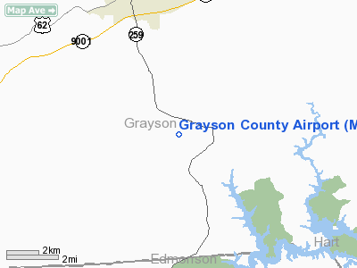
Grayson County, KY |
|
Magnetic Variation: |
01W (1985) |
Owner & Manager
|
Ownership: |
Publicly owned |
|
Owner: |
Grayson County Airport Board
ARPT BOARD CHAIRMAN: LEON HARRISON |
|
Address: |
695 Airport Road
Leitchfield, KY 42754 |
|
Phone number: |
270-242-7700 |
|
Manager: |
James Davis |
|
Address: |
1400 Shrewsbury
Leitchfield, KY 42754 |
|
Phone number: |
270-259-3081 |
Airport
Operations and Facilities
|
Airport
Use: |
Open to public |
|
Wind
indicator: |
Yes |
|
Segmented Circle: |
Yes |
|
Control
Tower: |
No |
|
Lighting
Schedule: |
RDO-CTL
ACTVT ROTG BCN - CTAF. |
|
Beacon
Color: |
Clear-Green (lighted land airport) |
|
Landing
fee charge: |
No |
|
Sectional chart: |
St Louis |
|
Region: |
ASO - Southern |
|
Traffic
Pattern Alt: |
800 ft |
|
Boundary
ARTCC: |
ZID - Indianapolis |
|
Tie-in
FSS: |
LOU - Louisville |
|
FSS on
Airport: |
No |
|
FSS Toll
Free: |
1-800-WX-BRIEF |
|
NOTAMs
Facility: |
LOU (NOTAM-d service avaliable) |
Airport Communications
|
CTAF: |
123.000 |
|
Unicom: |
123.000 |
Airport Services
|
Fuel
available: |
100LL
FUEL AVBL ON CALL: 270-259-3081. |
|
Bottled
Oxygen: |
NONE |
|
Bulk
Oxygen: |
NONE |
|
Runway Information
Runway 02/20
|
Dimension: |
4000 x 60 ft / 1219.2 x 18.3 m |
|
Surface: |
ASPH, Good Condition |
|
Weight Limit: |
Single wheel: 12500 lbs. |
|
Edge Lights: |
Medium |
|
|
Runway 02
|
Runway 20
|
|
Longitude: |
086-15-48.0800W |
086-15-32.1000W |
|
Latitude: |
37-23-39.5400N |
37-24-16.9900N |
|
Traffic
Pattern: |
Left |
Left |
|
Markings: |
Basic, Fair Condition |
Basic, Fair Condition |
|
Crossing
Height: |
27.00 ft |
26.00 ft |
|
VASI: |
2-box on left side |
2-box on left side |
|
Visual
Glide Angle: |
3.00° |
3.00° |
|
Obstruction: |
128 ft trees, 3496.0 ft from runway, 1218 ft left of
centerline, 25:1 slope to clear
+25 FT TREE 132 FT FROM RY END 55 FT L. |
60 ft tree, 963.0 ft from runway, 166 ft left of
centerline, 13:1 slope to clear |
|
Radio Navigation Aids
|
ID |
Type |
Name |
Ch |
Freq |
Var |
Dist |
|
BVQ |
NDB |
Beaver Creek |
|
260.00 |
02W |
25.9 nm |
|
GOI |
NDB |
Godman |
|
396.00 |
02W |
36.2 nm |
|
TEL |
NDB |
Tell City |
|
206.00 |
02W |
42.2 nm |
|
GMH |
NDB |
Muhlenberg |
|
362.00 |
01E |
44.2 nm |
|
BRY |
NDB |
Bardstown/dcmsnd |
|
248.00 |
02W |
45.8 nm |
|
TYC |
NDB |
Taylor County |
|
272.00 |
02W |
48.6 nm |
|
MYS |
VOR |
Mystic |
|
108.20 |
01W |
29.7 nm |
|
EWO |
VOR/DME |
New Hope |
045X |
110.80 |
01E |
31.2 nm |
|
FTK |
VOR/DME |
Fort Knox |
033X |
109.60 |
01W |
33.5 nm |
|
OWB |
VOR/DME |
Owensboro |
023X |
108.60 |
01E |
47.8 nm |
|
BWG |
VORTAC |
Bowling Green |
126X |
117.90 |
02E |
29.6 nm |
|
CCT |
VORTAC |
Central City |
035X |
109.80 |
01W |
47.9 nm |
Remarks
Based Aircraft
|
Aircraft based
on field: |
11 |
|
Single Engine
Airplanes: |
11 |
Operational Statistics
Time Period: 2005-08-11 - 2006-08-10
|
Aircraft
Operations: |
88/Week |
|
Air Taxi: |
8.8% |
|
General
Aviation Local: |
41.8% |
|
General
Aviation Itinerant: |
44.0% |
|
Military: |
5.5% |
Grayson County Airport
Address:
Grayson County, KY
Tel:
270-242-7700, 270-259-3081
Images
and information placed above are from
http://www.airport-data.com/airport/M20/
We
thank them for the data!
|
General Info |
| Country |
United
States |
| State |
KENTUCKY
|
| FAA ID |
M20
|
| Latitude |
37-23-58.188N |
|
Longitude |
086-15-36.904W |
|
Elevation |
760 feet
|
| Near
City |
LEITCHFIELD |
We don't guarantee the information is fresh and accurate. The data may
be wrong or outdated.
For more up-to-date information please refer to other sources.
|
|


