 |
|
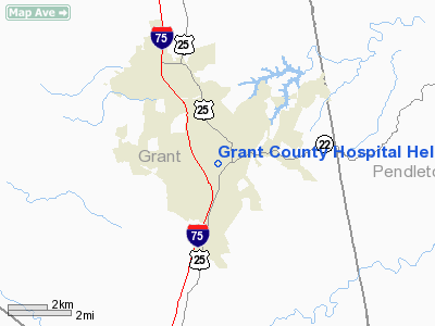
Grant County Hospital Heliport |
|
Location &
QuickFacts
|
FAA
Information Effective: |
2008-09-25 |
|
Airport
Identifier: |
38KY |
|
Airport
Status: |
Operational |
|
Longitude/Latitude: |
084-34-06.7920W/38-38-09.2480N
-84.568553/38.635902 (Estimated) |
|
Elevation: |
956 ft / 291.39 m (Estimated) |
|
Land: |
0 acres |
|
From
nearest city: |
2 nautical miles SE of Williamstown, KY |
|
Location: |
Grant County, KY |
|
Magnetic Variation: |
03W (1990) |
Owner & Manager
|
Ownership: |
Privately owned |
|
Owner: |
Grant County Hospital |
|
Address: |
238 Barnes Park
Williamstown, KY 41097 |
|
Phone number: |
606-824-4436 |
|
Manager: |
Chris Carle |
|
Address: |
238 Barnes Park
Williamstown, KY 41097 |
|
Phone number: |
606-824-4436 |
Airport
Operations and Facilities
|
Airport
Use: |
Private
MEDICAL USE. |
|
Segmented Circle: |
No |
|
Control
Tower: |
No |
|
Sectional chart: |
Cincinnati |
|
Region: |
ASO - Southern |
|
Boundary
ARTCC: |
ZID - Indianapolis |
|
Tie-in
FSS: |
LOU - Louisville |
|
FSS on
Airport: |
No |
|
FSS Toll
Free: |
1-800-WX-BRIEF |
|
Runway Information
Helipad H1
|
Dimension: |
30 x 30 ft / 9.1 x 9.1 m |
|
Surface: |
CONC, |
|
|
Runway H1
|
Runway
|
|
Traffic
Pattern: |
Left |
Left |
|
Radio Navigation Aids
|
ID |
Type |
Name |
Ch |
Freq |
Var |
Dist |
|
UR |
NDB |
Burln |
|
321.00 |
04W |
26.4 nm |
|
FEU |
NDB |
Arnold |
|
521.00 |
03W |
27.9 nm |
|
PWF |
NDB |
Sportys |
|
245.00 |
04W |
31.2 nm |
|
LUK |
NDB |
Cincinnati |
|
335.00 |
04W |
33.2 nm |
|
MDE |
NDB |
Madeira |
|
379.00 |
04W |
36.7 nm |
|
ISZ |
NDB |
Cincinnati-blue Ash |
|
388.00 |
04W |
37.8 nm |
|
LE |
NDB |
Blayd |
|
242.00 |
04W |
39.2 nm |
|
IMS |
NDB |
Madison |
|
404.00 |
03W |
42.5 nm |
|
XW |
NDB |
Flmng |
|
400.00 |
05W |
43.4 nm |
|
HAO |
NDB |
Hamilton |
|
260.00 |
04W |
44.3 nm |
|
IOB |
NDB |
Mount Sterling |
|
210.00 |
04W |
44.3 nm |
|
AMT |
NDB |
West Union |
|
359.00 |
04W |
48.9 nm |
|
FFT |
VOR |
Frankfort |
|
109.40 |
03W |
31.6 nm |
|
FLM |
VOR/DME |
Falmouth |
117X |
117.00 |
04W |
12.1 nm |
|
CVG |
VORTAC |
Cincinnati |
120X |
117.30 |
04W |
23.7 nm |
|
HYK |
VORTAC |
Lexington |
073X |
112.60 |
00E |
40.5 nm |
|
LUK |
VOT |
Cincinnati Muni/lunken |
|
108.40 |
|
30.0 nm |
Remarks
-
PRVDD VFR/PR USE;
APCH/DEP RTE OPS FROM 280-170 DEG; TKOF/LNDG AREA MKD; WIND INDICATOR MNTND.
Grant County Hospital Heliport
Address:
Grant County, KY
Tel:
606-824-4436
Images
and information placed above are from
http://www.airport-data.com/airport/38KY/
We
thank them for the data!
|
General Info |
| Country |
United
States |
| State |
KENTUCKY
|
| FAA ID |
38KY
|
| Latitude |
38-38-09.248N |
|
Longitude |
084-34-06.792W |
|
Elevation |
956 feet
|
| Near
City |
WILLIAMSTOWN |
We don't guarantee the information is fresh and accurate. The data may
be wrong or outdated.
For more up-to-date information please refer to other sources.
|
|


