 |
|
Glasgow Municipal Airport |
| Glasgow Municipal Airport |
| IATA: GLW â ICAO: KGLW â FAA LID: GLW |
| Summary |
| Airport type |
Public |
| Owner |
Glasgow Airport Board |
| Serves |
Glasgow, Kentucky |
| Elevation AMSL |
716 ft / 218 m |
| Coordinates |
37°01â²54â³N 085°57â²14â³W / 37.03167°N 85.95389°W / 37.03167; -85.95389 |
| Runways |
| Direction |
Length |
Surface |
| ft |
m |
| 7/25 |
5,301 |
1,616 |
Asphalt |
| Statistics (2006) |
| Aircraft operations |
13,350 |
| Based aircraft |
30 |
| Source: Federal Aviation Administration |
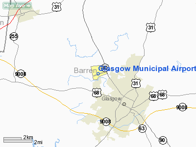
Glasgow Municipal Airport (IATA: GLW, ICAO: KGLW, FAA LID: GLW) is a public use airport located two nautical miles (3.7 km) northwest of the central business district of Glasgow, a city in Barren County, Kentucky, United States. It is owned by the Glasgow Airport Board.
Facilities and aircraft
Glasgow Municipal Airport covers an area of 192 acres (78 ha) at an elevation of 716 feet (218 m) above mean sea level. It has one asphalt paved runway designated 7/25 which measures 5,301 by 100 feet (1,616 x 30 m).
For the 12-month period ending February 8, 2006, the airport had 13,350 aircraft operations, an average of 36 per day: 85% general aviation, 13% air taxi and 1% military. At that time there were 30 aircraft based at this airport: 77% single-engine, 17% multi-engine, 3% jet and 3% helicopter.
The above content comes from Wikipedia and is published under free licenses – click here to read more.
|
Location &
QuickFacts
|
FAA
Information Effective: |
2008-09-25 |
|
Airport
Identifier: |
GLW |
|
Airport
Status: |
Operational |
|
Longitude/Latitude: |
085-57-13.5000W/37-01-54.4000N
-85.953750/37.031778 (Estimated) |
|
Elevation: |
716 ft / 218.24 m (Surveyed) |
|
Land: |
192 acres |
|
From
nearest city: |
2 nautical miles NW of Glasgow, KY |
|
Location: |
Barren County, KY |
|
Magnetic Variation: |
02W (1995) |
Owner & Manager
|
Ownership: |
Publicly owned |
|
Owner: |
Glasgow Airport Board
KEITH BRANHAM, AIRPORT BOARD CHAIRMAN. |
|
Address: |
390 Airport Road
Glasgow, KY 42141 |
|
Phone number: |
270-678-4548 |
|
Manager: |
Ed Begley |
|
Address: |
390 Airport Rd.
Glasgow, KY 42141 |
|
Phone number: |
270-678-4469 |
Airport
Operations and Facilities
|
Airport
Use: |
Open to public |
|
Wind
indicator: |
Yes |
|
Segmented Circle: |
Yes |
|
Control
Tower: |
No |
|
Lighting
Schedule: |
DUSK-DAWN
HIRL RY 07/25 PRESET LOW INTST; TO INCR INTST & ACTVT REIL RY 07-25
CTAF. |
|
Beacon
Color: |
Clear-Green (lighted land airport) |
|
Landing
fee charge: |
No |
|
Sectional chart: |
St Louis |
|
Region: |
ASO - Southern |
|
Boundary
ARTCC: |
ZME - Memphis |
|
Tie-in
FSS: |
LOU - Louisville |
|
FSS on
Airport: |
No |
|
FSS Toll
Free: |
1-800-WX-BRIEF |
|
NOTAMs
Facility: |
LOU (NOTAM-d service avaliable) |
|
Federal Agreements: |
NGY |
Airport Communications
|
CTAF: |
122.800 |
|
Unicom: |
122.800 |
Airport Services
|
Fuel
available: |
100LLA |
|
Airframe
Repair: |
MINOR |
|
Power
Plant Repair: |
MINOR |
|
Bottled
Oxygen: |
NONE |
|
Bulk
Oxygen: |
NONE |
|
Runway Information
Runway 07/25
|
Dimension: |
5301 x 100 ft / 1615.7 x 30.5 m |
|
Surface: |
ASPH, Good Condition |
|
Weight Limit: |
Single wheel: 30000 lbs. |
|
Edge Lights: |
High |
|
|
Runway 07
|
Runway 25
|
|
Longitude: |
085-57-44.5005W |
085-56-42.5390W |
|
Latitude: |
37-01-46.0301N |
37-02-02.7579N |
|
Elevation: |
704.00 ft |
716.00 ft |
|
Alignment: |
71 |
127 |
|
ILS Type: |
SDF
|
|
|
Traffic
Pattern: |
Left |
Left |
|
Markings: |
Non-precision instrument, Good Condition |
Nonstandard, Good Condition
RY 25 NSTD LOCATION OF DSPLCD THLD MARKINGS 40 FT FROM DSPLCD THLD LGTS
(LGTS IN CORRECT POSITION AT 288 FT, MARKINGS AT 328 FT). |
|
Crossing
Height: |
26.00 ft |
29.00 ft |
|
Displaced
threshold: |
0.00 ft |
301.00 ft |
|
VASI: |
2-light PAPI on left side |
2-light PAPI on left side |
|
Visual
Glide Angle: |
3.00° |
3.25° |
|
Runway End
Identifier: |
Yes |
Yes |
|
Obstruction: |
, 50:1 slope to clear |
33 ft road, 562.0 ft from runway, 321 ft right of
centerline, 10:1 slope to clear
RY 25 APCH RATIO 19:1 TO DSPLCD THLD. |
|
Decleard
distances: |
Take off run available 5301.00 ft
Take off distance available 5301.00 ft
Actual stop distance available 5000.00 ft
Landing distance available 5000.00 ft |
Take off run available 5301.00 ft
Take off distance available 5301.00 ft
Actual stop distance available 5301.00 ft
Landing distance available 5000.00 ft |
|
Radio Navigation Aids
|
ID |
Type |
Name |
Ch |
Freq |
Var |
Dist |
|
BVQ |
NDB |
Beaver Creek |
|
260.00 |
02W |
2.8 nm |
|
LFB |
NDB |
Lafayette |
|
245.00 |
02W |
31.5 nm |
|
TYC |
NDB |
Taylor County |
|
272.00 |
02W |
40.6 nm |
|
IKY |
NDB |
Springfield |
|
429.00 |
03W |
49.9 nm |
|
EWO |
VOR/DME |
New Hope |
045X |
110.80 |
01E |
38.4 nm |
|
BWG |
VORTAC |
Bowling Green |
126X |
117.90 |
02E |
24.3 nm |
|
LVT |
VORTAC |
Livingston |
021X |
108.40 |
02W |
46.5 nm |
Remarks
Based Aircraft
|
Aircraft based
on field: |
30 |
|
Single Engine
Airplanes: |
23 |
|
Multi Engine
Airplanes: |
5 |
|
Jet Engine
Airplanes: |
1 |
|
Helicopters: |
1 |
Operational Statistics
Time Period: 2005-02-09 - 2006-02-08
|
Aircraft
Operations: |
257/Week |
|
Air Taxi: |
13.5% |
|
General
Aviation Local: |
34.8% |
|
General
Aviation Itinerant: |
50.2% |
|
Military: |
1.5% |
Glasgow Municipal Airport
Address:
Barren County, KY
Tel:
270-678-4548, 270-678-4469
Images
and information placed above are from
http://www.airport-data.com/airport/GLW/
We
thank them for the data!
|
General Info |
| Country |
United
States |
| State |
KENTUCKY
|
| FAA ID |
GLW
|
| Latitude |
37-01-55.400N |
|
Longitude |
085-57-09.400W |
|
Elevation |
715 feet
|
| Near
City |
GLASGOW
|
We don't guarantee the information is fresh and accurate. The data may
be wrong or outdated.
For more up-to-date information please refer to other sources.
|
|


