 |
|
|
|
|
|
|
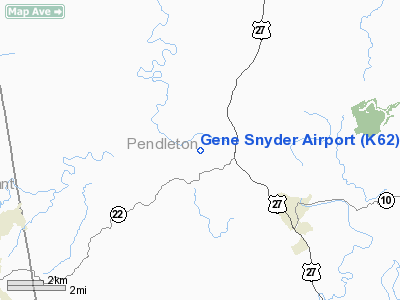
Location &
QuickFacts
|
FAA
Information Effective: |
2008-09-25 |
|
Airport
Identifier: |
K62 |
|
Airport
Status: |
Operational |
|
Longitude/Latitude: |
084-23-30.5500W/38-42-14.6700N
-84.391819/38.704075 (Estimated) |
|
Elevation: |
899 ft / 274.02 m (Estimated) |
|
Land: |
127 acres |
|
From
nearest city: |
4 nautical miles NW of Falmouth, KY |
|
Location: |
Pendleton County, KY |
|
Magnetic Variation: |
03W (1985) |
Owner & Manager
|
Ownership: |
Publicly owned |
|
Owner: |
Falmouth-pendleton Co Arpt Bd |
|
Address: |
400 Gene Snyder Airport Drive
Falmouth, KY 41040 |
|
Phone
number: |
859-472-2480
ARPT BOARD CHAIRMAN, RANDY WOLF |
|
Manager: |
Pending |
|
Address: |
400 Gene Snyder Airport Drive
Falmouth, KY 41040 |
|
Phone number: |
859-654-1200 |
Airport Operations and Facilities
|
Airport
Use: |
Open to public |
|
Wind
indicator: |
Yes |
|
Segmented Circle: |
Yes |
|
Control
Tower: |
No |
|
Lighting
Schedule: |
DUSK-DAWN
ACTVT MIRL RY 03/21 - 122.9. |
|
Beacon
Color: |
Clear-Green (lighted land airport) |
|
Landing
fee charge: |
No |
|
Sectional chart: |
Cincinnati |
|
Region: |
ASO - Southern |
|
Boundary
ARTCC: |
ZID - Indianapolis |
|
Tie-in
FSS: |
LOU - Louisville |
|
FSS on
Airport: |
No |
|
FSS Toll
Free: |
1-800-WX-BRIEF |
|
NOTAMs
Facility: |
LOU (NOTAM-d service avaliable) |
|
Federal Agreements: |
NGY |
Airport Communications
|
CTAF: |
122.700 |
|
Unicom: |
122.700 |
Airport Services
|
Fuel
available: |
100LL |
|
Bottled
Oxygen: |
NONE |
|
Bulk
Oxygen: |
NONE |
|
Runway Information
Runway 03/21
|
Dimension: |
3994 x 75 ft / 1217.4 x 22.9 m |
|
Surface: |
ASPH, Good Condition |
|
Weight Limit: |
Single wheel: 12500 lbs. |
|
Edge Lights: |
Medium |
|
|
Runway 03
|
Runway 21
|
|
Longitude: |
084-23-41.3700W |
084-23-19.7300W |
|
Latitude: |
38-41-56.8500N |
38-42-32.5000N |
|
Elevation: |
899.00 ft |
884.00 ft |
|
Alignment: |
25 |
127 |
|
Traffic
Pattern: |
Left |
Left |
|
Markings: |
Non-precision instrument, Good Condition |
Non-precision instrument, Good Condition |
|
Crossing
Height: |
37.00 ft |
41.00 ft |
|
VASI: |
4-light PAPI on left side |
4-light PAPI on left side |
|
Visual
Glide Angle: |
3.50° |
3.50° |
|
Obstruction: |
55 ft trees, 780.0 ft from runway, 180 ft right of
centerline, 10:1 slope to clear |
, 50:1 slope to clear
RY 21 +10 FT TREE 80 FT FROM THLD AND 100 FT RIGHT. |
|
Radio Navigation Aids
|
ID |
Type |
Name |
Ch |
Freq |
Var |
Dist |
|
PWF |
NDB |
Sportys |
|
245.00 |
04W |
23.9 nm |
|
UR |
NDB |
Burln |
|
321.00 |
04W |
27.2 nm |
|
LUK |
NDB |
Cincinnati |
|
335.00 |
04W |
27.5 nm |
|
MDE |
NDB |
Madeira |
|
379.00 |
04W |
31.2 nm |
|
ISZ |
NDB |
Cincinnati-blue Ash |
|
388.00 |
04W |
32.7 nm |
|
FEU |
NDB |
Arnold |
|
521.00 |
03W |
35.6 nm |
|
XW |
NDB |
Flmng |
|
400.00 |
05W |
35.8 nm |
|
AMT |
NDB |
West Union |
|
359.00 |
04W |
39.9 nm |
|
HAO |
NDB |
Hamilton |
|
260.00 |
04W |
41.1 nm |
|
IOB |
NDB |
Mount Sterling |
|
210.00 |
04W |
43.3 nm |
|
LE |
NDB |
Blayd |
|
242.00 |
04W |
44.9 nm |
|
HW |
NDB |
Cubla |
|
299.00 |
04W |
45.9 nm |
|
HKF |
NDB |
Hook Field |
|
239.00 |
04W |
47.8 nm |
|
HOC |
NDB |
Hillsboro |
|
278.00 |
05W |
49.1 nm |
|
FFT |
VOR |
Frankfort |
|
109.40 |
03W |
39.7 nm |
|
FLM |
VOR/DME |
Falmouth |
117X |
117.00 |
04W |
5.0 nm |
|
CVG |
VORTAC |
Cincinnati |
120X |
117.30 |
04W |
23.8 nm |
|
HYK |
VORTAC |
Lexington |
073X |
112.60 |
00E |
44.5 nm |
|
LUK |
VOT |
Cincinnati Muni/lunken |
|
108.40 |
|
24.8 nm |
Based Aircraft
|
Aircraft based
on field: |
25 |
|
Single Engine
Airplanes: |
24 |
|
Multi Engine
Airplanes: |
1 |
Operational Statistics
Time Period: 2005-02-24 - 2006-02-23
|
Aircraft
Operations: |
112/Week |
|
Air Taxi: |
5.2% |
|
General
Aviation Local: |
41.4% |
|
General
Aviation Itinerant: |
48.3% |
|
Military: |
5.2% |
Gene Snyder Airport
Address:
Pendleton County, KY
Tel:
859-472-2480, 859-654-1200
Images
and information placed above are from
http://www.airport-data.com/airport/K62/
We
thank them for the data!
|
General Info |
| Country |
United
States |
| State |
KENTUCKY
|
| FAA ID |
K62
|
| Latitude |
38-42-15.250N |
|
Longitude |
084-23-29.775W |
|
Elevation |
898 feet
|
| Near
City |
FALMOUTH
|
We don't guarantee the information is fresh and accurate. The data may
be wrong or outdated.
For more up-to-date information please refer to other sources.
|
|


