 |
|
|
Location &
QuickFacts
|
FAA
Information Effective: |
2008-09-25 |
|
Airport
Identifier: |
03KY |
|
Airport
Status: |
Operational |
|
Longitude/Latitude: |
087-32-29.0370W/37-47-30.1540N
-87.541399/37.791709 (Estimated) |
|
Elevation: |
385 ft / 117.35 m (Estimated) |
|
Land: |
0 acres |
|
From
nearest city: |
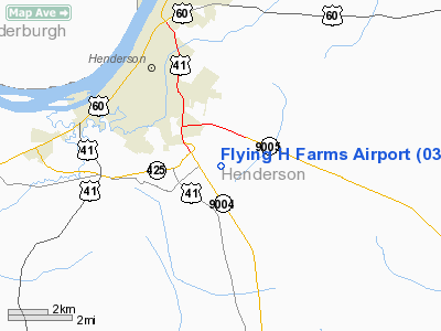
3 nautical miles E of Henderson, KY |
|
Location: |
Henderson County, KY |
|
Magnetic Variation: |
00W (1985) |
Owner & Manager
|
Ownership: |
Privately owned |
|
Owner: |
Kimber J. Heddens |
|
Address: |
P.o. Box 141
Henderson, KY 42420 |
|
Phone number: |
502-826-8032 |
|
Address: |
|
Airport Operations and Facilities
|
Airport Use: |
Private |
|
Wind indicator: |
No |
|
Segmented Circle: |
No |
|
Control Tower: |
No |
|
Landing fee charge: |
No |
|
Sectional chart: |
St Louis |
|
Region: |
ASO - Southern |
|
Boundary ARTCC: |
ZID - Indianapolis |
|
Tie-in FSS: |
LOU - Louisville |
|
FSS on Airport: |
No |
|
FSS Toll Free: |
1-800-WX-BRIEF |
Airport Services
|
Airframe
Repair: |
MINOR |
|
Power
Plant Repair: |
MINOR |
|
Runway Information
Runway 03/21
|
Dimension: |
2300 x 80 ft / 701.0 x 24.4 m |
|
Surface: |
TURF, |
|
|
Runway 03
|
Runway 21
|
|
Traffic
Pattern: |
Left |
Left |
|
Radio Navigation Aids
|
ID |
Type |
Name |
Ch |
Freq |
Var |
Dist |
|
GVA |
NDB |
Geneva |
|
224.00 |
01W |
10.9 nm |
|
PDW |
NDB |
Evansville |
|
284.00 |
00E |
14.9 nm |
|
TWT |
NDB |
Tradewater |
|
276.00 |
00E |
27.5 nm |
|
CUL |
NDB |
Carmi |
|
332.00 |
01W |
32.9 nm |
|
GMH |
NDB |
Muhlenberg |
|
362.00 |
01E |
38.5 nm |
|
TEL |
NDB |
Tell City |
|
206.00 |
02W |
42.5 nm |
|
FNZ |
NDB |
Ferdinand |
|
239.00 |
00E |
43.2 nm |
|
HSB |
NDB |
Harrisburg-raleigh |
|
230.00 |
00E |
47.7 nm |
|
OWB |
VOR/DME |
Owensboro |
023X |
108.60 |
01E |
18.1 nm |
|
HNB |
VOR/DME |
Huntingburg |
029X |
109.20 |
00E |
39.1 nm |
|
SAM |
VOR/DME |
Samsville |
113X |
116.60 |
03E |
49.0 nm |
|
PXV |
VORTAC |
Pocket City |
080X |
113.30 |
03E |
13.3 nm |
|
CCT |
VORTAC |
Central City |
035X |
109.80 |
01W |
27.9 nm |
Remarks
Flying H Farms Airport
Address:
Henderson County, KY
Tel:
502-826-8032
Images
and information placed above are from
http://www.airport-data.com/airport/03KY/
We
thank them for the data!
|
General Info |
| Country |
United
States |
| State |
KENTUCKY
|
| FAA ID |
03KY
|
| Latitude |
37-47-30.154N |
|
Longitude |
087-32-29.037W |
|
Elevation |
385 feet
|
| Near
City |
HENDERSON |
We don't guarantee the information is fresh and accurate. The data may
be wrong or outdated.
For more up-to-date information please refer to other sources.
|
|


