 |
|
|
Location &
QuickFacts
|
FAA
Information Effective: |
2008-09-25 |
|
Airport
Identifier: |
85KY |
|
Airport
Status: |
Operational |
|
Longitude/Latitude: |
085-08-19.0000W/38-28-13.0000N
-85.138611/38.470278 (Estimated) |
|
Elevation: |
890 ft / 271.27 m (Surveyed) |
|
Land: |
50 acres |
|
From
nearest city: |
3 nautical miles NE of New Castle, KY |
|
Location: |
Henry County, KY |
|
Magnetic Variation: |
02W (1985) |
Owner & Manager
|
Ownership: |
Privately owned |
|
Owner: |
William G Geiger |
|
Address: |
2680 Drennon Rd
Campbellsburg, KY 40011 |
|
Phone number: |
502-845-2216 |
|
Manager: |
William G Geiger |
|
Address: |
2680 Drennon Rd
Campbellsburg, KY 40011 |
|
Phone number: |
502-845-2216 |
Airport Operations and Facilities
|
Airport Use: |
Private |
|
Wind indicator: |
Yes |
|
Segmented Circle: |
No |
|
Control Tower: |
No |
|
Sectional chart: |
St Louis |
|
Region: |
ASO - Southern |
|
Boundary ARTCC: |
ZID - Indianapolis |
|
Tie-in FSS: |
LOU - Louisville |
|
FSS Toll Free: |
1-800-WX-BRIEF |
Airport Services
|
Runway Information
Runway 14/32
|
Dimension: |
3100 x 60 ft / 944.9 x 18.3 m |
|
Surface: |
TURF, |
|
|
Runway 14
|
Runway 32
|
|
Traffic
Pattern: |
Left |
Left |
|
Obstruction: |
|
14 ft pline, 300.0 ft from runway |
|
Radio Navigation Aids
|
ID |
Type |
Name |
Ch |
Freq |
Var |
Dist |
|
FEU |
NDB |
Arnold |
|
521.00 |
03W |
21.5 nm |
|
IMS |
NDB |
Madison |
|
404.00 |
03W |
23.1 nm |
|
LE |
NDB |
Blayd |
|
242.00 |
04W |
36.8 nm |
|
UR |
NDB |
Burln |
|
321.00 |
04W |
38.6 nm |
|
BRY |
NDB |
Bardstown/dcmsnd |
|
248.00 |
02W |
40.8 nm |
|
OVO |
NDB |
North Vernon |
|
374.00 |
02W |
41.0 nm |
|
EQZ |
NDB |
Captain |
|
308.00 |
02W |
45.9 nm |
|
FFT |
VOR |
Frankfort |
|
109.40 |
03W |
20.4 nm |
|
BQM |
VOR/DME |
Bowman |
059X |
112.20 |
01W |
28.7 nm |
|
FLM |
VOR/DME |
Falmouth |
117X |
117.00 |
04W |
40.4 nm |
|
ABB |
VORTAC |
Nabb |
071X |
112.40 |
01E |
24.4 nm |
|
IIU |
VORTAC |
Louisville |
095X |
114.80 |
01E |
30.2 nm |
|
CVG |
VORTAC |
Cincinnati |
120X |
117.30 |
04W |
38.6 nm |
|
HYK |
VORTAC |
Lexington |
073X |
112.60 |
00E |
43.7 nm |
|
SDF |
VOT |
Louisville Standifd |
|
111.00 |
|
33.2 nm |
Remarks
Based Aircraft
|
Aircraft based
on field: |
4 |
|
Single Engine
Airplanes: |
2 |
|
Multi Engine
Airplanes: |
2 |
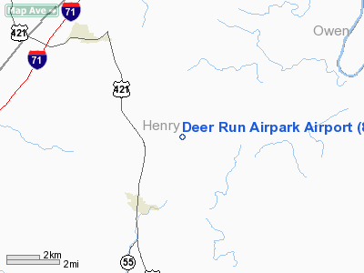
Deer Run Airpark Airport
Address:
Henry County, KY
Tel:
502-845-2216
Images
and information placed above are from
http://www.airport-data.com/airport/85KY/
We
thank them for the data!
|
General Info |
| Country |
United
States |
| State |
KENTUCKY
|
| FAA ID |
85KY
|
| Latitude |
38-28-13.000N |
|
Longitude |
085-08-19.000W |
|
Elevation |
890 feet
|
| Near
City |
NEW
CASTLE |
We don't guarantee the information is fresh and accurate. The data may
be wrong or outdated.
For more up-to-date information please refer to other sources.
|
|


