 |
|
|
Location &
QuickFacts
|
FAA
Information Effective: |
2008-09-25 |
|
Airport
Identifier: |
80KY |
|
Airport
Status: |
Operational |
|
Longitude/Latitude: |
087-14-07.9890W/37-23-46.1610N
-87.235552/37.396156 (Estimated) |
|
Elevation: |
465 ft / 141.73 m (Estimated) |
|
Land: |
12 acres |
|
From
nearest city: |
2 nautical miles SE of Sacramento, KY |
|
Location: |
Mc Lean County, KY |
|
Magnetic Variation: |
00W (1985) |
Owner & Manager
|
Ownership: |
Privately owned |
|
Owner: |
David Lowe |
|
Address: |
1231 Coffman School House Rd
Sacramento, KY 42372 |
|
Phone
number: |
502-736-5392 |
|
Manager: |
David Lowe |
|
Address: |
1231 Coffman School House Rd
Sacramento, KY 42372 |
|
Phone number: |
502-736-5392 |
Airport Operations and Facilities
|
Airport
Use: |
Private |
|
Wind
indicator: |
Yes |
|
Segmented Circle: |
No |
|
Control
Tower: |
No |
|
Lighting
Schedule: |
PHONE REQ
FOR LIRL RY 16/34 CALL 502-736-5392. |
|
Sectional chart: |
St Louis |
|
Region: |
ASO - Southern |
|
Boundary ARTCC: |
ZID - Indianapolis |
|
Tie-in FSS: |
LOU - Louisville |
|
FSS Toll Free: |
1-800-WX-BRIEF |
Airport Services
|
Runway Information
Runway 16/34
|
Dimension: |
1700 x 100 ft / 518.2 x 30.5 m |
|
Surface: |
TURF, |
|
Edge Lights: |
Low |
|
|
Runway 16
|
Runway 34
|
|
Traffic
Pattern: |
Left |
Left |
|
Radio Navigation Aids
|
ID |
Type |
Name |
Ch |
Freq |
Var |
Dist |
|
GMH |
NDB |
Muhlenberg |
|
362.00 |
01E |
10.8 nm |
|
HIX |
NDB |
Honey Grove |
|
356.00 |
01W |
31.4 nm |
|
TWT |
NDB |
Tradewater |
|
276.00 |
00E |
34.2 nm |
|
GVA |
NDB |
Geneva |
|
224.00 |
01W |
35.3 nm |
|
FK |
NDB |
Airbe |
|
273.00 |
01W |
40.5 nm |
|
PDW |
NDB |
Evansville |
|
284.00 |
00E |
41.2 nm |
|
TEL |
NDB |
Tell City |
|
206.00 |
02W |
45.3 nm |
|
HXW |
TACAN |
Screaming Eagle |
096X |
|
01W |
45.1 nm |
|
OWB |
VOR/DME |
Owensboro |
023X |
108.60 |
01E |
21.1 nm |
|
CKV |
VOR/DME |
Clarksville |
043X |
110.60 |
01W |
47.3 nm |
|
CCT |
VORTAC |
Central City |
035X |
109.80 |
01W |
1.6 nm |
|
PXV |
VORTAC |
Pocket City |
080X |
113.30 |
03E |
40.6 nm |
|
BWG |
VORTAC |
Bowling Green |
126X |
117.90 |
02E |
47.2 nm |
Remarks
Based Aircraft
|
Aircraft based
on field: |
18 |
|
Single Engine
Airplanes: |
15 |
|
Multi Engine
Airplanes: |
2 |
|
Ultralights: |
1 |
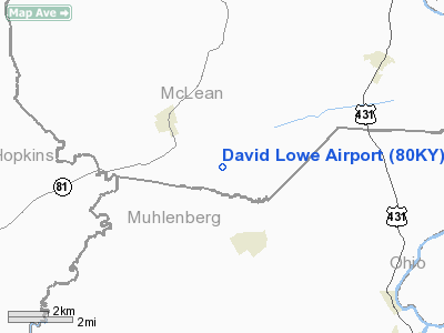
David Lowe Airport
Address:
Mc Lean County, KY
Tel:
502-736-5392
Images
and information placed above are from
http://www.airport-data.com/airport/80KY/
We
thank them for the data!
|
General Info |
| Country |
United
States |
| State |
KENTUCKY
|
| FAA ID |
80KY
|
| Latitude |
37-23-46.161N |
|
Longitude |
087-14-07.989W |
|
Elevation |
465 feet
|
| Near
City |
SACRAMENTO |
We don't guarantee the information is fresh and accurate. The data may
be wrong or outdated.
For more up-to-date information please refer to other sources.
|
|


