 |
|
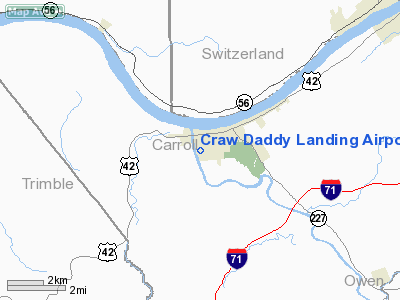
Craw Daddy Landing Airport |
|
Location &
QuickFacts
|
FAA
Information Effective: |
2008-09-25 |
|
Airport
Identifier: |
3KY4 |
|
Airport
Status: |
Operational |
|
Longitude/Latitude: |
085-10-58.0000W/38-40-22.0000N
-85.182778/38.672778 (Estimated) |
|
Elevation: |
460 ft / 140.21 m (Estimated) |
|
Land: |
50 acres |
|
From
nearest city: |
1 nautical miles SW of Carrollton, KY |
|
Location: |
Carroll County, KY |
|
Magnetic Variation: |
03W () |
Owner & Manager
|
Ownership: |
Privately owned |
|
Owner: |
Lan, Inc (lan-cay Park) |
|
Address: |
600 4th Street
Carrollton, KY 41008 |
|
Phone number: |
502-732-8845 |
|
Manager: |
Barry Brown |
|
Address: |
800 4th Street
Carrollton, KY 41008 |
|
Phone number: |
502-732-8845 |
Airport
Operations and Facilities
|
Airport
Use: |
Private |
|
Segmented Circle: |
No |
|
Control
Tower: |
No |
|
Sectional chart: |
St Louis |
|
Region: |
ASO - Southern |
|
Boundary
ARTCC: |
ZID - Indianapolis |
|
Tie-in
FSS: |
LOU - Louisville |
|
FSS Toll
Free: |
1-800-WX-BRIEF |
|
Runway Information
Runway 16/34
|
Dimension: |
2400 x 100 ft / 731.5 x 30.5 m |
|
Surface: |
TURF, |
|
|
Runway 16
|
Runway 34
|
|
Traffic
Pattern: |
Left |
Left |
|
Displaced
threshold: |
200.00 ft |
200.00 ft |
|
Radio Navigation Aids
|
ID |
Type |
Name |
Ch |
Freq |
Var |
Dist |
|
IMS |
NDB |
Madison |
|
404.00 |
03W |
14.1 nm |
|
UR |
NDB |
Burln |
|
321.00 |
04W |
29.5 nm |
|
OVO |
NDB |
North Vernon |
|
374.00 |
02W |
29.9 nm |
|
FEU |
NDB |
Arnold |
|
521.00 |
03W |
32.4 nm |
|
EQZ |
NDB |
Captain |
|
308.00 |
02W |
38.8 nm |
|
HLB |
NDB |
Batesville |
|
254.00 |
02W |
40.8 nm |
|
LE |
NDB |
Blayd |
|
242.00 |
04W |
48.0 nm |
|
LUK |
NDB |
Cincinnati |
|
335.00 |
04W |
49.0 nm |
|
BA |
NDB |
Clifs |
|
410.00 |
03W |
49.0 nm |
|
FFT |
VOR |
Frankfort |
|
109.40 |
03W |
32.2 nm |
|
BQM |
VOR/DME |
Bowman |
059X |
112.20 |
01W |
35.0 nm |
|
FLM |
VOR/DME |
Falmouth |
117X |
117.00 |
04W |
41.0 nm |
|
ABB |
VORTAC |
Nabb |
071X |
112.40 |
01E |
21.9 nm |
|
CVG |
VORTAC |
Cincinnati |
120X |
117.30 |
04W |
30.5 nm |
|
IIU |
VORTAC |
Louisville |
095X |
114.80 |
01E |
38.9 nm |
|
SDF |
VOT |
Louisville Standifd |
|
111.00 |
|
39.5 nm |
|
LUK |
VOT |
Cincinnati Muni/lunken |
|
108.40 |
|
45.3 nm |
Remarks
Based Aircraft
|
Aircraft based
on field: |
2 |
|
Single Engine
Airplanes: |
2 |
Craw Daddy Landing Airport
Address:
Carroll County, KY
Tel:
502-732-8845
Images
and information placed above are from
http://www.airport-data.com/airport/3KY4/
We
thank them for the data!
|
General Info |
| Country |
United
States |
| State |
KENTUCKY
|
| FAA ID |
3KY4
|
| Latitude |
38-40-22.000N |
|
Longitude |
085-10-58.000W |
|
Elevation |
460 feet
|
| Near
City |
CARROLLTON |
We don't guarantee the information is fresh and accurate. The data may
be wrong or outdated.
For more up-to-date information please refer to other sources.
|
|


