 |
|
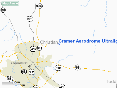
Cramer Aerodrome Ultralight |
|
Location &
QuickFacts
|
FAA
Information Effective: |
2008-09-25 |
|
Airport
Identifier: |
29KY |
|
Airport
Status: |
Operational |
|
Longitude/Latitude: |
087-25-38.0180W/36-53-35.1600N
-87.427227/36.893100 (Estimated) |
|
Elevation: |
640 ft / 195.07 m (Estimated) |
|
Land: |
86 acres |
|
From
nearest city: |
3 nautical miles NE of Hopkinsville, KY |
|
Location: |
Christian County, KY |
|
Magnetic Variation: |
00W (1985) |
Owner & Manager
|
Ownership: |
Privately owned |
|
Owner: |
Daniel Cramer |
|
Address: |
P.o. Box 2695
Clarksville, TN 37042 |
|
Phone
number: |
931-648-1115 |
|
Manager: |
Daniel Cramer |
|
Address: |
P.o. Box 2695
Clarksville, TN 37042 |
|
Phone number: |
931-648-1115 |
Airport Operations and Facilities
|
Airport
Use: |
Private |
|
Wind
indicator: |
Yes |
|
Segmented Circle: |
No |
|
Control
Tower: |
No |
|
Landing
fee charge: |
No |
|
Sectional chart: |
St Louis |
|
Region: |
ASO - Southern |
|
Boundary
ARTCC: |
ZME - Memphis |
|
Tie-in
FSS: |
LOU - Louisville |
|
FSS on
Airport: |
No |
|
FSS Toll
Free: |
1-800-WX-BRIEF |
|
Runway Information
Runway 09/27
|
Dimension: |
1700 x 25 ft / 518.2 x 7.6 m |
|
Surface: |
ASPH, |
|
|
Runway 09
|
Runway 27
|
|
Traffic
Pattern: |
Left |
Left |
|
Radio Navigation Aids
|
ID |
Type |
Name |
Ch |
Freq |
Var |
Dist |
|
HIX |
NDB |
Honey Grove |
|
356.00 |
01W |
4.4 nm |
|
FK |
NDB |
Airbe |
|
273.00 |
01W |
9.4 nm |
|
GMH |
NDB |
Muhlenberg |
|
362.00 |
01E |
23.8 nm |
|
PED |
NDB |
Needmore |
|
221.00 |
01W |
32.6 nm |
|
ON |
NDB |
Music |
|
279.00 |
03W |
33.9 nm |
|
TWT |
NDB |
Tradewater |
|
276.00 |
00E |
42.5 nm |
|
DMZ |
NDB |
Dickson |
|
203.00 |
01W |
46.0 nm |
|
AEY |
NDB |
Waverly |
|
329.00 |
00E |
49.1 nm |
|
HXW |
TACAN |
Screaming Eagle |
096X |
|
01W |
13.5 nm |
|
CKV |
VOR/DME |
Clarksville |
043X |
110.60 |
01W |
16.3 nm |
|
CCT |
VORTAC |
Central City |
035X |
109.80 |
01W |
30.4 nm |
|
BWG |
VORTAC |
Bowling Green |
126X |
117.90 |
02E |
47.3 nm |
Remarks
Based Aircraft
|
Aircraft based
on field: |
6 |
|
Ultralights: |
6 |
Cramer Aerodrome Ultralight
Address:
Christian County, KY
Tel:
931-648-1115
Images
and information placed above are from
http://www.airport-data.com/airport/29KY/
We
thank them for the data!
|
General Info |
| Country |
United
States |
| State |
KENTUCKY
|
| FAA ID |
29KY
|
| Latitude |
36-53-35.160N |
|
Longitude |
087-25-38.018W |
|
Elevation |
640 feet
|
| Near
City |
HOPKINSVILLE |
We don't guarantee the information is fresh and accurate. The data may
be wrong or outdated.
For more up-to-date information please refer to other sources.
|
|


