 |
|
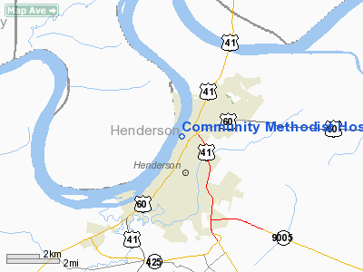
Community Methodist Hospital Heliport |
|
|
|
Location &
QuickFacts
|
FAA
Information Effective: |
2008-09-25 |
|
Airport
Identifier: |
1KY2 |
|
Airport
Status: |
Operational |
|
Longitude/Latitude: |
087-35-02.0480W/37-51-21.1530N
-87.583902/37.855876 (Estimated) |
|
Elevation: |
460 ft / 140.21 m (Estimated) |
|
Land: |
0 acres |
|
From
nearest city: |
1 nautical miles N of Henderson, KY |
|
Location: |
Henderson County, KY |
|
Magnetic Variation: |
01W (1990) |
Owner & Manager
|
Ownership: |
Privately owned |
|
Owner: |
Community Methodist Hospital |
|
Address: |
1305 North Elm St
Henderson, KY 42420 |
|
Phone
number: |
502-827-7000 |
|
Manager: |
William L. Newman Jr. |
|
Address: |
1305 North Elm St
Henderson, KY 42420 |
|
Phone number: |
502-827-7000 |
Airport Operations and Facilities
|
Airport
Use: |
Private
MEDICAL USE. |
|
Wind
indicator: |
Yes |
|
Segmented Circle: |
No |
|
Control
Tower: |
No |
|
Lighting
Schedule: |
PHONE REQ
FOR ROTG BCN & PERIMETER LIGHTS CALL (502) 827-7000. |
|
Beacon
Color: |
Clear-Green-Yellow (heliport) |
|
Sectional chart: |
St Louis |
|
Region: |
ASO - Southern |
|
Boundary
ARTCC: |
ZID - Indianapolis |
|
Tie-in
FSS: |
LOU - Louisville |
|
FSS on
Airport: |
No |
|
FSS Toll
Free: |
1-800-WX-BRIEF |
|
Runway Information
Helipad H1
|
Dimension: |
50 x 50 ft / 15.2 x 15.2 m |
|
Surface: |
CONC, |
|
|
Runway H1
|
Runway
|
|
Traffic
Pattern: |
Left |
Left |
|
Radio Navigation Aids
|
ID |
Type |
Name |
Ch |
Freq |
Var |
Dist |
|
GVA |
NDB |
Geneva |
|
224.00 |
01W |
9.4 nm |
|
PDW |
NDB |
Evansville |
|
284.00 |
00E |
11.4 nm |
|
TWT |
NDB |
Tradewater |
|
276.00 |
00E |
29.1 nm |
|
CUL |
NDB |
Carmi |
|
332.00 |
01W |
29.1 nm |
|
FNZ |
NDB |
Ferdinand |
|
239.00 |
00E |
42.5 nm |
|
GMH |
NDB |
Muhlenberg |
|
362.00 |
01E |
42.9 nm |
|
TEL |
NDB |
Tell City |
|
206.00 |
02W |
43.4 nm |
|
HSB |
NDB |
Harrisburg-raleigh |
|
230.00 |
00E |
45.7 nm |
|
AJG |
NDB |
Mount Carmel |
|
524.00 |
02W |
45.9 nm |
|
OWB |
VOR/DME |
Owensboro |
023X |
108.60 |
01E |
21.0 nm |
|
HNB |
VOR/DME |
Huntingburg |
029X |
109.20 |
00E |
38.0 nm |
|
SAM |
VOR/DME |
Samsville |
113X |
116.60 |
03E |
44.6 nm |
|
PXV |
VORTAC |
Pocket City |
080X |
113.30 |
03E |
9.5 nm |
|
CCT |
VORTAC |
Central City |
035X |
109.80 |
01W |
32.3 nm |
Remarks
-
VFR; PRIVATE USE;
AREA IS MARKED; WIND INDICATOR IS MAINTAINED; OPNS CONDUCTED FROM 70 DEG TO
100 DEG & FROM 200 DEG TO 20 DEG.
Community Methodist Hospital Heliport
Address:
Henderson County, KY
Tel:
502-827-7000
Images
and information placed above are from
http://www.airport-data.com/airport/1KY2/
We
thank them for the data!
|
General Info |
| Country |
United
States |
| State |
KENTUCKY
|
| FAA ID |
1KY2
|
| Latitude |
37-51-21.153N |
|
Longitude |
087-35-02.048W |
|
Elevation |
460 feet
|
| Near
City |
HENDERSON |
We don't guarantee the information is fresh and accurate. The data may
be wrong or outdated.
For more up-to-date information please refer to other sources.
|
|


