 |
|
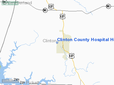
Clinton County Hospital Heliport |
|
|
|
Location &
QuickFacts
|
FAA
Information Effective: |
2008-09-25 |
|
Airport
Identifier: |
45KY |
|
Airport
Status: |
Operational |
|
Longitude/Latitude: |
085-08-52.0000W/36-41-54.0000N
-85.147778/36.698333 (Estimated) |
|
Elevation: |
597 ft / 181.97 m (Estimated) |
|
Land: |
0 acres |
|
From
nearest city: |
0 nautical miles N of Albany, KY |
|
Location: |
Clinton County, KY |
|
Magnetic Variation: |
02W (1990) |
Owner & Manager
|
Ownership: |
Publicly owned |
|
Owner: |
Clinton County Hospital |
|
Address: |
723 Burkesville Hwy
Albany, KY 42602 |
|
Phone number: |
606-387-6421 |
|
Manager: |
Randall A. Flowers |
|
Address: |
723 Burkesville Hwy
Albany, KY 42602 |
|
Phone number: |
606-387-6421 |
Airport
Operations and Facilities
|
Airport
Use: |
Private
MEDICAL USE. |
|
Wind
indicator: |
Yes |
|
Segmented Circle: |
No |
|
Control
Tower: |
No |
|
Lighting
Schedule: |
DUSK DAWN |
|
Beacon
Color: |
Clear-Green-Yellow (heliport) |
|
Sectional chart: |
St Louis |
|
Region: |
ASO - Southern |
|
Boundary
ARTCC: |
ZID - Indianapolis |
|
Tie-in
FSS: |
LOU - Louisville |
|
FSS on
Airport: |
No |
|
FSS Toll
Free: |
1-800-WX-BRIEF |
|
Runway Information
Helipad H1
|
Dimension: |
60 x 60 ft / 18.3 x 18.3 m |
|
Surface: |
CONC, |
|
|
Runway H1
|
Runway
|
|
Traffic
Pattern: |
Left |
Left |
|
Radio Navigation Aids
|
ID |
Type |
Name |
Ch |
Freq |
Var |
Dist |
|
EKQ |
NDB |
Elk Spring |
|
290.00 |
03W |
17.1 nm |
|
CDX |
NDB |
Cumberland River |
|
388.00 |
05E |
28.7 nm |
|
BPO |
NDB |
Piney Grove |
|
403.00 |
05W |
33.8 nm |
|
TYC |
NDB |
Taylor County |
|
272.00 |
02W |
42.5 nm |
|
LFB |
NDB |
Lafayette |
|
245.00 |
02W |
45.4 nm |
|
BVQ |
NDB |
Beaver Creek |
|
260.00 |
02W |
45.7 nm |
|
HEM |
NDB |
Huchn |
|
233.00 |
02W |
47.7 nm |
|
LVT |
VORTAC |
Livingston |
021X |
108.40 |
02W |
6.9 nm |
Remarks
-
90 FT PLINE 40 FT
NORTH OF PAD.
-
VFR WX CONDS;
APCH/DEP OPNS CONDUCTED FROM 045 TO 150 USING PAD AS CENTER; TKOF/LNDG AERNDG
AREA MARKED; NON-OBSTRUCTING WIND INDICATOR MAINTD NEXT TO TKOF/LNDG AREA.
Clinton County Hospital Heliport
Address:
Clinton County, KY
Tel:
606-387-6421
Images
and information placed above are from
http://www.airport-data.com/airport/45KY/
We
thank them for the data!
|
General Info |
| Country |
United
States |
| State |
KENTUCKY
|
| FAA ID |
45KY
|
| Latitude |
36-41-53.236N |
|
Longitude |
085-08-48.841W |
|
Elevation |
950 feet
|
| Near
City |
ALBANY
|
We don't guarantee the information is fresh and accurate. The data may
be wrong or outdated.
For more up-to-date information please refer to other sources.
|
|


