 |
|
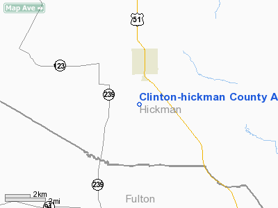
Clinton-Hickman County Airport |
|
Location &
QuickFacts
|
FAA
Information Effective: |
2008-09-25 |
|
Airport
Identifier: |
0KY7 |
|
Airport
Status: |
Operational |
|
Longitude/Latitude: |
088-59-55.0000W/36-38-10.0000N
-88.998611/36.636111 (Estimated) |
|
Elevation: |
360 ft / 109.73 m (Surveyed) |
|
Land: |
0 acres |
|
From
nearest city: |
2 nautical miles S of Clinton, KY |
|
Location: |
Hickman County, KY |
|
Magnetic Variation: |
01E (1990) |
Owner & Manager
|
Ownership: |
Publicly owned |
|
Owner: |
Clinton-hickman County |
|
Address: |
Hickman County Courthouse
Clinton, KY 42031 |
|
Manager: |
Clinton-hickman County |
|
Address: |
Hickman County Courthouse
Clinton, KY 42031 |
Airport
Operations and Facilities
|
Airport
Use: |
Private |
|
Segmented Circle: |
No |
|
Control
Tower: |
No |
|
Sectional chart: |
St Louis |
|
Region: |
ASO - Southern |
|
Boundary
ARTCC: |
ZME - Memphis |
|
Tie-in
FSS: |
LOU - Louisville |
|
FSS on
Airport: |
No |
|
FSS Toll
Free: |
1-800-WX-BRIEF |
|
Runway Information
Runway N/S
|
Dimension: |
2200 x 60 ft / 670.6 x 18.3 m |
|
Surface: |
TURF, |
|
|
Runway N
|
Runway S
|
|
Traffic
Pattern: |
Left |
Left |
|
Obstruction: |
|
40 ft trees, 2300.0 ft from runway |
|
Radio Navigation Aids
|
ID |
Type |
Name |
Ch |
Freq |
Var |
Dist |
|
GGK |
NDB |
Mayfield |
|
401.00 |
00E |
19.9 nm |
|
UC |
NDB |
Obion |
|
212.00 |
00E |
20.3 nm |
|
CHQ |
NDB |
Charleston |
|
208.00 |
01E |
21.3 nm |
|
CIR |
NDB |
Cairo |
|
397.00 |
00E |
27.8 nm |
|
BDD |
NDB |
Bellgrade |
|
254.00 |
00E |
34.4 nm |
|
TIQ |
NDB |
Trainer |
|
410.00 |
00E |
36.5 nm |
|
HZD |
NDB |
Huntingdon |
|
217.00 |
00E |
41.8 nm |
|
TGC |
NDB |
Gibson |
|
378.00 |
01E |
42.8 nm |
|
DNT |
NDB |
Nally Dunston |
|
343.00 |
01W |
43.3 nm |
|
DXE |
NDB |
Dexter |
|
423.00 |
00E |
46.3 nm |
|
CGI |
VOR/DME |
Cape Girardeau |
076X |
112.90 |
01E |
45.0 nm |
|
CNG |
VORTAC |
Cunningham |
078X |
113.10 |
03E |
23.7 nm |
|
DYR |
VORTAC |
Dyersburg |
115X |
116.80 |
03E |
40.2 nm |
|
MAW |
VORTAC |
Malden |
049X |
111.20 |
03E |
44.3 nm |
Remarks
Clinton-hickman County Airport
Address:
Hickman County, KY
Tel:
Images
and information placed above are from
http://www.airport-data.com/airport/0KY7/
We
thank them for the data!
|
General Info |
| Country |
United
States |
| State |
KENTUCKY
|
| FAA ID |
0KY7
|
| Latitude |
36-38-10.000N |
|
Longitude |
088-59-55.000W |
|
Elevation |
360 feet
|
| Near
City |
CLINTON
|
We don't guarantee the information is fresh and accurate. The data may
be wrong or outdated.
For more up-to-date information please refer to other sources.
|
|


