|
|
|
 |
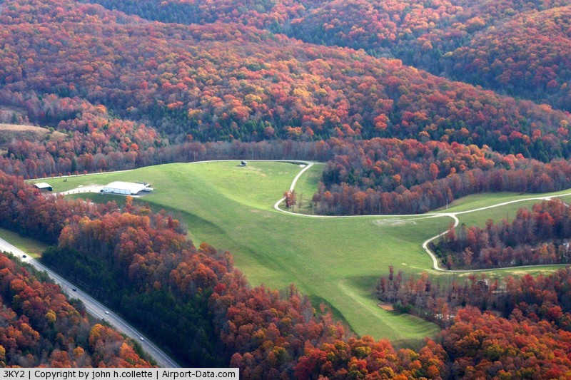
(Click on the photo to enlarge) |
|
Location &
QuickFacts
|
FAA
Information Effective: |
2008-09-25 |
|
Airport
Identifier: |
3KY2 |
|
Airport
Status: |
Operational |
|
Longitude/Latitude: |
084-15-27.0000W/37-09-04.0000N
-84.257500/37.151111 (Estimated) |
|
Elevation: |
1265 ft / 385.57 m (Estimated) |
|
Land: |
119 acres |
|
From
nearest city: |
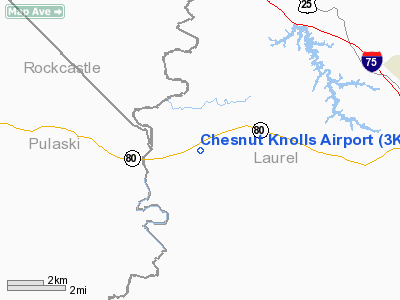
9 nautical miles W of London, KY |
|
Location: |
Laurel County, KY |
|
Magnetic Variation: |
04W (1995) |
Owner & Manager
|
Ownership: |
Privately owned |
|
Owner: |
Chesnut Knolls Aviation Foundation |
|
Address: |
8375 Russell Dyche Hwy
London, KY 40741 |
|
Manager: |
Bruce Chesnut |
|
Address: |
402 Parman Street
London, KY 40741 |
|
Phone number: |
606-878-6001
EXT 102. |
Airport Operations and Facilities
|
Airport Use: |
Private |
|
Wind indicator: |
Yes |
|
Segmented Circle: |
No |
|
Control Tower: |
No |
|
Sectional chart: |
Cincinnati |
|
Region: |
ASO - Southern |
|
Boundary ARTCC: |
ZID - Indianapolis |
|
Tie-in FSS: |
LOU - Louisville |
|
FSS Toll Free: |
1-800-WX-BRIEF |
Airport
Communications
|
Runway Information
Runway 10/28
|
Dimension: |
2150 x 70 ft / 655.3 x 21.3 m |
|
Surface: |
TURF, |
|
|
Runway 10
|
Runway 28
|
|
Traffic
Pattern: |
Left |
Left |
|
Obstruction: |
20 ft trees, 100.0 ft from runway |
|
|
Radio Navigation Aids
|
ID |
Type |
Name |
Ch |
Freq |
Var |
Dist |
|
CDX |
NDB |
Cumberland River |
|
388.00 |
05E |
22.4 nm |
|
EKQ |
NDB |
Elk Spring |
|
290.00 |
03W |
33.6 nm |
|
DVK |
NDB |
Goodall |
|
311.00 |
03W |
35.2 nm |
|
XYC |
NDB |
Seco |
|
393.00 |
03W |
38.1 nm |
|
BPO |
NDB |
Piney Grove |
|
403.00 |
05W |
38.2 nm |
|
JAU |
NDB |
Jacksboro |
|
204.00 |
03W |
49.1 nm |
|
TYC |
NDB |
Taylor County |
|
272.00 |
02W |
49.5 nm |
|
AZQ |
VOR/DME |
Hazard |
049X |
111.20 |
04W |
49.7 nm |
|
LOZ |
VORTAC |
London |
108X |
116.10 |
03W |
10.0 nm |
Remarks
-
DEER ON & INVOF ARPT.
-
PRVDD ALL APCH/DEP
OPNS CONDUCTED IN AREA ALIGNED WITH RY CNTRLN, AREA IS MKD, WIND INDICATOR IS
MAINTAINED.
Based Aircraft
|
Aircraft based
on field: |
5 |
|
Single Engine
Airplanes: |
3 |
|
Ultralights: |
2 |
Chesnut Knolls Airport
Address:
Laurel County, KY
Tel:
606-878-6001
Images
and information placed above are from
http://www.airport-data.com/airport/3KY2/
We
thank them for the data!
|
General Info |
| Country |
United
States |
| State |
KENTUCKY
|
| FAA ID |
3KY2
|
| Latitude |
37-09-04.000N |
|
Longitude |
084-15-27.000W |
|
Elevation |
1265
feet |
| Near
City |
LONDON
|
We don't guarantee the information is fresh and accurate. The data may
be wrong or outdated.
For more up-to-date information please refer to other sources.
|
|