 |
|
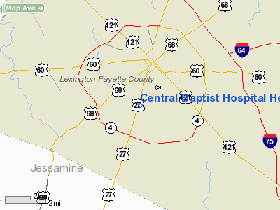
Central Baptist Hospital Heliport |
|
|
|
Location &
QuickFacts
|
FAA
Information Effective: |
2008-09-25 |
|
Airport
Identifier: |
1KY4 |
|
Airport
Status: |
Operational |
|
Longitude/Latitude: |
084-30-43.0000W/38-01-05.0000N
-84.511944/38.018056 (Estimated) |
|
Elevation: |
1076 ft / 327.96 m (Estimated) |
|
Land: |
0 acres |
|
From
nearest city: |
2 nautical miles N of Lexington, KY |
|
Location: |
Fayette County, KY |
|
Magnetic Variation: |
03W (1990) |
Owner & Manager
|
Ownership: |
Privately owned |
|
Owner: |
Baptist Health Care Systems |
|
Address: |
1740 Nicholasville Road
Lexington, KY 40503 |
|
Phone number: |
606-275-6100 |
|
Manager: |
Patti Howard |
|
Address: |
1740 Nicholasville Road
Lexington, KY 40503 |
|
Phone number: |
606-275-6100 |
Airport
Operations and Facilities
|
Airport
Use: |
Private
MEDICAL USE. |
|
Wind
indicator: |
Yes |
|
Segmented Circle: |
No |
|
Control
Tower: |
No |
|
Lighting
Schedule: |
DUSK-DAWN |
|
Beacon
Color: |
Clear-Green-Yellow (heliport) |
|
Sectional chart: |
Cincinnati |
|
Region: |
ASO - Southern |
|
Boundary
ARTCC: |
ZID - Indianapolis |
|
Tie-in
FSS: |
LOU - Louisville |
|
FSS on
Airport: |
No |
|
FSS Toll
Free: |
1-800-WX-BRIEF |
|
Runway Information
Helipad H1
|
Dimension: |
75 x 75 ft / 22.9 x 22.9 m |
|
Surface: |
CONC, |
|
|
Runway H1
|
Runway
|
|
Traffic
Pattern: |
Left |
Left |
|
Radio Navigation Aids
|
ID |
Type |
Name |
Ch |
Freq |
Var |
Dist |
|
LE |
NDB |
Blayd |
|
242.00 |
04W |
7.3 nm |
|
FEU |
NDB |
Arnold |
|
521.00 |
03W |
18.8 nm |
|
IOB |
NDB |
Mount Sterling |
|
210.00 |
04W |
25.2 nm |
|
XYC |
NDB |
Seco |
|
393.00 |
03W |
27.7 nm |
|
DVK |
NDB |
Goodall |
|
311.00 |
03W |
29.1 nm |
|
IKY |
NDB |
Springfield |
|
429.00 |
03W |
41.4 nm |
|
BRY |
NDB |
Bardstown/dcmsnd |
|
248.00 |
02W |
47.2 nm |
|
FFT |
VOR |
Frankfort |
|
109.40 |
03W |
21.2 nm |
|
FLM |
VOR/DME |
Falmouth |
117X |
117.00 |
04W |
39.1 nm |
|
HYK |
VORTAC |
Lexington |
073X |
112.60 |
00E |
3.6 nm |
Remarks
-
VFR; PVT USE
ONLY; OPNS CONDUCTED FROM 20-70 DEGREES & 270-280 DEGREES; AREA IS MKD; WIND
INDICATOR IS MAINTAINED.
Central Baptist Hospital Heliport
Address:
Fayette County, KY
Tel:
606-275-6100
Images
and information placed above are from
http://www.airport-data.com/airport/1KY4/
We
thank them for the data!
|
General Info |
| Country |
United
States |
| State |
KENTUCKY
|
| FAA ID |
1KY4
|
| Latitude |
38-01-05.000N |
|
Longitude |
084-30-43.000W |
|
Elevation |
1076
feet |
| Near
City |
LEXINGTON |
We don't guarantee the information is fresh and accurate. The data may
be wrong or outdated.
For more up-to-date information please refer to other sources.
|
|


