 |
|
|
Location &
QuickFacts
|
FAA
Information Effective: |
2008-09-25 |
|
Airport
Identifier: |
05KY |
|
Airport
Status: |
Operational |
|
Longitude/Latitude: |
084-24-26.0000W/37-32-08.0000N
-84.407222/37.535556 (Estimated) |
|
Elevation: |
1070 ft / 326.14 m (Estimated) |
|
Land: |
13 acres |
|
From
nearest city: |
8 nautical miles W of Berea, KY |
|
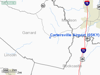
Location: |
Garrard County, KY |
|
Magnetic Variation: |
() |
Owner & Manager
|
Ownership: |
Privately owned |
|
Owner: |
Johnnie W. Bullens |
|
Address: |
4194 Cartersville Road
Paint Lick, KY 40461 |
|
Phone
number: |
859-925-3248 |
|
Manager: |
Johnnie W. Bullens |
|
Address: |
4194 Cartersville Road
Paint Lick, KY 40461 |
|
Phone number: |
859-925-3248 |
Airport Operations and Facilities
|
Airport
Use: |
Private |
|
Wind
indicator: |
Yes |
|
Control
Tower: |
No |
|
Sectional chart: |
Cincinnati |
|
Region: |
ASO - Southern |
|
Boundary
ARTCC: |
ZID - Indianapolis |
|
Tie-in
FSS: |
LOU - Louisville |
|
FSS Toll
Free: |
1-800-WX-BRIEF |
|
Runway Information
Runway 02/20
|
Dimension: |
1270 x 150 ft / 387.1 x 45.7 m |
|
Surface: |
TURF, |
|
|
Runway 02
|
Runway 20
|
|
Traffic
Pattern: |
Left |
Left |
|
Displaced
threshold: |
150.00 ft
DISP THLD MKD WITH CONC BLOCKS. |
0.00 ft |
|
Obstruction: |
50 ft trees, 100.0 ft from runway |
|
|
Radio Navigation Aids
|
ID |
Type |
Name |
Ch |
Freq |
Var |
Dist |
|
DVK |
NDB |
Goodall |
|
311.00 |
03W |
17.2 nm |
|
XYC |
NDB |
Seco |
|
393.00 |
03W |
22.4 nm |
|
LE |
NDB |
Blayd |
|
242.00 |
04W |
29.7 nm |
|
CDX |
NDB |
Cumberland River |
|
388.00 |
05E |
35.0 nm |
|
IOB |
NDB |
Mount Sterling |
|
210.00 |
04W |
37.4 nm |
|
IKY |
NDB |
Springfield |
|
429.00 |
03W |
39.9 nm |
|
TYC |
NDB |
Taylor County |
|
272.00 |
02W |
40.7 nm |
|
FEU |
NDB |
Arnold |
|
521.00 |
03W |
45.3 nm |
|
EKQ |
NDB |
Elk Spring |
|
290.00 |
03W |
46.1 nm |
|
FFT |
VOR |
Frankfort |
|
109.40 |
03W |
45.6 nm |
|
HYK |
VORTAC |
Lexington |
073X |
112.60 |
00E |
26.1 nm |
|
LOZ |
VORTAC |
London |
108X |
116.10 |
03W |
33.4 nm |
Remarks
-
APCH FM NE ONLY
TO RY 20 ONLY. DEPART TO NE ONLY RY 2.
-
RY RISES 40 FT AT
MIDFIELD.
-
PRVDD VFR OPNS
AND PVT USE.
Based Aircraft
|
Aircraft based
on field: |
1 |
|
Single Engine
Airplanes: |
1 |
Cartersville Airport
Address:
Garrard County, KY
Tel:
859-925-3248
Images
and information placed above are from
http://www.airport-data.com/airport/05KY/
We
thank them for the data!
|
|


