 |
|
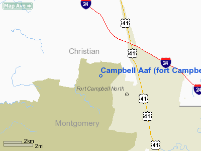
Campbell AAF (fort Campbell) Airport |
| Campbell Army Airfield |
| IATA: HOP – ICAO: KHOP – FAA LID: HOP |
| Summary |
| Airport type |
Military |
| Owner |
United States Army |
| Location |
Fort Campbell, Christian County, Kentucky, near Hopkinsville, Kentucky |
| Elevation AMSL |
573 ft / 175 m |
| Coordinates |
36°40′20″N 087°29′33″W / 36.67222°N 87.4925°W / 36.67222; -87.4925 |
| Runways |
| Direction |
Length |
Surface |
| ft |
m |
| 5/23 |
11,826 |
3,605 |
Asphalt |
| 18/36 |
4,500 |
1,372 |
Asphalt |
| Source: Federal Aviation Administration |
Campbell Army Airfield (IATA: HOP, ICAO: KHOP, FAA LID: HOP) is a military airport at Fort Campbell, which is located near Hopkinsville, a city in Christian County, Kentucky, United States. Previously Campbell Air Force Base, a U.S. Air Force installation from 1947 to 1959, this U.S. Army airfield has two asphalt paved runways: 5/23 is 11,826 by 200 feet (3,605 x 61 m) and 18/36 is 4,500 by 150 feet (1,372 x 46 m).
The above content comes from Wikipedia and is published under free licenses – click here to read more.
|
Location &
QuickFacts
|
FAA
Information Effective: |
2008-09-25 |
|
Airport
Identifier: |
HOP |
|
Airport
Status: |
Operational |
|
Longitude/Latitude: |
087-29-32.9500W/36-40-20.4980N
-87.492486/36.672361 (Estimated) |
|
Elevation: |
573 ft / 174.65 m (Estimated) |
|
Land: |
0 acres |
|
From
nearest city: |
2 nautical miles NW of Fort Campbell/hopkinsville, KY |
|
Location: |
Christian County, KY |
|
Magnetic Variation: |
01W (1995) |
Owner & Manager
|
Ownership: |
Army owned |
|
Owner: |
Us Army Atca-aso |
|
Address: |
9325 Gunston Road
Ft Belvoir, VA 22060 |
|
Phone number: |
502-798-7146 |
|
Address: |
|
Airport Operations and Facilities
|
Airport
Use: |
Private |
|
Segmented Circle: |
No |
|
Control
Tower: |
Yes |
|
Lighting
Schedule: |
DUSK-DAWN |
|
Beacon
Color: |
Split-Clear-Green (lighted military airport) |
|
Sectional chart: |
St Louis |
|
Region: |
ASO - Southern |
|
Boundary
ARTCC: |
ZME - Memphis |
|
Tie-in
FSS: |
HOP - Campbell Aaf
FSS-LOUISVILLE LOU-NOTAM LOU |
|
FSS on
Airport: |
No |
|
FSS Toll
Free: |
1-800-WX-BRIEF |
|
NOTAMs
Facility: |
LOU (NOTAM-d service avaliable) |
|
Certification type/date: |
I A U 10/1976 |
|
Runway Information
Runway 05/23
|
Dimension: |
11826 x 200 ft / 3604.6 x 61.0 m |
|
Surface: |
ASPH, |
|
Pavement
Class: |
130/F/A/W/T |
|
Edge Lights: |
High |
|
|
Runway 05
|
Runway 23
|
|
Longitude: |
087-30-18.3800W |
087-28-37.1680W |
|
Latitude: |
36-39-40.4480N |
36-41-04.2810N |
|
Elevation: |
548.00 ft |
571.00 ft |
|
ILS Type: |
|
ILS |
|
Traffic
Pattern: |
Left |
Right |
|
Displaced
threshold: |
896.00 ft |
0.00 ft |
|
RVR
Equipment: |
|
touchdown |
|
Approach
lights: |
|
SALS |
|
Runway 18/36
|
Dimension: |
4500 x 150 ft / 1371.6 x 45.7 m |
|
Surface: |
ASPH, |
|
Pavement
Class: |
18 /F/B/W/T |
|
|
Runway 18
|
Runway 36
|
|
Longitude: |
087-29-46.9530W |
087-29-46.1590W |
|
Latitude: |
36-40-37.8280N |
36-39-53.3550N |
|
Elevation: |
562.00 ft |
556.00 ft |
|
Traffic
Pattern: |
Left |
Left |
|
Radio Navigation Aids
|
ID |
Type |
Name |
Ch |
Freq |
Var |
Dist |
|
FK |
NDB |
Airbe |
|
273.00 |
01W |
5.4 nm |
|
HIX |
NDB |
Honey Grove |
|
356.00 |
01W |
14.6 nm |
|
ON |
NDB |
Music |
|
279.00 |
03W |
27.6 nm |
|
PED |
NDB |
Needmore |
|
221.00 |
01W |
28.9 nm |
|
DMZ |
NDB |
Dickson |
|
203.00 |
01W |
32.9 nm |
|
AEY |
NDB |
Waverly |
|
329.00 |
00E |
35.5 nm |
|
GMH |
NDB |
Muhlenberg |
|
362.00 |
01E |
37.0 nm |
|
VI |
NDB |
Opery |
|
344.00 |
02W |
49.4 nm |
|
HXW |
TACAN |
Screaming Eagle |
096X |
|
01W |
0.2 nm |
|
CKV |
VOR/DME |
Clarksville |
043X |
110.60 |
01W |
4.9 nm |
|
CCT |
VORTAC |
Central City |
035X |
109.80 |
01W |
44.1 nm |
Remarks
-
FUEL: J8
-
OIL: O-123-128-148-156 SP
-
RSTD: PPR CIV ACFT.
-
CAUTION: R3701
AND SMALL ARMS RNG 1000 YD DEP END RWY 23. TWY LGT BTN TWY FEEDER TO RWY 05
AND RWY 36 ARE NSTD (WHITE), DO NOT CONFUSE WITH RWY LGT.
DEER HAZ. PJE.
-
TFC PAT: R/W
1300'; F/W CAT A, B 1600', CAT C, D, E 2100'; OVERHEAD 2600'.
-
MISC: NO HGR TRAN
ACFT. BASE OPS 24 HR DSN 635-7146/7147, C270-798-7146/47.
WX FCST AVBL H24. H24 WX OBSN
SVC.
-
JASU: 3(M-32A-86)
3(AM32-95) 1(MC-2A)
Campbell Aaf (fort Campbell) Airport
Address:
Christian County, KY
Tel:
502-798-7146
Images
and information placed above are from
http://www.airport-data.com/airport/HOP/
We
thank them for the data!
|
General Info |
| Country |
United
States |
| State |
KENTUCKY
|
| FAA ID |
HOP
|
| Latitude |
36-40-22.170N |
|
Longitude |
087-29-30.040W |
|
Elevation |
573 feet
|
| Near
City |
FORT
CAMPBELL/HOPKINSVILLE |
We don't guarantee the information is fresh and accurate. The data may
be wrong or outdated.
For more up-to-date information please refer to other sources.
|
|


