 |
|
|
Location &
QuickFacts
|
FAA
Information Effective: |
2008-09-25 |
|
Airport
Identifier: |
0KY4 |
|
Airport
Status: |
Operational |
|
Longitude/Latitude: |
087-04-55.0000W/37-33-52.0000N
-87.081944/37.564444 (Estimated) |
|
Elevation: |
427 ft / 130.15 m (Estimated) |
|
Land: |
0 acres |
|
From
nearest city: |
10 nautical miles SE of Owensboro, KY |
|
Location: |
Daviess County, KY |
|
Magnetic Variation: |
01W (1990) |
Owner & Manager
|
Ownership: |
Privately owned |
|
Owner: |
Douglas M. Cambron |
|
Address: |
732 E. Harmons Ferry Rd.
Utica, KY 42376 |
|
Phone
number: |
502-733-9009 |
|
Manager: |
Douglas M. Cambron |
|
Address: |
732 E. Harmons Ferry Rd.
Utica, KY 42376 |
|
Phone number: |
501-733-9009 |
Airport Operations and Facilities
|
Airport
Use: |
Private |
|
Segmented Circle: |
No |
|
Control
Tower: |
No |
|
Sectional chart: |
St Louis |
|
Region: |
ASO - Southern |
|
Boundary
ARTCC: |
ZID - Indianapolis |
|
Tie-in
FSS: |
LOU - Louisville |
|
FSS on
Airport: |
No |
|
FSS Toll
Free: |
1-800-WX-BRIEF |
|
Runway Information
Runway 18/36
|
Dimension: |
1675 x 75 ft / 510.5 x 22.9 m |
|
Surface: |
TURF, |
|
|
Runway 18
|
Runway 36
|
|
Traffic
Pattern: |
Left |
Left |
|
Obstruction: |
40 ft plines |
|
|
Radio Navigation Aids
|
ID |
Type |
Name |
Ch |
Freq |
Var |
Dist |
|
GMH |
NDB |
Muhlenberg |
|
362.00 |
01E |
20.6 nm |
|
TEL |
NDB |
Tell City |
|
206.00 |
02W |
32.8 nm |
|
PDW |
NDB |
Evansville |
|
284.00 |
00E |
35.7 nm |
|
GVA |
NDB |
Geneva |
|
224.00 |
01W |
35.8 nm |
|
TWT |
NDB |
Tradewater |
|
276.00 |
00E |
41.7 nm |
|
FNZ |
NDB |
Ferdinand |
|
239.00 |
00E |
42.7 nm |
|
HIX |
NDB |
Honey Grove |
|
356.00 |
01W |
42.9 nm |
|
MYS |
VOR |
Mystic |
|
108.20 |
01W |
44.5 nm |
|
OWB |
VOR/DME |
Owensboro |
023X |
108.60 |
01E |
11.5 nm |
|
HNB |
VOR/DME |
Huntingburg |
029X |
109.20 |
00E |
41.7 nm |
|
CCT |
VORTAC |
Central City |
035X |
109.80 |
01W |
14.0 nm |
|
PXV |
VORTAC |
Pocket City |
080X |
113.30 |
03E |
39.0 nm |
|
BWG |
VORTAC |
Bowling Green |
126X |
117.90 |
02E |
48.9 nm |
Remarks
-
PROVIDED VFR/PR
USE ONLY.
Based Aircraft
|
Aircraft based
on field: |
1 |
|
Single Engine
Airplanes: |
1 |
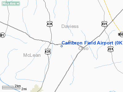
Cambron Field Airport
Address:
Daviess County, KY
Tel:
502-733-9009
Images
and information placed above are from
http://www.airport-data.com/airport/0KY4/
We
thank them for the data!
|
General Info |
| Country |
United
States |
| State |
KENTUCKY
|
| FAA ID |
0KY4
|
| Latitude |
37-33-52.000N |
|
Longitude |
087-04-55.000W |
|
Elevation |
427 feet
|
| Near
City |
OWENSBORO |
We don't guarantee the information is fresh and accurate. The data may
be wrong or outdated.
For more up-to-date information please refer to other sources.
|
|


