 |
|
|
Location &
QuickFacts
|
FAA
Information Effective: |
2008-09-25 |
|
Airport
Identifier: |
76KY |
|
Airport
Status: |
Operational |
|
Longitude/Latitude: |
084-50-29.8160W/38-00-53.2710N
-84.841616/38.014798 (Estimated) |
|
Elevation: |
770 ft / 234.70 m (Estimated) |
|
Land: |
4 acres |
|
From
nearest city: |
4 nautical miles SE of Lawrenceburg, KY |
|
Location: |
Anderson County, KY |
|
Magnetic Variation: |
03W (1985) |
Owner & Manager
|
Ownership: |
Privately owned |
|
Owner: |
Jim Misheff |
|
Address: |
Po Box 441
Lawrenceburg, KY 40342 |
|
Phone number: |
502-839-3561 |
|
Address: |
|
Airport
Operations and Facilities
|
Airport
Use: |
Private
PERSONAL USE. |
|
Segmented Circle: |
No |
|
Control
Tower: |
No |
|
Sectional chart: |
Cincinnati |
|
Region: |
ASO - Southern |
|
Boundary
ARTCC: |
ZID - Indianapolis |
|
Tie-in
FSS: |
LOU - Louisville |
|
FSS Toll
Free: |
1-800-WX-BRIEF |
|
Runway Information
Runway E/W
|
Dimension: |
1400 x 100 ft / 426.7 x 30.5 m |
|
Surface: |
TURF, |
|
|
Runway E
|
Runway W
|
|
Traffic
Pattern: |
Left |
Left |
|
Radio Navigation Aids
|
ID |
Type |
Name |
Ch |
Freq |
Var |
Dist |
|
LE |
NDB |
Blayd |
|
242.00 |
04W |
8.7 nm |
|
FEU |
NDB |
Arnold |
|
521.00 |
03W |
12.1 nm |
|
DVK |
NDB |
Goodall |
|
311.00 |
03W |
26.6 nm |
|
IKY |
NDB |
Springfield |
|
429.00 |
03W |
29.6 nm |
|
BRY |
NDB |
Bardstown/dcmsnd |
|
248.00 |
02W |
32.0 nm |
|
IOB |
NDB |
Mount Sterling |
|
210.00 |
04W |
40.8 nm |
|
XYC |
NDB |
Seco |
|
393.00 |
03W |
41.5 nm |
|
TYC |
NDB |
Taylor County |
|
272.00 |
02W |
41.5 nm |
|
FFT |
VOR |
Frankfort |
|
109.40 |
03W |
10.6 nm |
|
BQM |
VOR/DME |
Bowman |
059X |
112.20 |
01W |
41.0 nm |
|
FLM |
VOR/DME |
Falmouth |
117X |
117.00 |
04W |
45.6 nm |
|
EWO |
VOR/DME |
New Hope |
045X |
110.80 |
01E |
45.8 nm |
|
HYK |
VORTAC |
Lexington |
073X |
112.60 |
00E |
17.7 nm |
|
IIU |
VORTAC |
Louisville |
095X |
114.80 |
01E |
35.2 nm |
|
SDF |
VOT |
Louisville Standifd |
|
111.00 |
|
43.4 nm |
Remarks
Based Aircraft
|
Aircraft based
on field: |
1 |
|
Ultralights: |
1 |
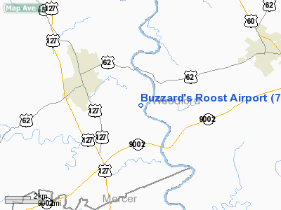
Buzzard's Roost Airport
Address:
Anderson County, KY
Tel:
502-839-3561
Images
and information placed above are from
http://www.airport-data.com/airport/76KY/
We
thank them for the data!
|
General Info |
| Country |
United
States |
| State |
KENTUCKY
|
| FAA ID |
76KY
|
| Latitude |
38-00-53.271N |
|
Longitude |
084-50-29.816W |
|
Elevation |
770 feet
|
| Near
City |
LAWRENCEBURG |
We don't guarantee the information is fresh and accurate. The data may
be wrong or outdated.
For more up-to-date information please refer to other sources.
|
|


