 |
|
|
Location &
QuickFacts
|
FAA
Information Effective: |
2008-09-25 |
|
Airport
Identifier: |
73KY |
|
Airport
Status: |
Operational |
|
Longitude/Latitude: |
085-48-03.0000W/38-01-59.9000N
-85.800833/38.033306 (Estimated) |
|
Elevation: |
480 ft / 146.30 m (Estimated) |
|
Land: |
0 acres |
|
From
nearest city: |
5 nautical miles EN of Brooks, KY |
|
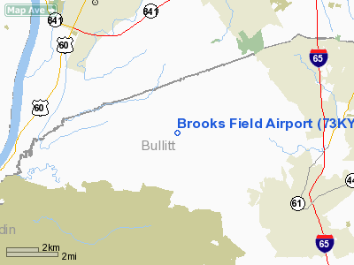
Location: |
Bullitt County, KY |
|
Magnetic Variation: |
() |
Owner & Manager
|
Ownership: |
Privately owned |
|
Owner: |
Dwayne E. Hargrove |
|
Address: |
4096 Knob Creek Road
Brooks, KY 40107 |
|
Phone number: |
502-957-2211 |
|
Manager: |
Dwayne E. Hargrove |
|
Address: |
189 Symmetric St
Louisville, KY 40229 |
Airport Operations and Facilities
|
Airport Use: |
Private |
|
Wind indicator: |
Yes |
|
Control Tower: |
No |
|
Sectional chart: |
St Louis |
|
Region: |
ASO - Southern |
|
Boundary ARTCC: |
ZID - Indianapolis |
|
Tie-in FSS: |
LOU - Louisville |
|
FSS Toll Free: |
1-800-WX-BRIEF |
Airport
Communications
|
Runway Information
Runway 06/24
|
Dimension: |
2150 x 80 ft / 655.3 x 24.4 m |
|
Surface: |
TURF, |
|
|
Runway 06
|
Runway 24
|
|
Traffic
Pattern: |
Left |
Left |
|
Obstruction: |
20 ft trees |
50 ft trees, 600.0 ft from runway |
|
Radio Navigation Aids
|
ID |
Type |
Name |
Ch |
Freq |
Var |
Dist |
|
GOI |
NDB |
Godman |
|
396.00 |
02W |
9.5 nm |
|
BRY |
NDB |
Bardstown/dcmsnd |
|
248.00 |
02W |
18.7 nm |
|
IKY |
NDB |
Springfield |
|
429.00 |
03W |
35.9 nm |
|
TEL |
NDB |
Tell City |
|
206.00 |
02W |
42.1 nm |
|
RRJ |
NDB |
Oranj |
|
368.00 |
02W |
45.4 nm |
|
TYC |
NDB |
Taylor County |
|
272.00 |
02W |
46.3 nm |
|
IMS |
NDB |
Madison |
|
404.00 |
03W |
46.6 nm |
|
FEU |
NDB |
Arnold |
|
521.00 |
03W |
47.7 nm |
|
MYS |
VOR |
Mystic |
|
108.20 |
01W |
22.6 nm |
|
FFT |
VOR |
Frankfort |
|
109.40 |
03W |
43.1 nm |
|
FTK |
VOR/DME |
Fort Knox |
033X |
109.60 |
01W |
11.1 nm |
|
BQM |
VOR/DME |
Bowman |
059X |
112.20 |
01W |
13.5 nm |
|
EWO |
VOR/DME |
New Hope |
045X |
110.80 |
01E |
24.9 nm |
|
IIU |
VORTAC |
Louisville |
095X |
114.80 |
01E |
11.4 nm |
|
ABB |
VORTAC |
Nabb |
071X |
112.40 |
01E |
34.3 nm |
|
SDF |
VOT |
Louisville Standifd |
|
111.00 |
|
9.2 nm |
Remarks
-
150 FT PLINE 1 NM
NE OF RY 06/24.
-
PVDD VFR & PVT USE.
Based Aircraft
|
Aircraft based
on field: |
2 |
|
Single Engine
Airplanes: |
2 |
Brooks Field Airport
Address:
Bullitt County, KY
Tel:
502-957-2211
Images
and information placed above are from
http://www.airport-data.com/airport/73KY/
We
thank them for the data!
|
|


