 |
|
|
|
|
|
|
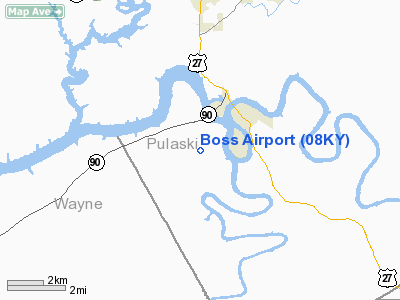
Location &
QuickFacts
|
FAA
Information Effective: |
2008-09-25 |
|
Airport
Identifier: |
08KY |
|
Airport
Status: |
Operational |
|
Longitude/Latitude: |
084-37-33.7870W/36-58-21.2750N
-84.626052/36.972576 (Estimated) |
|
Elevation: |
820 ft / 249.94 m (Estimated) |
|
Land: |
120 acres |
|
From
nearest city: |
2 nautical miles SW of Burnside, KY |
|
Location: |
Pulaski County, KY |
|
Magnetic Variation: |
03W (1985) |
Owner & Manager
|
Ownership: |
Privately owned |
|
Owner: |
Cumberland Aero Service Inc |
|
Address: |
121 Boss Lane
Bronston, KY 42518 |
|
Phone number: |
606-561-5260 |
|
Manager: |
Edward F. Boss |
|
Address: |
121 Boss Lane
Bronston, KY 42518 |
|
Phone number: |
606-561-5260 |
Airport Operations and Facilities
|
Airport Use: |
Private |
|
Wind indicator: |
Yes |
|
Segmented Circle: |
No |
|
Control Tower: |
No |
|
Landing fee charge: |
No |
|
Sectional chart: |
Cincinnati |
|
Region: |
ASO - Southern |
|
Boundary ARTCC: |
ZID - Indianapolis |
|
Tie-in FSS: |
LOU - Louisville |
|
FSS on Airport: |
No |
|
FSS Toll Free: |
1-800-WX-BRIEF |
Airport Services
|
Airframe
Repair: |
MAJOR |
|
Power
Plant Repair: |
MAJOR |
|
Bottled
Oxygen: |
NONE |
|
Bulk
Oxygen: |
NONE |
|
Runway Information
Runway 09/27
|
Dimension: |
2500 x 60 ft / 762.0 x 18.3 m |
|
Surface: |
TURF, Good Condition |
|
|
Runway 09
|
Runway 27
|
|
Traffic
Pattern: |
Left |
Left |
|
Obstruction: |
30 ft trees, 300.0 ft from runway, 30 ft right of
centerline, 10:1 slope to clear |
60 ft trees, 1200.0 ft from runway, 100 ft right of
centerline, 20:1 slope to clear |
|
Radio Navigation Aids
|
ID |
Type |
Name |
Ch |
Freq |
Var |
Dist |
|
CDX |
NDB |
Cumberland River |
|
388.00 |
05E |
3.0 nm |
|
EKQ |
NDB |
Elk Spring |
|
290.00 |
03W |
13.0 nm |
|
BPO |
NDB |
Piney Grove |
|
403.00 |
05W |
27.0 nm |
|
DVK |
NDB |
Goodall |
|
311.00 |
03W |
36.9 nm |
|
TYC |
NDB |
Taylor County |
|
272.00 |
02W |
39.3 nm |
|
JAU |
NDB |
Jacksboro |
|
204.00 |
03W |
44.3 nm |
|
IKY |
NDB |
Springfield |
|
429.00 |
03W |
49.4 nm |
|
LOZ |
VORTAC |
London |
108X |
116.10 |
03W |
25.0 nm |
|
LVT |
VORTAC |
Livingston |
021X |
108.40 |
02W |
34.9 nm |
Remarks
-
NUMEROUS SMALL
TREES (10-15') IN SIDE SLOPES.
-
VFR OPNS ONLY.
Based Aircraft
|
Aircraft based
on field: |
4 |
|
Single Engine
Airplanes: |
4 |
Operational Statistics
Time Period: 1990-08-22 - 1991-08-21
|
Aircraft
Operations: |
29/Week |
|
General
Aviation Local: |
26.7% |
|
General
Aviation Itinerant: |
73.3% |
Boss Airport
Address:
Pulaski County, KY
Tel:
606-561-5260
Images
and information placed above are from
http://www.airport-data.com/airport/08KY/
We
thank them for the data!
|
General Info |
| Country |
United
States |
| State |
KENTUCKY
|
| FAA ID |
08KY
|
| Latitude |
36-58-21.275N |
|
Longitude |
084-37-33.787W |
|
Elevation |
820 feet
|
| Near
City |
BURNSIDE
|
We don't guarantee the information is fresh and accurate. The data may
be wrong or outdated.
For more up-to-date information please refer to other sources.
|
|


