|
|
Big Sandy Regional Airport |
| Big Sandy Regional Airport |
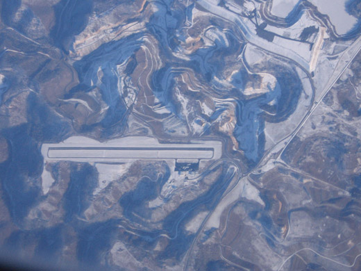 |
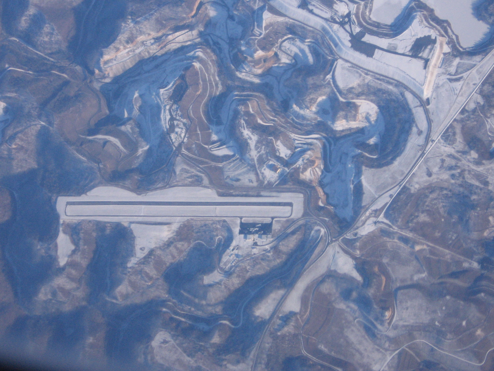
| K22 aerial photo January 21, 2009 |
| IATA: none â ICAO: none â FAA LID: K22 |
| Summary |
| Airport type |
Public |
| Owner |
Big Sandy Regional Airport Board |
| Serves |
Prestonsburg, Inez |
| Elevation AMSL |
1,221 ft / 372 m |
| Coordinates |
37°45â²04â³N 082°38â²12â³W / 37.75111°N 82.63667°W / 37.75111; -82.63667 |
| Website |
BigSandyRegional.com |
| Runways |
| Direction |
Length |
Surface |
| ft |
m |
| 3/21 |
5,000 |
1,524 |
Asphalt |
| Statistics (2006) |
| Aircraft operations |
6,400 |
| Based aircraft |
17 |
| Source: FAA and airport website |
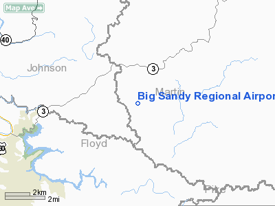
Big Sandy Regional Airport (FAA LID: K22) is a public use airport located in southwest Martin County, Kentucky, United States. The airport is nine nautical miles (17 km) northeast of the central business district of Prestonsburg, a city in Floyd County. It is owned by the Big Sandy Regional Airport Board.
Facilities and aircraft
Big Sandy Regional Airport covers an area of 136 acres (55 ha) at an elevation of 1,221 feet (372 m) above mean sea level. It has one asphalt paved runway designated 3/21 which measures 5,000 by 100 feet (1,524 x 30 m).
For the 12-month period ending September 21, 2006, the airport had 6,400 aircraft operations, an average of 17 per day: 81% general aviation, 14% air taxi and 5% military. At that time there were 17 aircraft based at this airport: 76% single-engine, 6% multi-engine, 6% jet and 12% helicopter.
The above content comes from Wikipedia and is published under free licenses – click here to read more.
|
Location &
QuickFacts
|
FAA
Information Effective: |
2008-09-25 |
|
Airport
Identifier: |
K22 |
|
Airport
Status: |
Operational |
|
Longitude/Latitude: |
082-38-12.1000W/37-45-03.7000N
-82.636694/37.751028 (Estimated) |
|
Elevation: |
1221 ft / 372.16 m (Surveyed) |
|
Land: |
136 acres |
|
From
nearest city: |
9 nautical miles NE of Prestonsburg, KY |
|
Location: |
Martin County, KY |
|
Magnetic Variation: |
05W (1990) |
Owner & Manager
|
Ownership: |
Publicly owned |
|
Owner: |
Big Sandy Regional Airport Bd |
|
Address: |
Hc64 Box 926
Debord, KY 41214 |
|
Phone number: |
606-789-7777
ARPT BOARD CHAIRMAN. |
|
Manager: |
Gary Cox |
|
Address: |
Hc64 Box 926
Debord, KY 41214 |
|
Phone number: |
606-298-5930
(FBO) GARY COX, DAYTIME 606-298-5930. |
Airport
Operations and Facilities
|
Airport
Use: |
Open to public |
|
Wind
indicator: |
Yes |
|
Segmented Circle: |
Yes |
|
Control
Tower: |
No |
|
Lighting
Schedule: |
DUSK-DAWN
ACTVT MIRL RY 03/21 AND REIL RYS 03 & 21 - CTAF. |
|
Beacon
Color: |
Clear-Green (lighted land airport) |
|
Sectional chart: |
Cincinnati |
|
Region: |
ASO - Southern |
|
Boundary
ARTCC: |
ZID - Indianapolis |
|
Tie-in
FSS: |
LOU - Louisville |
|
FSS on
Airport: |
No |
|
FSS Toll
Free: |
1-800-WX-BRIEF |
|
NOTAMs
Facility: |
LOU (NOTAM-d service avaliable) |
|
Federal Agreements: |
NGY |
Airport Communications
|
CTAF: |
123.050 |
|
Unicom: |
123.050 |
Airport Services
|
Fuel
available: |
100LLA |
|
Airframe
Repair: |
NONE |
|
Power
Plant Repair: |
NONE |
|
Runway Information
Runway 03/21
|
Dimension: |
5000 x 100 ft / 1524.0 x 30.5 m |
|
Surface: |
ASPH, Fair Condition |
|
Weight Limit: |
Single wheel: 30000 lbs. |
|
Edge Lights: |
Medium |
|
|
Runway 03
|
Runway 21
|
|
Longitude: |
082-38-28.1500W |
082-37-55.9900W |
|
Latitude: |
37-44-42.5100N |
37-45-24.8240N |
|
Elevation: |
1170.00 ft |
1221.00 ft |
|
Alignment: |
31 |
127 |
|
Traffic
Pattern: |
Left |
Left |
|
Markings: |
Non-precision instrument, Fair Condition |
Non-precision instrument, Fair Condition |
|
Crossing
Height: |
28.00 ft |
28.00 ft |
|
VASI: |
4-light PAPI on left side |
4-light PAPI on left side |
|
Visual
Glide Angle: |
4.00° |
3.00° |
|
Runway End
Identifier: |
Yes |
Yes |
|
Obstruction: |
115 ft pole, 2200.0 ft from runway, 200 ft left of
centerline, 17:1 slope to clear |
, 50:1 slope to clear |
|
Radio Navigation Aids
|
ID |
Type |
Name |
Ch |
Freq |
Var |
Dist |
|
AJY |
FAN MARKER |
Ashland |
|
|
03W |
49.1 nm |
|
GTC |
NDB |
Guyandot |
|
293.00 |
03W |
34.6 nm |
|
AZQ |
VOR/DME |
Hazard |
049X |
111.20 |
04W |
36.9 nm |
|
ECB |
VORTAC |
Newcombe |
041X |
110.40 |
02W |
27.7 nm |
Remarks
-
DEER AND BIRDS ON
& INVOF ARPT.
-
TWY A/B
INTERSECTION SIGN UNLIGHTED.
Based Aircraft
|
Aircraft based
on field: |
17 |
|
Single Engine
Airplanes: |
13 |
|
Multi Engine
Airplanes: |
1 |
|
Jet Engine
Airplanes: |
1 |
|
Helicopters: |
2 |
Operational Statistics
Time Period: 2005-09-22 - 2006-09-21
|
Aircraft
Operations: |
124/Week |
|
Air Taxi: |
14.1% |
|
General
Aviation Local: |
46.9% |
|
General
Aviation Itinerant: |
34.4% |
|
Military: |
4.7% |
Big Sandy Regional Airport
Address:
Martin County, KY
Tel:
606-789-7777, 606-298-5930
Images
and information placed above are from
http://www.airport-data.com/airport/K22/
We
thank them for the data!
|
General Info |
| Country |
United
States |
| State |
KENTUCKY
|
| FAA ID |
K22
|
| Latitude |
37-45-03.700N |
|
Longitude |
082-38-12.100W |
|
Elevation |
1221
feet |
| Near
City |
PRESTONSBURG |
We don't guarantee the information is fresh and accurate. The data may
be wrong or outdated.
For more up-to-date information please refer to other sources.
|
|