 |
|
|
Location &
QuickFacts
|
FAA
Information Effective: |
2008-09-25 |
|
Airport
Identifier: |
91KY |
|
Airport
Status: |
Operational |
|
Longitude/Latitude: |
082-36-21.5670W/38-12-38.3050N
-82.605991/38.210640 (Estimated) |
|
Elevation: |
568 ft / 173.13 m (Estimated) |
|
Land: |
100 acres |
|
From
nearest city: |
12 nautical miles N of Louisa, KY |
|
Location: |
Lawrence County, KY |
|
Magnetic Variation: |
05W (1990) |
Owner & Manager
|
Ownership: |
Privately owned |
|
Owner: |
Gene A. Wilson |
|
Address: |
Route 2 Box 289
Catlettsburg, KY 41129 |
|
Phone number: |
606-638-0202 |
|
Manager: |
Gene A. Wilson |
|
Address: |
Route 2 Box 289
Catlettsburg, KY 41129 |
|
Phone number: |
606-638-0202 |
Airport
Operations and Facilities
|
Airport
Use: |
Private |
|
Wind
indicator: |
Yes |
|
Segmented Circle: |
No |
|
Control
Tower: |
No |
|
Sectional chart: |
Cincinnati |
|
Region: |
ASO - Southern |
|
Boundary
ARTCC: |
ZID - Indianapolis |
|
Tie-in
FSS: |
LOU - Louisville |
|
FSS on
Airport: |
No |
|
FSS Toll
Free: |
1-800-WX-BRIEF |
|
Runway Information
Helipad H1
|
Dimension: |
20 x 20 ft / 6.1 x 6.1 m |
|
Surface: |
CONC, |
|
|
Runway H1
|
Runway
|
|
Traffic
Pattern: |
Left |
Left |
|
Radio Navigation Aids
|
ID |
Type |
Name |
Ch |
Freq |
Var |
Dist |
|
AJY |
FAN MARKER |
Ashland |
|
|
03W |
22.7 nm |
|
PMH |
NDB |
Portsmouth |
|
373.00 |
04W |
36.1 nm |
|
GTC |
NDB |
Guyandot |
|
293.00 |
03W |
41.9 nm |
|
GAS |
NDB |
Gallipolis |
|
420.00 |
07W |
42.9 nm |
|
ECB |
VORTAC |
Newcombe |
041X |
110.40 |
02W |
14.7 nm |
|
YRK |
VORTAC |
York |
075X |
112.80 |
05W |
31.4 nm |
|
HVQ |
VORTAC |
Charleston |
121X |
117.40 |
03W |
40.3 nm |
|
HNN |
VORTAC |
Henderson |
106X |
115.90 |
03W |
42.6 nm |
|
CRW |
VOT |
Charleston Kanawha |
|
108.80 |
|
48.8 nm |
Remarks
-
VFR WX CONDS; PVT
USE; ALL OPNS CONDUCTED FROM 350 TO 030 DEG AND 150 TO 200 DEG; TKOF/LNDG AREA
MARKED; WIND INDICATOR MAINTD.
Based Aircraft
|
Aircraft based
on field: |
1 |
|
Helicopters: |
1 |
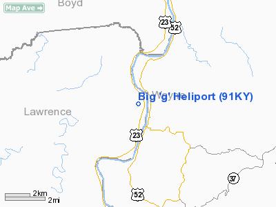
Big 'g' Heliport
Address:
Lawrence County, KY
Tel:
606-638-0202
Images
and information placed above are from
http://www.airport-data.com/airport/91KY/
We
thank them for the data!
|
General Info |
| Country |
United
States |
| State |
KENTUCKY
|
| FAA ID |
91KY
|
| Latitude |
38-12-38.305N |
|
Longitude |
082-36-21.567W |
|
Elevation |
568 feet
|
| Near
City |
LOUISA
|
We don't guarantee the information is fresh and accurate. The data may
be wrong or outdated.
For more up-to-date information please refer to other sources.
|
|


