 |
|
|
Location &
QuickFacts
|
FAA
Information Effective: |
2008-09-25 |
|
Airport
Identifier: |
23KY |
|
Airport
Status: |
Operational |
|
Longitude/Latitude: |
088-19-07.0000W/37-13-51.0000N
-88.318611/37.230833 (Estimated) |
|
Elevation: |
500 ft / 152.40 m (Estimated) |
|
Land: |
0 acres |
|
From
nearest city: |
3 nautical miles E of Burna, KY |
|
Location: |
Livingston County, KY |
|
Magnetic Variation: |
00E (1990) |
Owner & Manager
|
Ownership: |
Privately owned |
|
Owner: |
William E. Barnes |
|
Address: |
850 Klondike Mine Road
Burna, KY 42028 |
|
Phone number: |
502-988-3214 |
|
Address: |
|
Airport Operations and Facilities
|
Airport
Use: |
Private |
|
Segmented Circle: |
No |
|
Control
Tower: |
No |
|
Sectional chart: |
St Louis |
|
Region: |
ASO - Southern |
|
Boundary
ARTCC: |
ZME - Memphis |
|
Tie-in
FSS: |
LOU - Louisville |
|
FSS on
Airport: |
No |
|
FSS Toll
Free: |
1-800-WX-BRIEF |
|
Runway Information
Runway 05/23
|
Dimension: |
2600 x 75 ft / 792.5 x 22.9 m |
|
Surface: |
TURF, |
|
|
Runway 05
|
Runway 23
|
|
Traffic
Pattern: |
Left |
Left |
|
Radio Navigation Aids
|
ID |
Type |
Name |
Ch |
Freq |
Var |
Dist |
|
BDD |
NDB |
Bellgrade |
|
254.00 |
00E |
17.6 nm |
|
TWT |
NDB |
Tradewater |
|
276.00 |
00E |
22.7 nm |
|
GGK |
NDB |
Mayfield |
|
401.00 |
00E |
35.0 nm |
|
HSB |
NDB |
Harrisburg-raleigh |
|
230.00 |
00E |
36.5 nm |
|
GVA |
NDB |
Geneva |
|
224.00 |
01W |
43.2 nm |
|
CIR |
NDB |
Cairo |
|
397.00 |
00E |
44.5 nm |
|
MWA |
VOR/DME |
Marion |
041X |
110.40 |
04E |
45.6 nm |
|
CNG |
VORTAC |
Cunningham |
078X |
113.10 |
03E |
28.2 nm |
|
PXV |
VORTAC |
Pocket City |
080X |
113.30 |
03E |
49.6 nm |
Remarks
Based Aircraft
|
Aircraft based
on field: |
1 |
|
Single Engine
Airplanes: |
1 |
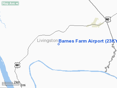
Barnes Farm Airport
Address:
Livingston County, KY
Tel:
502-988-3214
Images
and information placed above are from
http://www.airport-data.com/airport/23KY/
We
thank them for the data!
|
General Info |
| Country |
United
States |
| State |
KENTUCKY
|
| FAA ID |
23KY
|
| Latitude |
37-13-51.000N |
|
Longitude |
088-19-07.000W |
|
Elevation |
500 feet
|
| Near
City |
BURNA
|
We don't guarantee the information is fresh and accurate. The data may
be wrong or outdated.
For more up-to-date information please refer to other sources.
|
|


