 |
|
| Barkley Regional Airport |
| IATA: PAH â ICAO: KPAH â FAA LID: PAH |
| Summary |
| Airport type |
Public |
| Owner |
Barkley Regional Airport Authority |
| Serves |
Paducah, Kentucky |
| Elevation AMSL |
410 ft / 125 m |
| Coordinates |
37°03â²37â³N 088°46â²23â³W / 37.06028°N 88.77306°W / 37.06028; -88.77306 |
| Website |
www.BarkleyRegional.com |
| Runways |
| Direction |
Length |
Surface |
| ft |
m |
| 4/22 |
6,499 |
1,981 |
Asphalt |
| 14/32 |
5,500 |
1,676 |
Asphalt |
| Statistics (2010) |
| Aircraft operations |
36,776 |
| Based aircraft |
41 |
| Source: Federal Aviation Administration |
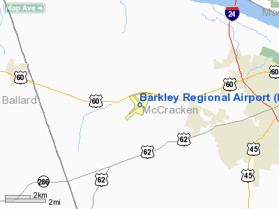
Barkley Regional Airport (IATA: PAH, ICAO: KPAH, FAA LID: PAH) is a public use airport located 12 nautical miles (22 km) west of the central business district of Paducah, a city in McCracken County, Kentucky, United States. It is owned by the Barkley Regional Airport Authority. The airport is mostly used for general aviation, but is also served by one commercial airline.
The airport also serves the area around Kentucky Lake. There are 100 people employed at the airport. The only current airline is United Express operated by SkyWest Airlines who operates two daily round-trip Canadair Regional Jet flights to Chicago, Illinois. Barkely Regional Airport is the 3rd busiest in Kentucky (not including Cincinnati/Northern Kentucky International Airport). History
Barkley Regional Airport is named after former Vice-President of the United States, Alben W. Barkley, who was from Kentucky. The airport was built to serve the southwestern portion of Kentucky and Southern Illinois. The airport was previously served by Northwest Airlink operated by Mesaba Airlines. Northwest operated daily flights using Saab turboprops to Memphis International Airport. When Northwest merged with the Atlanta-based Delta Air Lines, service to Memphis from Paducah was terminated. This service was quickly replaced when the Chicago-based United Airlines started operating daily CRJ-200 flights to Chicago-O'Hare International Airport. The service is operated by SkyWest Airlines on behalf of United's regional brand, United Express. Service began in the Winter of 2010 and continues on today.
Facilities and aircraft
Barkley Regional Airport covers an area of 1,001 acres (405 ha) at an elevation of 410 feet (125 m) above mean sea level. It has two asphalt paved runways: 4/22 is 6,499 by 150 feet (1,981 x 46 m) and 14/32 is 5,500 by 150 feet (1,676 x 46 m). An expansion of runway 14/32 was completed in December 2005.
For the 12-month period ending December 31, 2010, the airport had 36,776 aircraft operations, an average of 100 per day: 87% general aviation, 5% scheduled commercial, 5% military, and 3% air taxi. At that time there were 41 aircraft based at this airport: 71% single-engine, 17% multi-engine and 12% jet.
Airlines and destinations
| Airlines |
Destinations |
| United Express operated by SkyWest Airlines |
Chicago-O'Hare |
The above content comes from Wikipedia and is published under free licenses – click here to read more.
|
Location &
QuickFacts
|
FAA
Information Effective: |
2008-09-25 |
|
Airport
Identifier: |
PAH |
|
Airport
Status: |
Operational |
|
Longitude/Latitude: |
088-46-22.6500W/37-03-37.0350N
-88.772958/37.060288 (Estimated) |
|
Elevation: |
410 ft / 124.97 m (Surveyed) |
|
Land: |
1001 acres |
|
From
nearest city: |
12 nautical miles W of Paducah, KY |
|
Location: |
Mc Cracken County, KY |
|
Magnetic Variation: |
01W (2005) |
Owner & Manager
|
Ownership: |
Publicly owned |
|
Owner: |
Barkley Regional Airport Authority |
|
Address: |
Po Box 1131
Paducah, KY 42002-1131 |
|
Phone number: |
270-744-0521 |
|
Manager: |
Richard Roof |
|
Address: |
Po Box 1131
Paducah, KY 42002-1131 |
|
Phone number: |
270-744-0521 |
Airport
Operations and Facilities
|
Airport
Use: |
Open to public |
|
Wind
indicator: |
Yes |
|
Segmented Circle: |
Yes |
|
Control
Tower: |
Yes |
|
Lighting
Schedule: |
DUSK-DAWN
WHEN ATCT CLSD ACTVT HIRL RY 04/22, MIRL RY 14/32, MALSR RY 04, PAPI
RY 32, REIL RYS 22 & 32, TWY LGTS & LGTD WIND CONE - CTAF. |
|
Beacon
Color: |
Clear-Green (lighted land airport) |
|
Landing
fee charge: |
No |
|
Sectional chart: |
St Louis |
|
Region: |
ASO - Southern |
|
Boundary
ARTCC: |
ZME - Memphis |
|
Tie-in
FSS: |
LOU - Louisville |
|
FSS on
Airport: |
No |
|
FSS Toll
Free: |
1-800-WX-BRIEF |
|
NOTAMs
Facility: |
PAH (NOTAM-d service avaliable) |
|
Certification type/date: |
I A S 05/1973
CLSD TO UNSKED ACR OPNS WITH MORE THAN 30 PSGR SEATS EXCP 24 HRS PPR
CALL AMGR 270-744-0521. |
|
Federal Agreements: |
NGY3 |
Airport Communications
|
CTAF: |
119.600 |
|
Unicom: |
123.000 |
Airport Services
|
Fuel
available: |
100LLA |
|
Airframe
Repair: |
MAJOR |
|
Power
Plant Repair: |
MAJOR |
|
Bottled
Oxygen: |
NONE |
|
Bulk
Oxygen: |
NONE |
|
Runway Information
Runway 04/22
|
Dimension: |
6499 x 150 ft / 1980.9 x 45.7 m |
|
Surface: |
ASPH, Good Condition |
|
Surface
Treatment: |
Saw-cut or plastic Grooved |
|
Weight Limit: |
Single wheel: 76000 lbs.
Dual wheel: 99000 lbs.
Dual tandem wheel: 170000 lbs. |
|
Edge Lights: |
High |
|
|
Runway 04
|
Runway 22
|
|
Longitude: |
088-46-53.3239W |
088-45-57.9311W |
|
Latitude: |
37-03-12.5279N |
37-03-58.9865N |
|
Elevation: |
410.00 ft |
380.00 ft |
|
Alignment: |
44 |
127 |
|
ILS Type: |
ILS |
|
|
Traffic
Pattern: |
Left |
Left |
|
Markings: |
Precision instrument, Good Condition |
Precision instrument, Good Condition |
|
Crossing
Height: |
0.00 ft |
59.00 ft |
|
VASI: |
|
4-box on left side |
|
Visual
Glide Angle: |
0.00° |
3.00° |
|
Approach
lights: |
MALSR |
|
|
Runway End
Identifier: |
|
Yes |
|
Obstruction: |
37 ft pole, 1600.0 ft from runway, 312 ft right of
centerline, 37:1 slope to clear |
28 ft trees, 1000.0 ft from runway, 500 ft right of
centerline, 28:1 slope to clear |
|
Decleard
distances: |
Take off run available 6499.00 ft
Take off distance available 6499.00 ft
Actual stop distance available 6499.00 ft
Landing distance available 6499.00 ft |
Take off run available 6499.00 ft
Take off distance available 6499.00 ft
Actual stop distance available 6499.00 ft
Landing distance available 6499.00 ft |
|
Runway 14/32
|
Dimension: |
5500 x 150 ft / 1676.4 x 45.7 m |
|
Surface: |
ASPH, Good Condition |
|
Surface
Treatment: |
Saw-cut or plastic Grooved |
|
Weight Limit: |
Single wheel: 75000 lbs.
Dual wheel: 100000 lbs.
Dual tandem wheel: 170000 lbs. |
|
Edge Lights: |
Medium |
|
|
Runway 14
|
Runway 32
|
|
Longitude: |
088-46-41.1921W |
088-45-57.0728W |
|
Latitude: |
37-03-59.1982N |
37-03-17.8939N |
|
Elevation: |
392.00 ft |
409.00 ft |
|
Alignment: |
127 |
127 |
|
Traffic
Pattern: |
Left |
Left |
|
Markings: |
Non-precision instrument, Good Condition |
Non-precision instrument, Good Condition |
|
Displaced
threshold: |
100.00 ft |
0.00 ft |
|
VASI: |
|
4-light PAPI on left side |
|
Runway End
Identifier: |
|
Yes |
|
Obstruction: |
26 ft tree, 900.0 ft from runway, 200 ft left of
centerline, 26:1 slope to clear |
20 ft trees, 1038.0 ft from runway, 340 ft right of
centerline, 14:1 slope to clear |
|
Decleard
distances: |
Take off run available 5500.00 ft
Take off distance available 5500.00 ft
Actual stop distance available 5500.00 ft
Landing distance available 5400.00 ft |
Take off run available 5500.00 ft
Take off distance available 5500.00 ft
Actual stop distance available 5400.00 ft
Landing distance available 5400.00 ft |
|
Radio Navigation Aids
|
ID |
Type |
Name |
Ch |
Freq |
Var |
Dist |
|
BDD |
NDB |
Bellgrade |
|
254.00 |
00E |
7.1 nm |
|
CIR |
NDB |
Cairo |
|
397.00 |
00E |
21.6 nm |
|
GGK |
NDB |
Mayfield |
|
401.00 |
00E |
23.8 nm |
|
CHQ |
NDB |
Charleston |
|
208.00 |
01E |
30.9 nm |
|
HSB |
NDB |
Harrisburg-raleigh |
|
230.00 |
00E |
46.4 nm |
|
TWT |
NDB |
Tradewater |
|
276.00 |
00E |
46.5 nm |
|
UC |
NDB |
Obion |
|
212.00 |
00E |
47.1 nm |
|
CGI |
VOR/DME |
Cape Girardeau |
076X |
112.90 |
01E |
39.6 nm |
|
MWA |
VOR/DME |
Marion |
041X |
110.40 |
04E |
43.2 nm |
|
CNG |
VORTAC |
Cunningham |
078X |
113.10 |
03E |
4.4 nm |
Remarks
-
NWS ON ARPT CALL 270-744-6440.
-
EXISTED PRIOR TO 1959.
Based Aircraft
|
Aircraft based
on field: |
47 |
|
Single Engine
Airplanes: |
39 |
|
Multi Engine
Airplanes: |
5 |
|
Jet Engine
Airplanes: |
2 |
|
Helicopters: |
1 |
Operational Statistics
Time Period: 2007-01-01 - 2007-12-31
|
Aircraft
Operations: |
109/Day |
|
Commerical: |
5.5% |
|
Air Taxi: |
6.8% |
|
General
Aviation Local: |
37.4% |
|
General
Aviation Itinerant: |
46.1% |
|
Military: |
4.1% |
Barkley Regional Airport
Address:
Mc Cracken County, KY
Tel:
270-744-0521
Images
and information placed above are from
http://www.airport-data.com/airport/PAH/
We
thank them for the data!
|
General Info |
| Country |
United
States |
| State |
KENTUCKY
|
| FAA ID |
PAH
|
| Latitude |
37-03-39.000N |
|
Longitude |
088-46-25.500W |
|
Elevation |
410 feet
|
| Near
City |
PADUCAH
|
We don't guarantee the information is fresh and accurate. The data may
be wrong or outdated.
For more up-to-date information please refer to other sources.
|
|


