|
|
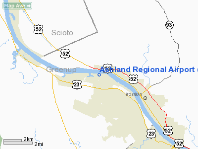
| Ashland Regional Airport |
 |
| IATA: none â ICAO: KDWU â FAA LID: DWU |
| Summary |
| Airport type |
Public |
| Owner |
Ashland Regional Airport Board |
| Serves |
Ashland, Kentucky |
| Elevation AMSL |
546 ft / 166 m |
| Coordinates |
38°33â²16â³N 082°44â²17â³W / 38.55444°N 82.73806°W / 38.55444; -82.73806 |
| Website |
AshlandRegionalAirport.com |
| Runways |
| Direction |
Length |
Surface |
| ft |
m |
| 10/28 |
5,602 |
1,707 |
Asphalt |
| Statistics (2007) |
| Aircraft operations |
4,500 |
| Based aircraft |
47 |
| Source: Federal Aviation Administration |
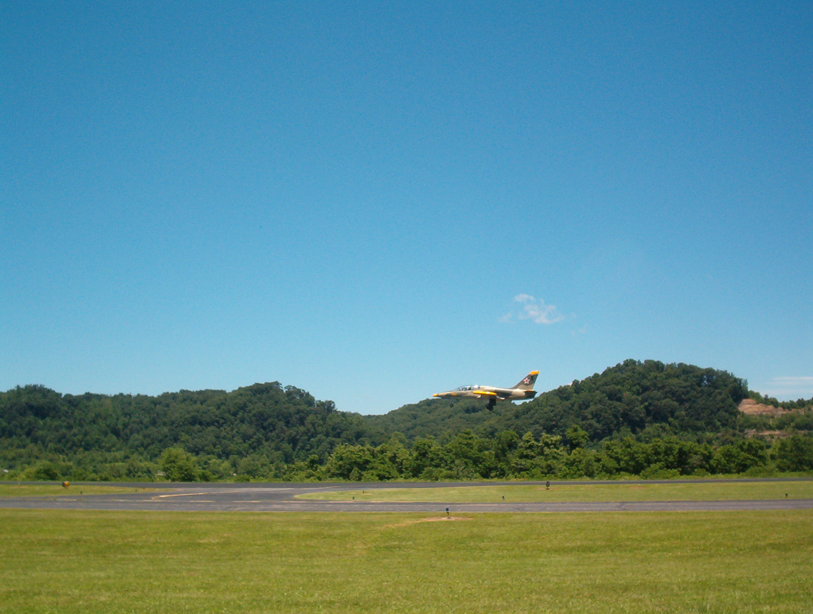
Ashland Regional Airport (ICAO: KDWU, FAA LID: DWU) is a public use airport in Worthington, Greenup County, Kentucky, owned by the Ashland Regional Airport Board. It is located six nautical miles (11 km) northwest of the central business district of Ashland, a city in Boyd County, Kentucky, United States. Currently, the airport serves local charter and private aircraft. Community events, such as car and air shows, also take place at the airport.
Although most U.S. airports use the same three-letter location identifier for the FAA and IATA, this airport is assigned DWU by the FAA but has no designation from the IATA. History
It opened in 1953 as Ashland-Boyd County Airport and featured a 5,000 ft (1,500 m) runway with a 3,000 ft (910 m) clearance.
The airport was once used extensively by the oil manufacturing company Ashland Inc. before the company's corporate headquarters was moved from Russell to Covington.
Facilities and aircraft
Ashland Regional Airport covers an area of 170 acres (69 ha) at an elevation of 546 feet (166 m) above mean sea level. It has one asphalt paved runway designated 10/28 which measures 5,602 by 100 feet (1,707 x 30 m).
For the 12-month period ending July 23, 2007, the airport had 4,500 aircraft operations, an average of 12 per day: 96% general aviation, 2% air taxi and 2% military. At that time there were 47 aircraft based at this airport: 77% single-engine, 15% multi-engine, 4% jet and 4% helicopter.
The above content comes from Wikipedia and is published under free licenses – click here to read more.
|
Location &
QuickFacts
|
FAA
Information Effective: |
2008-09-25 |
|
Airport
Identifier: |
DWU |
|
Airport
Status: |
Operational |
|
Longitude/Latitude: |
082-44-16.8000W/38-33-16.2000N
-82.738000/38.554500 (Estimated) |
|
Elevation: |
546 ft / 166.42 m (Surveyed) |
|
Land: |
170 acres |
|
From
nearest city: |
6 nautical miles NW of Ashland, KY |
|
Location: |
Greenup County, KY |
|
Magnetic Variation: |
05W (1995) |
Owner & Manager
|
Ownership: |
Publicly owned |
|
Owner: |
Ashland Regional Airport Board
MIKE GILLUM, AIRPORT BOARD CHAIRMAN. |
|
Address: |
501 Scott St
Worthington, KY 41183 |
|
Phone number: |
606-928-4934 |
|
Manager: |
Larry Wilson |
|
Address: |
501 Scott St
Worthington, KY 41183 |
|
Phone number: |
606-494-2034 |
Airport
Operations and Facilities
|
Airport
Use: |
Open to public |
|
Wind
indicator: |
Yes |
|
Segmented Circle: |
Yes |
|
Control
Tower: |
No |
|
Lighting
Schedule: |
DUSK-DAWN
ACTVT MIRL RY 10/28, REIL & PAPI RYS 10 & 28 - CTAF. |
|
Beacon
Color: |
Clear-Green (lighted land airport) |
|
Landing
fee charge: |
Yes
FEE WAIVED WITH FUEL PURCHASE. |
|
Sectional chart: |
Cincinnati |
|
Region: |
ASO - Southern |
|
Boundary
ARTCC: |
ZID - Indianapolis |
|
Tie-in
FSS: |
LOU - Louisville |
|
FSS on
Airport: |
No |
|
FSS Toll
Free: |
1-800-WX-BRIEF |
|
NOTAMs
Facility: |
LOU (NOTAM-d service avaliable) |
|
Federal Agreements: |
NGY |
Airport Communications
|
CTAF: |
122.800 |
|
Unicom: |
122.800 |
Airport Services
|
Fuel
available: |
100LLA |
|
Airframe
Repair: |
MINOR |
|
Power
Plant Repair: |
MINOR |
|
Bulk
Oxygen: |
NONE |
|
Runway Information
Runway 10/28
|
Dimension: |
5602 x 100 ft / 1707.5 x 30.5 m |
|
Surface: |
ASPH, Good Condition |
|
Weight Limit: |
Single wheel: 51000 lbs.
Dual wheel: 65000 lbs.
Dual tandem wheel: 105000 lbs. |
|
Edge Lights: |
Medium |
|
|
Runway 10
|
Runway 28
|
|
Longitude: |
082-44-51.7300W |
082-43-41.9290W |
|
Latitude: |
38-33-20.1360N |
38-33-12.2600N |
|
Elevation: |
546.00 ft |
544.00 ft |
|
Alignment: |
98 |
127 |
|
ILS Type: |
SDF |
|
|
Traffic
Pattern: |
Left |
Left |
|
Markings: |
Non-precision instrument, Fair Condition |
Non-precision instrument, Fair Condition |
|
Crossing
Height: |
38.00 ft |
43.00 ft |
|
VASI: |
2-light PAPI on left side |
2-light PAPI on left side |
|
Visual
Glide Angle: |
3.00° |
3.30° |
|
Runway End
Identifier: |
Yes |
Yes |
|
Obstruction: |
25 ft tree, 201.0 ft from runway, 160 ft left of
centerline
+20 FT TREES 0-200 FT FM RY END & 160 FT LEFT. |
15 ft trees, 201.0 ft from runway, 150 ft left of
centerline
+15 FT TREES 0-200 FT FM RY END & 170 FT LEFT. |
|
Radio Navigation Aids
|
ID |
Type |
Name |
Ch |
Freq |
Var |
Dist |
|
AJY |
FAN MARKER |
Ashland |
|
|
03W |
2.7 nm |
|
PMH |
NDB |
Portsmouth |
|
373.00 |
04W |
14.6 nm |
|
GAS |
NDB |
Gallipolis |
|
420.00 |
07W |
31.8 nm |
|
PZO |
NDB |
Peebles |
|
329.00 |
02W |
35.3 nm |
|
EOP |
NDB |
Waverly |
|
385.00 |
06W |
37.9 nm |
|
XW |
NDB |
Flmng |
|
400.00 |
05W |
42.7 nm |
|
AMT |
NDB |
West Union |
|
359.00 |
04W |
42.8 nm |
|
YRK |
VORTAC |
York |
075X |
112.80 |
05W |
12.5 nm |
|
ECB |
VORTAC |
Newcombe |
041X |
110.40 |
02W |
25.2 nm |
|
HNN |
VORTAC |
Henderson |
106X |
115.90 |
03W |
35.5 nm |
|
HVQ |
VORTAC |
Charleston |
121X |
117.40 |
03W |
47.2 nm |
Remarks
-
RDO TWR LCTD
10560' FM END RWY 28.
-
FOR ARPT SVCS
CALL TOLL FREE 877-359-2745.
-
EXISTED PRIOR TO 1959.
Based Aircraft
|
Aircraft based
on field: |
47 |
|
Single Engine
Airplanes: |
36 |
|
Multi Engine
Airplanes: |
7 |
|
Jet Engine
Airplanes: |
2 |
|
Helicopters: |
2 |
Operational Statistics
Time Period: 2006-07-24 - 2007-07-23
|
Aircraft
Operations: |
87/Week |
|
Air Taxi: |
2.2% |
|
General
Aviation Local: |
55.6% |
|
General
Aviation Itinerant: |
40.0% |
|
Military: |
2.2% |
Ashland Regional Airport
Address:
Greenup County, KY
Tel:
606-928-4934, 606-494-2034
Images
and information placed above are from
http://www.airport-data.com/airport/DWU/
We
thank them for the data!
|
General Info |
| Country |
United
States |
| State |
KENTUCKY
|
| FAA ID |
DWU
|
| Latitude |
38-33-16.200N |
|
Longitude |
082-44-16.800W |
|
Elevation |
546 feet
|
| Near
City |
ASHLAND
|
We don't guarantee the information is fresh and accurate. The data may
be wrong or outdated.
For more up-to-date information please refer to other sources.
|
|