 |
|
|
Location &
QuickFacts
|
FAA
Information Effective: |
2008-09-25 |
|
Airport
Identifier: |
0KY1 |
|
Airport
Status: |
Operational |
|
Longitude/Latitude: |
086-37-06.0000W/36-45-56.0000N
-86.618333/36.765556 (Estimated) |
|
Elevation: |
504 ft / 153.62 m (Estimated) |
|
Land: |
0 acres |
|
From
nearest city: |
3 nautical miles NW of Franklin, KY |
|
Location: |
Simpson County, KY |
|
Magnetic Variation: |
01W (1990) |
Owner & Manager
|
Ownership: |
Privately owned |
|
Owner: |
Jurgen Arnemann |
|
Address: |
1895 Blackjack Road
Franklin, KY 42134 |
|
Phone number: |
502-586-6694 |
|
Manager: |
Jurgen Arnemann |
|
Address: |
1895 Blackjack Road
Franklin, KY 42134 |
|
Phone number: |
502-586-6694 |
Airport
Operations and Facilities
|
Airport
Use: |
Private |
|
Segmented Circle: |
No |
|
Control
Tower: |
No |
|
Sectional chart: |
St Louis |
|
Region: |
ASO - Southern |
|
Boundary
ARTCC: |
ZME - Memphis |
|
Tie-in
FSS: |
LOU - Louisville |
|
FSS on
Airport: |
No |
|
FSS Toll
Free: |
1-800-WX-BRIEF |
|
Runway Information
Runway 10/28
|
Dimension: |
3200 x 75 ft / 975.4 x 22.9 m |
|
Surface: |
ASPH, |
|
|
Runway 10
|
Runway 28
|
|
Traffic
Pattern: |
Left |
Left |
|
Radio Navigation Aids
|
ID |
Type |
Name |
Ch |
Freq |
Var |
Dist |
|
PED |
NDB |
Needmore |
|
221.00 |
01W |
19.9 nm |
|
ON |
NDB |
Music |
|
279.00 |
03W |
26.3 nm |
|
LFB |
NDB |
Lafayette |
|
245.00 |
02W |
30.8 nm |
|
BVQ |
NDB |
Beaver Creek |
|
260.00 |
02W |
33.0 nm |
|
VI |
NDB |
Opery |
|
344.00 |
02W |
33.8 nm |
|
HIX |
NDB |
Honey Grove |
|
356.00 |
01W |
35.3 nm |
|
JUE |
NDB |
Lebanon |
|
414.00 |
02W |
37.5 nm |
|
GMH |
NDB |
Muhlenberg |
|
362.00 |
01E |
38.0 nm |
|
FK |
NDB |
Airbe |
|
273.00 |
01W |
38.4 nm |
|
SWZ |
NDB |
Sewart |
|
391.00 |
02W |
49.2 nm |
|
FQW |
NDB |
Walter Hill |
|
371.00 |
02W |
49.8 nm |
|
HXW |
TACAN |
Screaming Eagle |
096X |
|
01W |
42.6 nm |
|
CKV |
VOR/DME |
Clarksville |
043X |
110.60 |
01W |
39.2 nm |
|
BWG |
VORTAC |
Bowling Green |
126X |
117.90 |
02E |
12.9 nm |
|
BNA |
VORTAC |
Nashville |
088X |
114.10 |
02W |
37.9 nm |
|
CCT |
VORTAC |
Central City |
035X |
109.80 |
01W |
48.3 nm |
|
BNA |
VOT |
Nashville Metropoln |
|
108.60 |
|
38.5 nm |
|
MQY |
VOT |
Smyrna |
|
110.20 |
|
45.9 nm |
Remarks
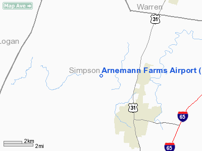
Arnemann Farms Airport
Address:
Simpson County, KY
Tel:
502-586-6694
Images
and information placed above are from
http://www.airport-data.com/airport/0KY1/
We
thank them for the data!
|
General Info |
| Country |
United
States |
| State |
KENTUCKY
|
| FAA ID |
0KY1
|
| Latitude |
36-45-56.000N |
|
Longitude |
086-37-06.000W |
|
Elevation |
504 feet
|
| Near
City |
FRANKLIN
|
We don't guarantee the information is fresh and accurate. The data may
be wrong or outdated.
For more up-to-date information please refer to other sources.
|
|


