 |
|
|
Location &
QuickFacts
|
FAA
Information Effective: |
2008-09-25 |
|
Airport
Identifier: |
8KY0 |
|
Airport
Status: |
Operational |
|
Longitude/Latitude: |
084-27-49.0000W/38-23-48.0000N
-84.463611/38.396667 (Estimated) |
|
Elevation: |
980 ft / 298.70 m (Estimated) |
|
Land: |
5 acres |
|
From
nearest city: |
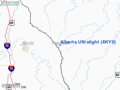
1 nautical miles W of Alberta, KY |
|
Location: |
Harrison County, KY |
|
Magnetic Variation: |
04W (1995) |
Owner & Manager
|
Ownership: |
Privately owned |
|
Owner: |
David E. Williams |
|
Address: |
P.o. Box 353
Cynthiana, KY 41031 |
|
Phone
number: |
606-234-6277 |
|
Manager: |
David E. Williams |
|
Address: |
P.o. Box 353
Cynthiana, KY 41031 |
|
Phone number: |
606-234-6277 |
Airport Operations and Facilities
|
Airport
Use: |
Private |
|
Wind
indicator: |
Yes |
|
Segmented Circle: |
No |
|
Control
Tower: |
No |
|
Sectional chart: |
Cincinnati |
|
Region: |
ASO - Southern |
|
Boundary
ARTCC: |
ZID - Indianapolis |
|
Tie-in
FSS: |
LOU - Louisville |
|
FSS on
Airport: |
No |
|
FSS Toll
Free: |
1-800-WX-BRIEF |
|
Runway Information
Runway 18/36
|
Dimension: |
700 x 60 ft / 213.4 x 18.3 m |
|
Surface: |
TURF, |
|
|
Runway 18
|
Runway 36
|
|
Traffic
Pattern: |
Left |
Right |
|
Radio Navigation Aids
|
ID |
Type |
Name |
Ch |
Freq |
Var |
Dist |
|
FEU |
NDB |
Arnold |
|
521.00 |
03W |
20.0 nm |
|
LE |
NDB |
Blayd |
|
242.00 |
04W |
26.3 nm |
|
IOB |
NDB |
Mount Sterling |
|
210.00 |
04W |
30.5 nm |
|
XW |
NDB |
Flmng |
|
400.00 |
05W |
39.9 nm |
|
UR |
NDB |
Burln |
|
321.00 |
04W |
41.6 nm |
|
PWF |
NDB |
Sportys |
|
245.00 |
04W |
42.5 nm |
|
XYC |
NDB |
Seco |
|
393.00 |
03W |
43.5 nm |
|
LUK |
NDB |
Cincinnati |
|
335.00 |
04W |
46.2 nm |
|
MDE |
NDB |
Madeira |
|
379.00 |
04W |
49.9 nm |
|
FFT |
VOR |
Frankfort |
|
109.40 |
03W |
24.6 nm |
|
FLM |
VOR/DME |
Falmouth |
117X |
117.00 |
04W |
16.8 nm |
|
HYK |
VORTAC |
Lexington |
073X |
112.60 |
00E |
25.9 nm |
|
CVG |
VORTAC |
Cincinnati |
120X |
117.30 |
04W |
38.9 nm |
|
LUK |
VOT |
Cincinnati Muni/lunken |
|
108.40 |
|
43.4 nm |
Remarks
-
+329 FT TWR 1/2
MI SW OF ULTRALIGHT FLIGHTPARK.
-
PRVDD VFR ONLY;
PR USE ONLY.
Based Aircraft
|
Aircraft based
on field: |
1 |
|
Ultralights: |
1 |
Alberta Ultralight
Address:
Harrison County, KY
Tel:
606-234-6277
Images
and information placed above are from
http://www.airport-data.com/airport/8KY0/
We
thank them for the data!
|
General Info |
| Country |
United
States |
| State |
KENTUCKY
|
| FAA ID |
8KY0
|
| Latitude |
38-23-48.000N |
|
Longitude |
084-27-49.000W |
|
Elevation |
980 feet
|
| Near
City |
ALBERTA
|
We don't guarantee the information is fresh and accurate. The data may
be wrong or outdated.
For more up-to-date information please refer to other sources.
|
|


