 |
|
|
Location &
QuickFacts
|
FAA
Information Effective: |
2008-09-25 |
|
Airport
Identifier: |
52KY |
|
Airport
Status: |
Operational |
|
Longitude/Latitude: |
084-18-08.7570W/38-07-05.2780N
-84.302432/38.118133 (Estimated) |
|
Elevation: |
900 ft / 274.32 m (Estimated) |
|
Land: |
0 acres |
|
From
nearest city: |
5 nautical miles SW of Paris, KY |
|
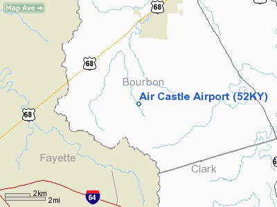
Location: |
Bourbon County, KY |
|
Magnetic Variation: |
03W (1985) |
Owner & Manager
|
Ownership: |
Privately owned |
|
Owner: |
Dan L. Thompson |
|
Address: |
1950 Bethlehem Rd
Paris, KY 40361 |
|
Phone number: |
606-987-7791 |
|
Manager: |
Dan L. Thompson |
|
Address: |
1950 Bethlehem Rd
Paris, KY 40361 |
|
Phone number: |
606-987-7791 |
Airport
Operations and Facilities
|
Airport
Use: |
Private |
|
Wind
indicator: |
Yes |
|
Segmented Circle: |
No |
|
Control
Tower: |
No |
|
Landing
fee charge: |
No |
|
Sectional chart: |
Cincinnati |
|
Region: |
ASO - Southern |
|
Boundary
ARTCC: |
ZID - Indianapolis |
|
Tie-in
FSS: |
LOU - Louisville |
|
FSS on
Airport: |
No |
|
FSS Toll
Free: |
1-800-WX-BRIEF |
|
Runway Information
Runway 17/35
|
Dimension: |
1300 x 50 ft / 396.2 x 15.2 m |
|
Surface: |
TURF, |
|
|
Runway 17
|
Runway 35
|
|
Traffic
Pattern: |
Left |
Left |
|
Obstruction: |
|
35 ft trees, 500.0 ft from runway |
|
Radio Navigation Aids
|
ID |
Type |
Name |
Ch |
Freq |
Var |
Dist |
|
IOB |
NDB |
Mount Sterling |
|
210.00 |
04W |
15.6 nm |
|
LE |
NDB |
Blayd |
|
242.00 |
04W |
18.7 nm |
|
FEU |
NDB |
Arnold |
|
521.00 |
03W |
25.1 nm |
|
XYC |
NDB |
Seco |
|
393.00 |
03W |
25.2 nm |
|
DVK |
NDB |
Goodall |
|
311.00 |
03W |
39.2 nm |
|
XW |
NDB |
Flmng |
|
400.00 |
05W |
41.3 nm |
|
FFT |
VOR |
Frankfort |
|
109.40 |
03W |
28.9 nm |
|
FLM |
VOR/DME |
Falmouth |
117X |
117.00 |
04W |
31.9 nm |
|
HYK |
VORTAC |
Lexington |
073X |
112.60 |
00E |
12.2 nm |
Remarks
Based Aircraft
|
Aircraft based
on field: |
2 |
|
Single Engine
Airplanes: |
2 |
Air Castle Airport
Address:
Bourbon County, KY
Tel:
606-987-7791
Images
and information placed above are from
http://www.airport-data.com/airport/52KY/
We
thank them for the data!
|
General Info |
| Country |
United
States |
| State |
KENTUCKY
|
| FAA ID |
52KY
|
| Latitude |
38-07-05.278N |
|
Longitude |
084-18-08.757W |
|
Elevation |
900 feet
|
| Near
City |
PARIS
|
We don't guarantee the information is fresh and accurate. The data may
be wrong or outdated.
For more up-to-date information please refer to other sources.
|
|


