 |
|
|
Location &
QuickFacts
|
FAA
Information Effective: |
2008-09-25 |
|
Airport
Identifier: |
6KY4 |
|
Airport
Status: |
Operational |
|
Longitude/Latitude: |
085-57-14.0000W/36-45-12.0000N
-85.953889/36.753333 (Estimated) |
|
Elevation: |
870 ft / 265.18 m (Estimated) |
|
Land: |
0 acres |
|
From
nearest city: |
2 nautical miles N of Fountain Run, KY |
|
Location: |
Barren County, KY |
|
Magnetic Variation: |
() |
Owner & Manager
|
Ownership: |
Privately owned |
|
Owner: |
Lawrence Landon Adair, Jr |
|
Address: |
265 Jordan Road
Fountain Run, KY 42133 |
|
Phone
number: |
270-434-3790 |
|
Manager: |
Lawrence Landon Adair, Jr |
|
Address: |
265 Jordan Road
Fountain Run, KY 42133 |
|
Phone number: |
270-434-3790 |
Airport Operations and Facilities
|
Airport
Use: |
Private |
|
Wind
indicator: |
Yes |
|
Control
Tower: |
No |
|
Sectional chart: |
St Louis |
|
Region: |
ASO - Southern |
|
Boundary
ARTCC: |
ZME - Memphis |
|
Tie-in
FSS: |
LOU - Louisville |
|
FSS Toll
Free: |
1-800-WX-BRIEF |
|
Runway Information
Runway 09/27
|
Dimension: |
1800 x 75 ft / 548.6 x 22.9 m |
|
Surface: |
TURF, |
|
|
Runway 09
|
Runway 27
|
|
Traffic
Pattern: |
Left |
Left |
|
Radio Navigation Aids
|
ID |
Type |
Name |
Ch |
Freq |
Var |
Dist |
|
LFB |
NDB |
Lafayette |
|
245.00 |
02W |
15.2 nm |
|
BVQ |
NDB |
Beaver Creek |
|
260.00 |
02W |
16.1 nm |
|
JUE |
NDB |
Lebanon |
|
414.00 |
02W |
38.0 nm |
|
SKN |
NDB |
Hurricane |
|
256.00 |
02W |
46.8 nm |
|
VI |
NDB |
Opery |
|
344.00 |
02W |
47.2 nm |
|
PED |
NDB |
Needmore |
|
221.00 |
01W |
48.3 nm |
|
HEM |
NDB |
Huchn |
|
233.00 |
02W |
49.3 nm |
|
BWG |
VORTAC |
Bowling Green |
126X |
117.90 |
02E |
25.8 nm |
|
LVT |
VORTAC |
Livingston |
021X |
108.40 |
02W |
39.3 nm |
Remarks
-
PRVDD VFR OPNS
AND PVT USE.
Based Aircraft
|
Aircraft based
on field: |
1 |
|
Single Engine
Airplanes: |
1 |
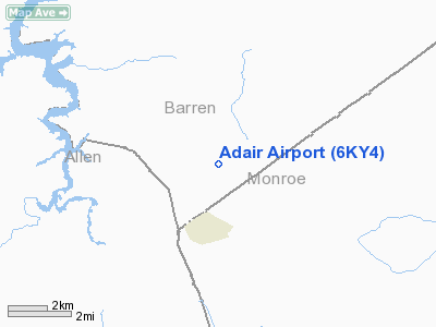
Adair Airport
Address:
Barren County, KY
Tel:
270-434-3790
Images
and information placed above are from
http://www.airport-data.com/airport/6KY4/
We
thank them for the data!
|
|


