 |
|
|
Location &
QuickFacts
|
FAA
Information Effective: |
2008-09-25 |
|
Airport
Identifier: |
SN41 |
|
Airport
Status: |
Operational |
|
Longitude/Latitude: |
094-49-36.0000W/37-30-15.0000N
-94.826667/37.504167 (Estimated) |
|
Elevation: |
1300 ft / 396.24 m (Estimated) |
|
Land: |
0 acres |
|
From
nearest city: |
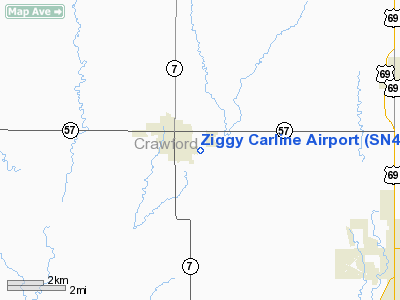
2 nautical miles SE of Girard, KS |
|
Location: |
Crawford County, KS |
|
Magnetic Variation: |
05E (1990) |
Owner & Manager
|
Ownership: |
Privately owned |
|
Owner: |
Dennis Garbin |
|
Address: |
190 190th St
Girard, KS 66743 |
|
Phone number: |
620-720-6424 |
|
Manager: |
Dennis Garbin |
|
Address: |
190 190th St
Girard, KS 66743 |
|
Phone number: |
620-720-6424 |
Airport
Operations and Facilities
|
Airport
Use: |
Private |
|
Segmented Circle: |
No |
|
Control
Tower: |
No |
|
Sectional chart: |
Kansas City |
|
Region: |
ACE - Central |
|
Boundary
ARTCC: |
ZKC - Kansas City |
|
Tie-in
FSS: |
ICT - Wichita |
|
FSS on
Airport: |
No |
|
FSS Toll
Free: |
1-800-WX-BRIEF |
|
Runway Information
Runway 18/36
|
Dimension: |
1700 x 100 ft / 518.2 x 30.5 m |
|
Surface: |
TURF, |
|
|
Runway 18
|
Runway 36
|
|
Traffic
Pattern: |
Left |
Left |
|
Radio Navigation Aids
|
ID |
Type |
Name |
Ch |
Freq |
Var |
Dist |
|
PTS |
NDB |
Pittsburg |
|
365.00 |
05E |
6.0 nm |
|
FSK |
NDB |
Fort Scott |
|
379.00 |
05E |
17.8 nm |
|
LLU |
NDB |
Spring River |
|
356.00 |
05E |
24.7 nm |
|
EAD |
NDB |
Nevada |
|
209.00 |
06E |
32.8 nm |
|
MSB |
NDB |
Monarch |
|
410.00 |
04E |
32.9 nm |
|
PPF |
NDB |
Parsons |
|
258.00 |
06E |
34.1 nm |
|
CFV |
NDB |
Coffeyville |
|
212.00 |
05E |
43.3 nm |
|
CNU |
VOR/DME |
Chanute |
029X |
109.20 |
05E |
37.3 nm |
|
EOS |
VOR/DME |
Neosho |
120X |
117.30 |
07E |
44.0 nm |
|
OSW |
VORTAC |
Oswego |
123X |
117.60 |
08E |
27.5 nm |
|
BUM |
VORTAC |
Butler |
106X |
115.90 |
07E |
48.9 nm |
Remarks
-
PROVIDED APCH TO
EACH RY MNTND FOR A MINIMUM 20:1 GLIDE SLOPE AND TRANSITIONAL SURFACE MNTND
FOR A 7:1 GLIDE SLOPE.
Based Aircraft
|
Aircraft based
on field: |
1 |
|
Single Engine
Airplanes: |
1 |
Ziggy Carline Airport
Address:
Crawford County, KS
Tel:
620-720-6424
Images
and information placed above are from
http://www.airport-data.com/airport/SN41/
We
thank them for the data!
|
General Info |
| Country |
United
States |
| State |
KANSAS
|
| FAA ID |
SN41
|
| Latitude |
37-30-15.000N |
|
Longitude |
094-49-36.000W |
|
Elevation |
1300
feet |
| Near
City |
GIRARD
|
We don't guarantee the information is fresh and accurate. The data may
be wrong or outdated.
For more up-to-date information please refer to other sources.
|
|


